Forecast issued at: Friday 11th July 2025 11:00
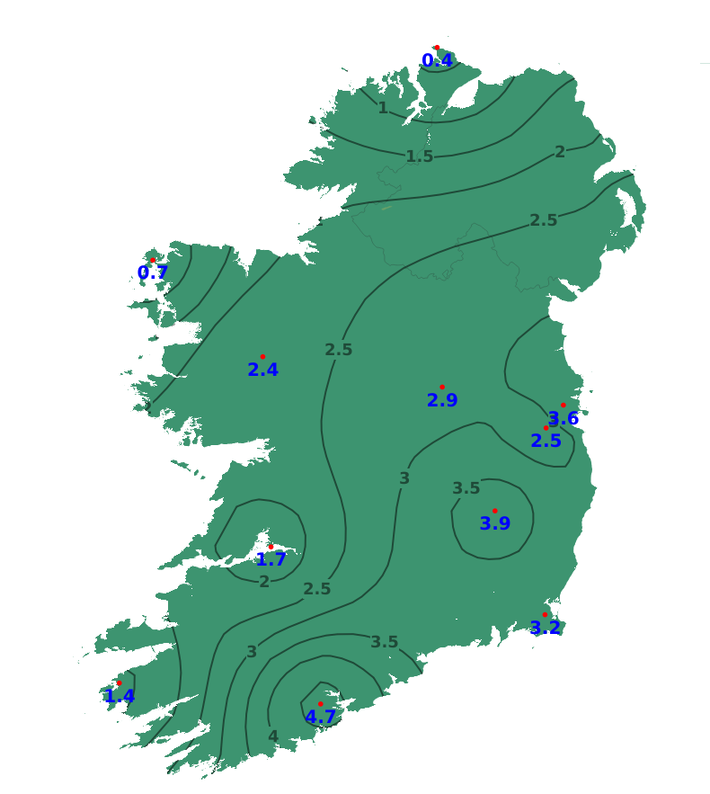
Rain
Over the past week, rainfall amounts were below average for most of Ireland and just above average in the northwest. Between 0 and 8 mm of rainfall (5 to 52 % of average) fell over Leinster, and much of Munster and Ulster. Amounts of between 15 and 20 mm (50 to 90% of average) were recorded over west Munster, Connacht and north Ulster. For northwestern coastal regions, between 18 and 22 mm of rain were recorded (103 to 125% of average) From today until Sunday evening, the weather over Ireland will be largely dry with little or no rainfall. From later on Sunday and into the early days of next week, there will be rain or showers at times. Rainfall amounts will be above average widely, with amounts of between 25 and 50mm forecast generally. It looks set to be driest in the east and wettest in the west.
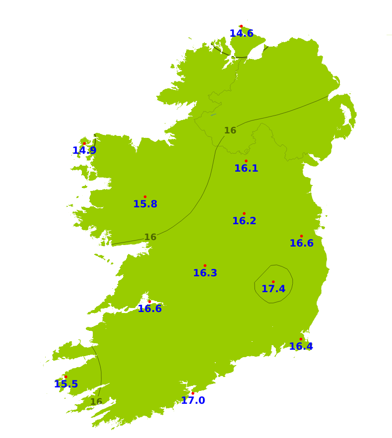
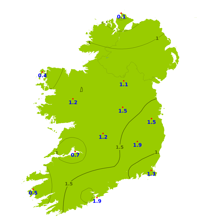
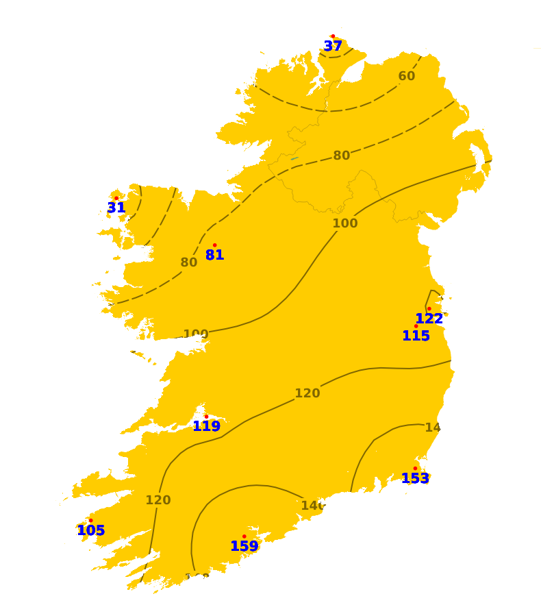
Temperatures
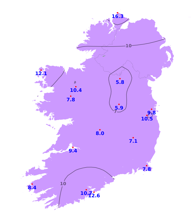
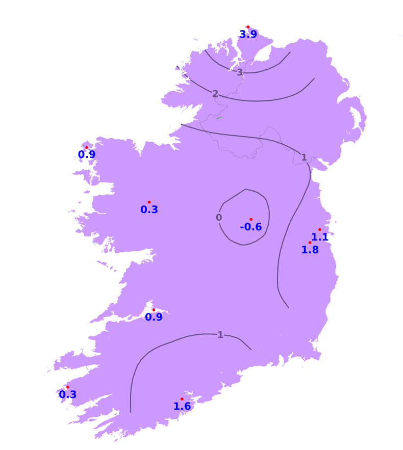
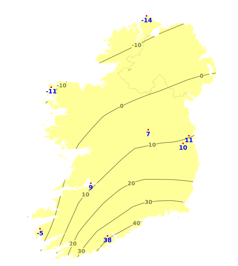
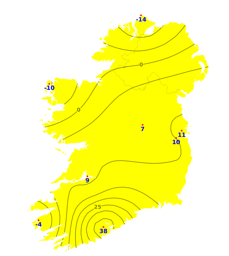
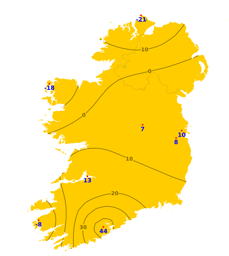
Mean air temperatures for the past week have now trended above normal in most areas. The coolest spot was in Malin Head in County Donegal with a mean temperature of 14.6 degrees and the warmest station was Oak Park, County Carlow with a mean air temperature of 17.4 degrees. The range was between 0.1 degrees below normal to 2.2 degrees above. Mean soil temperatures were above average throughout the country by between 0.4 and 4.7 degrees, with temperatures of between 15.1 and 19.6 degrees recorded. Over the coming week, mean air temperatures are expected to be between 1 and 3 degrees above normal, ranging from 16 to 20 degrees. Mean soil temperatures will continue above normal.
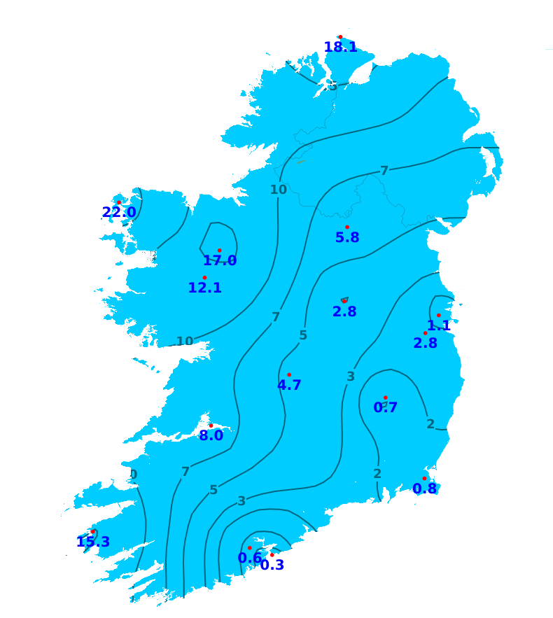
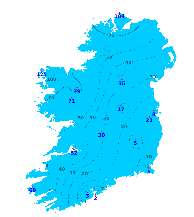
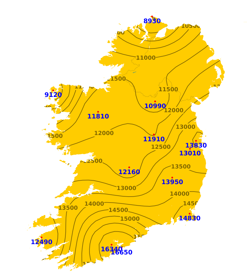
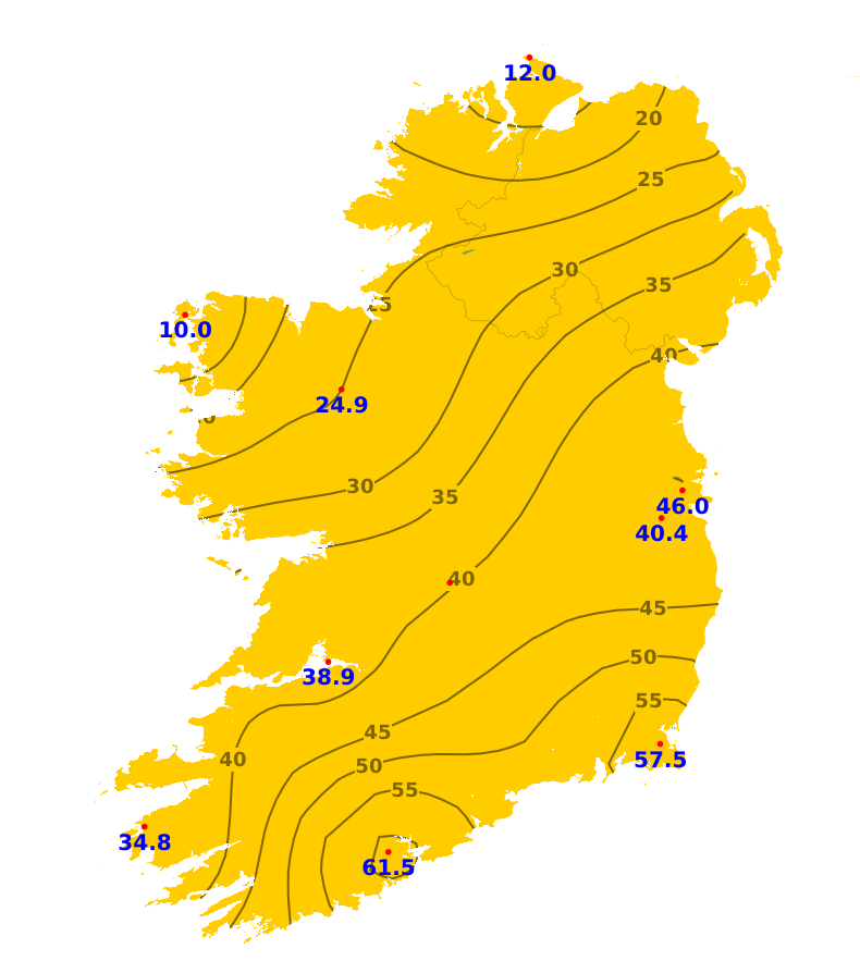
Sunshine
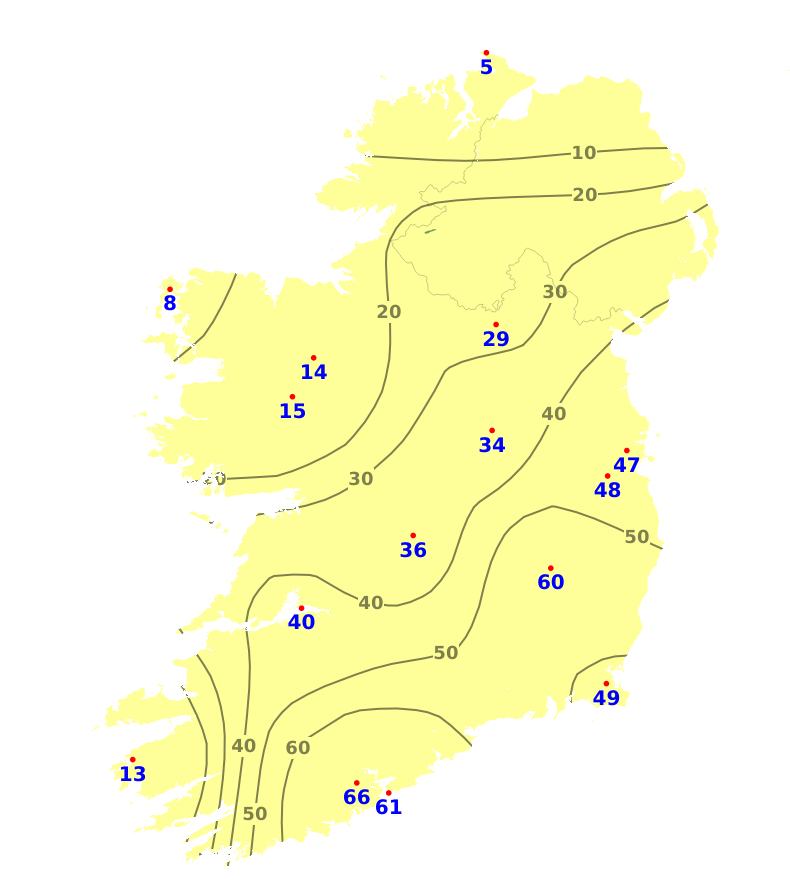
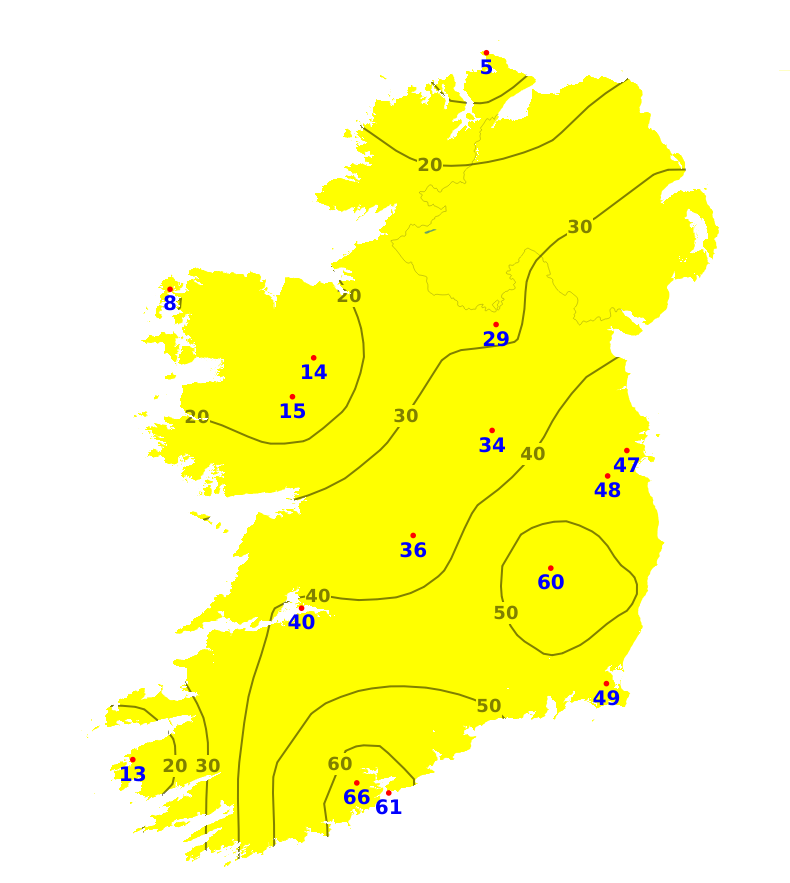
Sunshine amounts varied greatly across Ireland over the last week. It was dull in the north and northwest with just 10 hours of sunshine recorded at Belmullet in County Mayo (31% of normal). It was brighter further south and east with Roches Point in County Cork recording almost 62 hours of sunshine (159% of the norm). Between now and Sunday, sunshine amounts will be above average in most areas, but possibly below average near west and northwest coasts. From Monday onwards, sunshine amounts are likely to be below average in many areas as the weather turns more unsettled.
Drying Conditions
Drying conditions will be good or very good up to Sunday, but will deteriorate somewhat next week.
Spraying
There'll be good opportunities for spraying up until Sunday.
Field Conditions
Moderately and well drained soils in the north, west and far southwest are close to saturation, with poorly drained soils there waterlogged. Elsewhere, soils are drier, with Soil Moisture Deficits (SMDs) currently ranging between 20 and 60 mm for all soil types, highest in the south, with some restriction to growth. Between now and Sunday, SMDs will increase widely by around 10 to 15mm, though more substantially in the northwest, west and far southwest.
Forecast maps and meteograms can be found on Blight Forecast.