Forecast issued at: Tuesday 28th April 2026 13:00
Rain
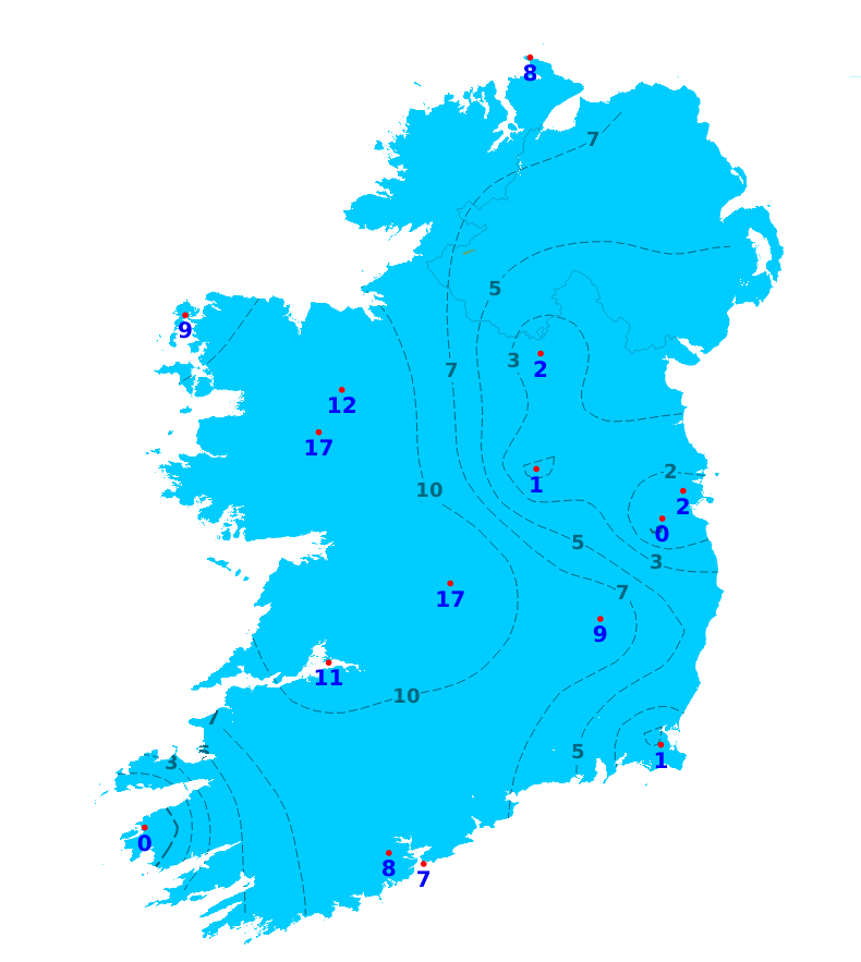
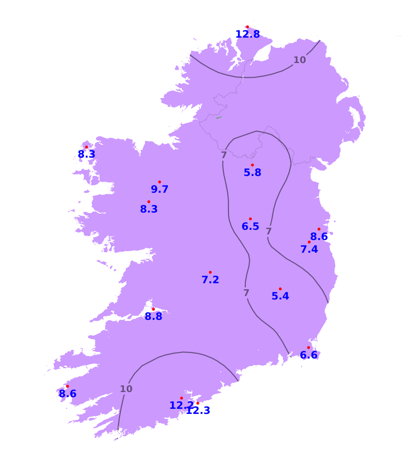
Rainfall amounts for the last seven days were well below average across the country with all stations recording less than 3mm which equations to 17% or less of the average for the time of year. Claremorris, Co. Mayo recorded the most with 2.9mm while Casement Aerodrome recorded no rainfall. It will continue dry for today (Tuesday) and tomorrow (Wednesday) before more unsettled conditions develop. Much of Ulster, north Connacht and north and east Leinster will likely see drier than normal conditions with 75% or less of their average. Elsewhere it will likely be wetter with between 100 and 225% of the average expected, wettest in the south-west with 30 to 40mm for many there.
Temperatures
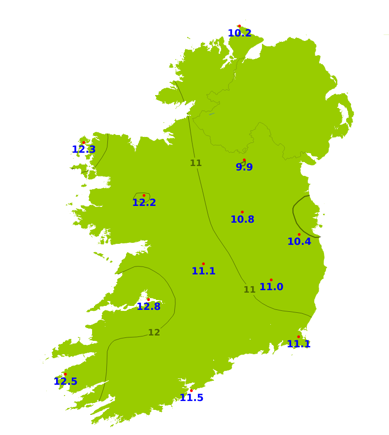
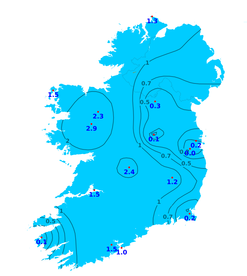
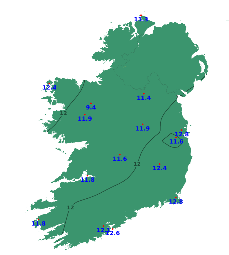
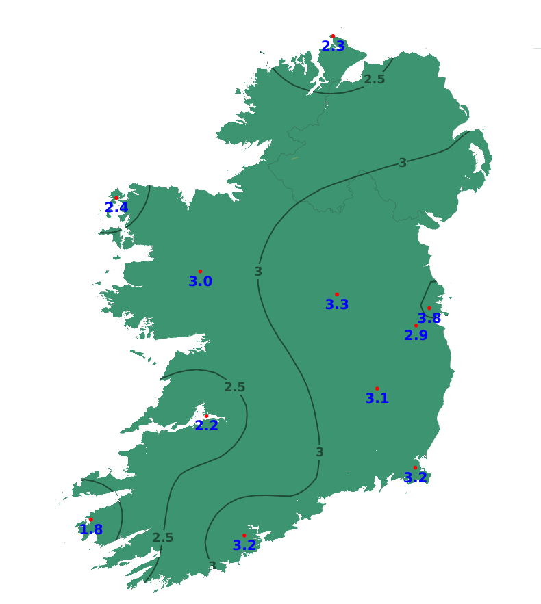
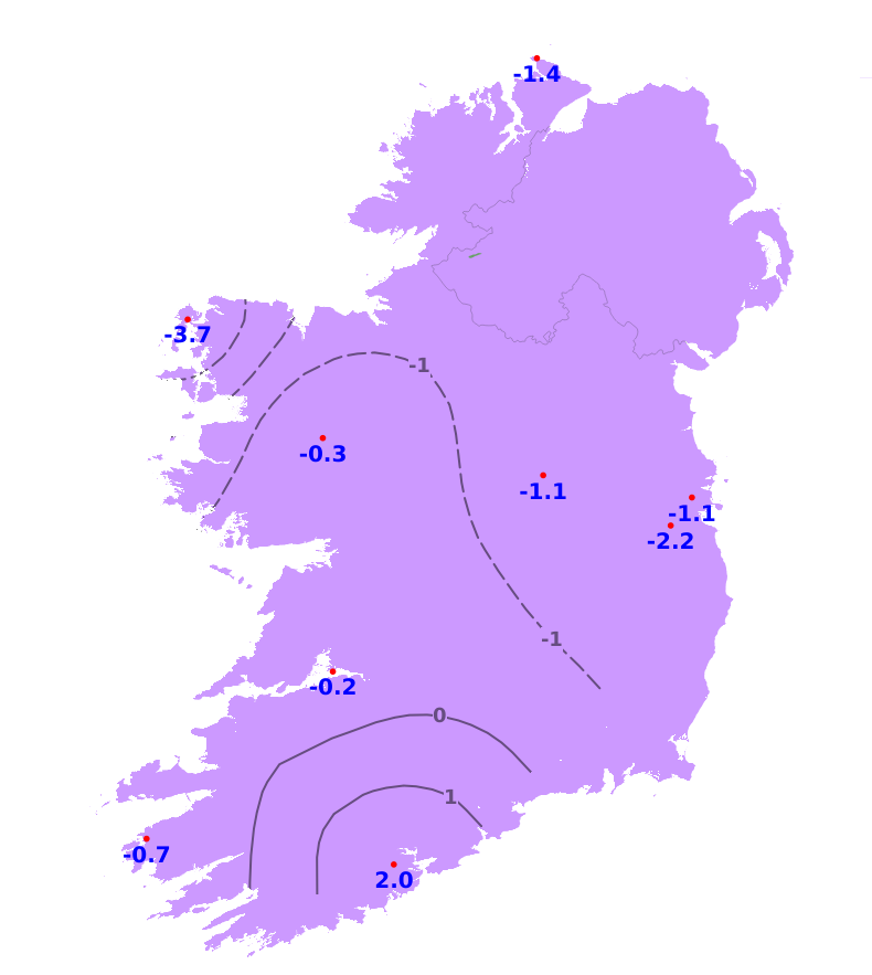
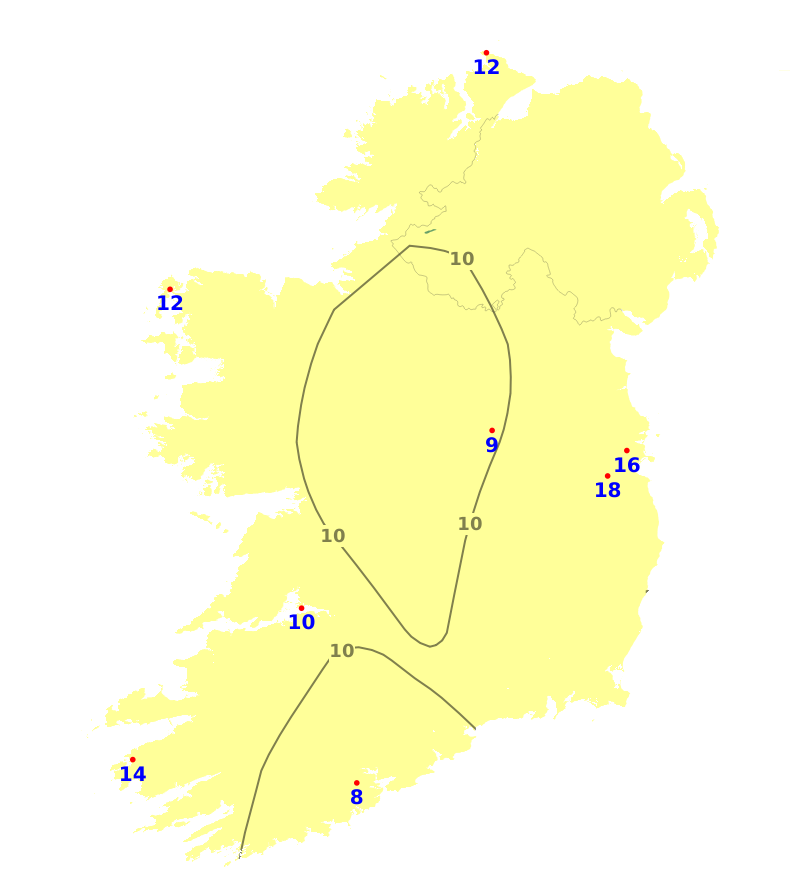
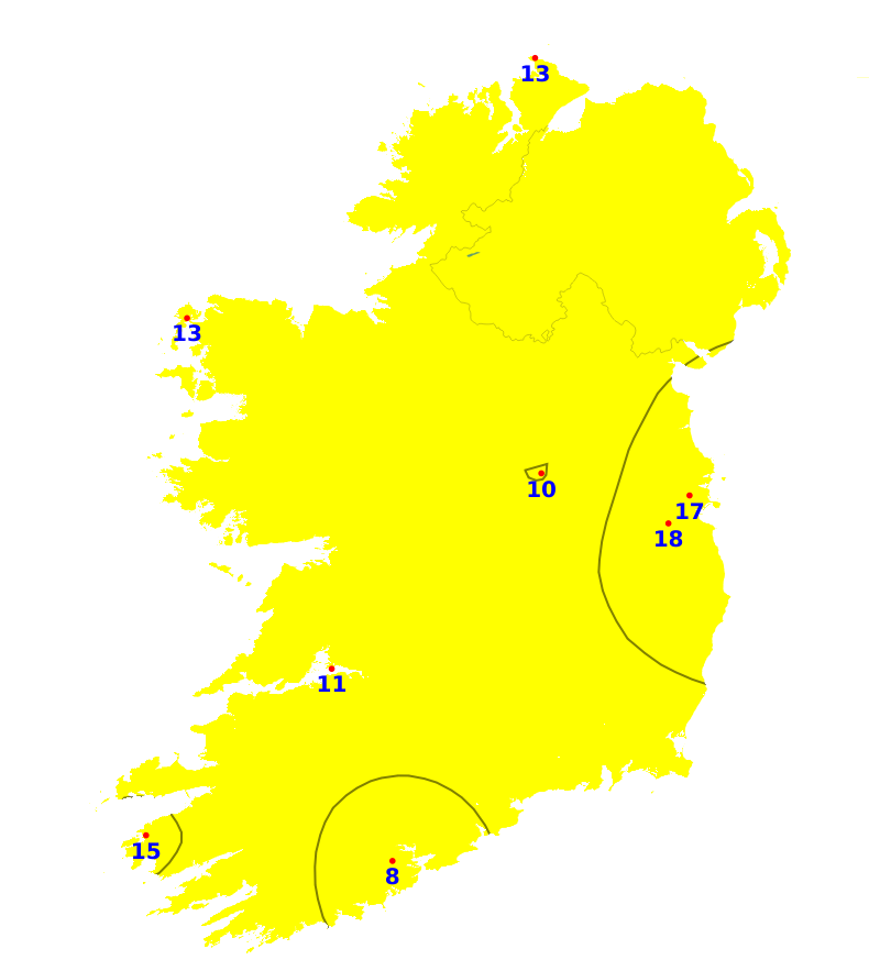
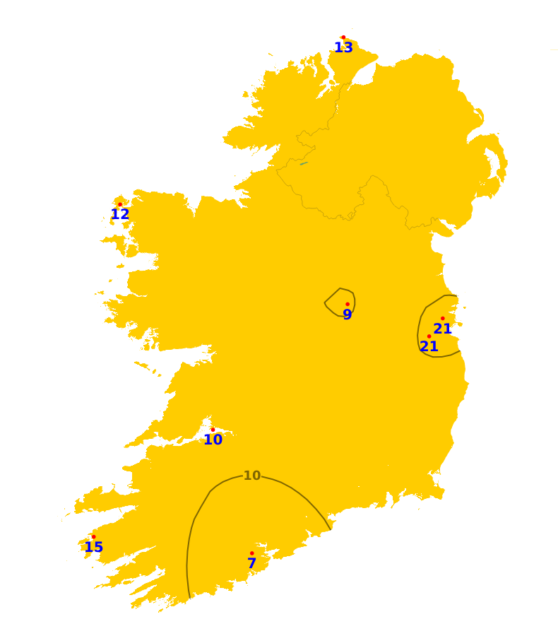
Mean air temperatures over the past week have been above average, especially away from the north and east. Temperatures ranged between 9.3 degrees at Dublin Airport to 12.8 degrees at Shannon Airport, Co. Clare. This equates to between 0.2 and 2 degrees above normal. Mean soil temperatures were well above normal, ranging from 9.4 to 12.8 degrees which is 1.8 to 3.8 degrees warmer than usual. Over the coming week, temperatures will fluctuate but will generally be around normal or a degree above over the western half of the country, and 1 or 2 degrees warmer than normal further east.
Sunshine
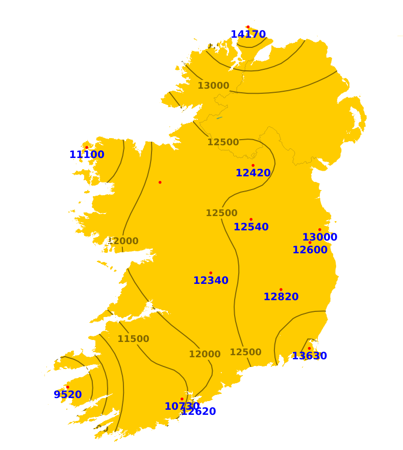
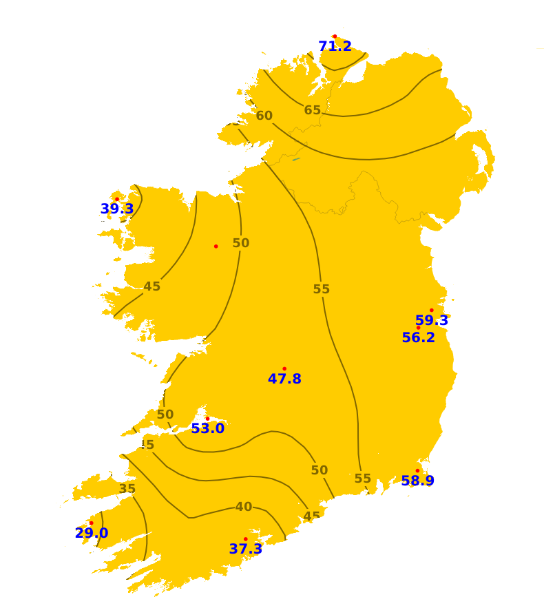
Sunshine amounts away from the south-west were close to or above normal. Valentia Observatory, Co. Kerry recorded the least with 29 hours which is 77% of its average. Malin Head, Co. Donegal recorded the most with 71.2 hours which is 186% of its average. There will be sunny spells today and plenty of sunshine tomorrow (Wednesday) but overall, sunshine amounts will be below normal for the coming week.
Drying Conditions
Drying conditions will become more limited from Thursday onwards but there will be very good opportunities tomorrow (Wednesday) with plenty of sunshine and a moderate to fresh easterly breeze.
Spraying
Spraying conditions will also be limited from Thursday onwards with more unsettled conditions. Today (Tuesday) will often the best opportunity as it will be dry with no more than moderate winds. Breezier conditions tomorrow (Wednesday) may inhibit some spraying.
Field Conditions
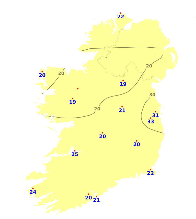
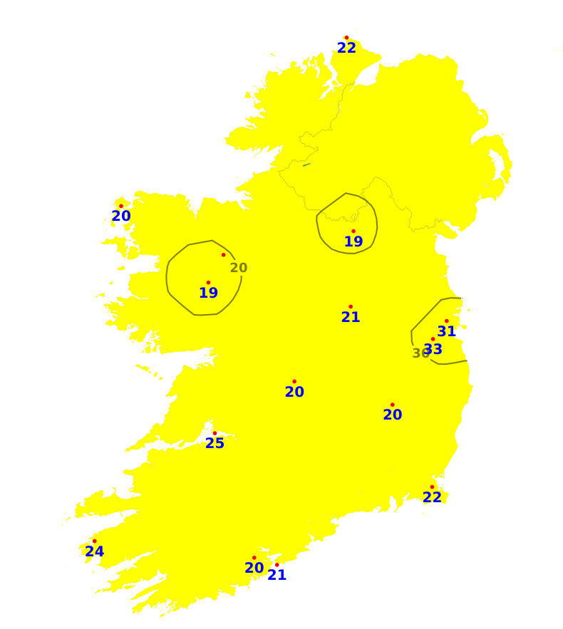
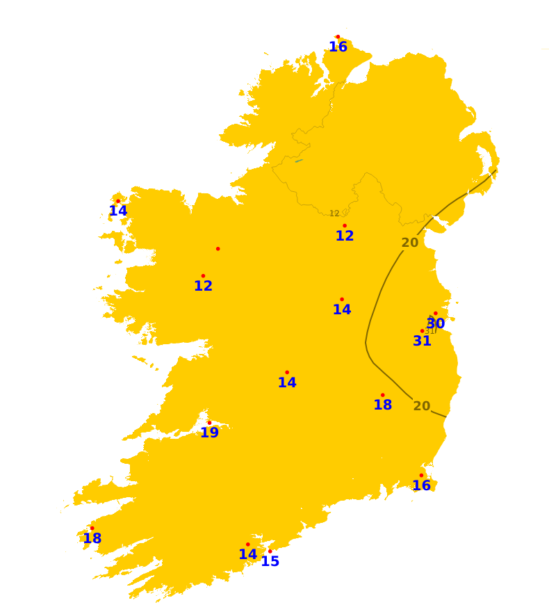
Soil moisture deficits (SMDs) for moderately and well drained soils currently range from 19mm in parts of the midlands to 34mm in parts of the east while SMDs for poorly drained soils range from 12mm in parts of the midlands to 32mm in parts of the east. Over the coming week, there will be little change in eastern and northern areas, SMDs elsewhere will decrease with some soils in the southwest, midwest and west becoming saturated or waterlogged.
Forecast maps and meteograms can be found on Blight Forecast.
