Forecast issued at: Friday 31st July 2026 12:00
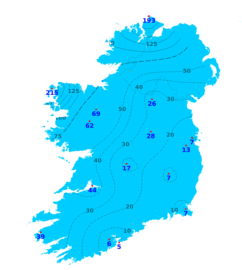
Rain
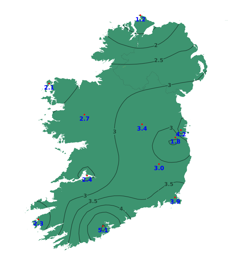
In terms of rainfall amounts, there was a northwest-southeast divide across the country during the past 7 days. While parts of the south and east saw less than 10% of average rainfall, the northwest saw approximately twice its average rainfall. The least rainfall (0.8mm or 5% of average) was recorded at Roches Point, Co. Cork. The most rainfall (42.5mm or 215% of average) was recorded at Belmullet, Co. Mayo. With showers and rain forecast for the week ahead, rainfall amounts will increase generally. Rainfall amounts are still forecast to be below average for most for the time of year, between 20 and 100% of average.
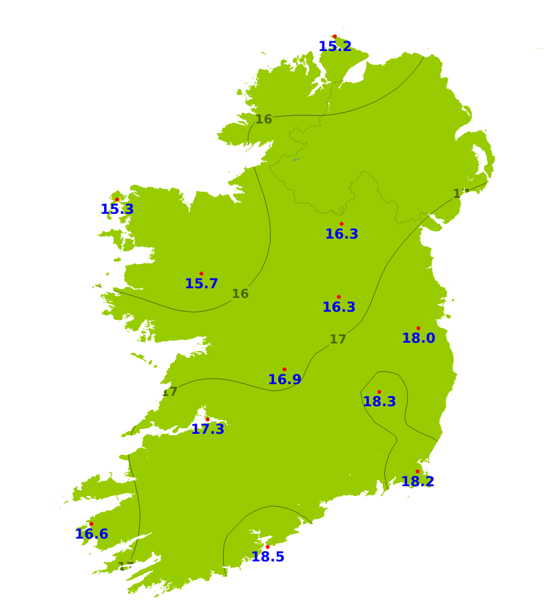
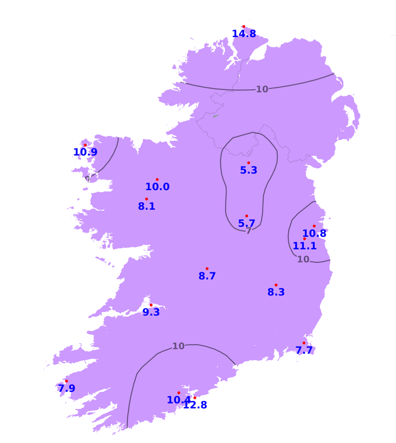
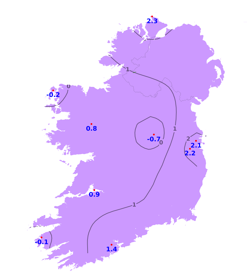
Temperatures
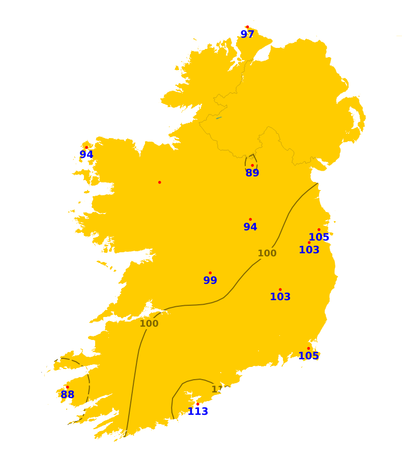
All areas experienced average or above mean air temperatures during the past 7 days, with the coolest conditions in the northwest and the warmest conditions in the south and southeast. The lowest such temperature was 15.0 degrees recorded at Knock Airport, Co. Mayo which was 1.1 degrees above average. The highest such temperature was 18.5 degrees recorded at Roches Point, Co. Cork which was 2.9 degrees above average. For the coming 7 days, mean air temperatures are expected to be within a degree either side of average, ranging from 15 to 17 degrees, and again warmest in the south and east. Mean soil temperatures were above average during the past week by between 1.2 and 5.1 degrees, ranging from 16.4 degrees in the north to 21.2 degrees in the south, and would be expected to remain above average for the coming week.
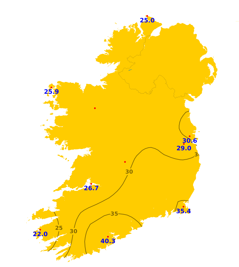
Sunshine
Sunshine amounts were below average during the past week, apart from the south and southeast which saw average amounts. The least sunshine was recorded at Valentia, Co. Kerry where there was just 22.0 hours or 70% of average. The most sunshine was recorded at Roches Point, Co. Cork where 40.3 hours or 108% of average was recorded. While spells of sunshine are expected today and Saturday, it will become more limited for the coming week.
Drying Conditions
With fresher conditions over the coming days, there will be good drying conditions today and Saturday. Showers will gradually become more isolated for the afternoon today , meaning drying conditions may deteriorate for a time. The best conditions will likely be on Saturday when mostly dry weather is forecast. Drying conditions are expected to deteriorate from Sunday onwards with cloudier and wetter conditions expected.
Spraying
The best spraying opportunities are likely to be on Saturday when mostly dry conditions are expected. However, breezier conditions may limit opportunities for some. Opportunities will become more limited from Sunday onwards, but there is uncertainty in the detail and some areas may still experience opportunities for spraying.
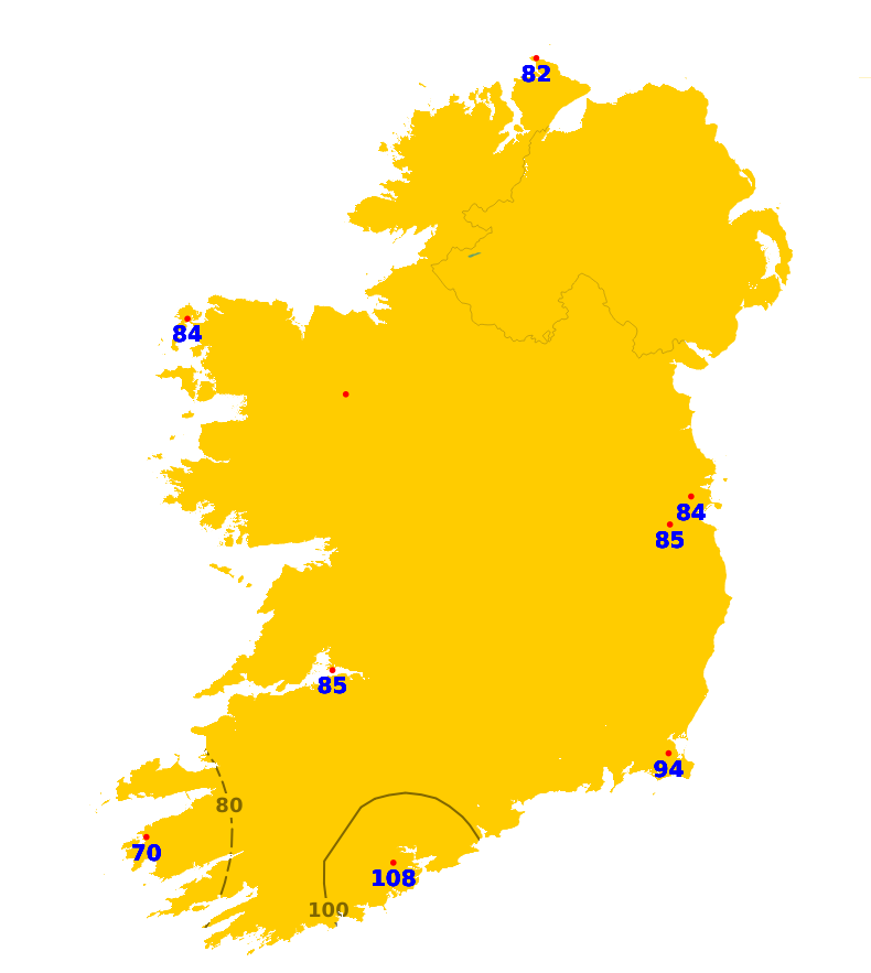
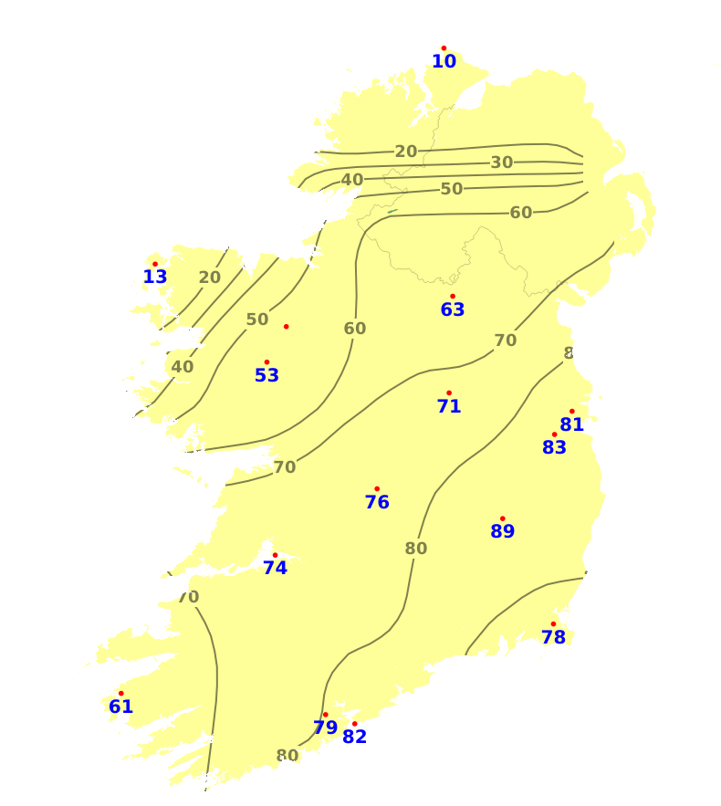
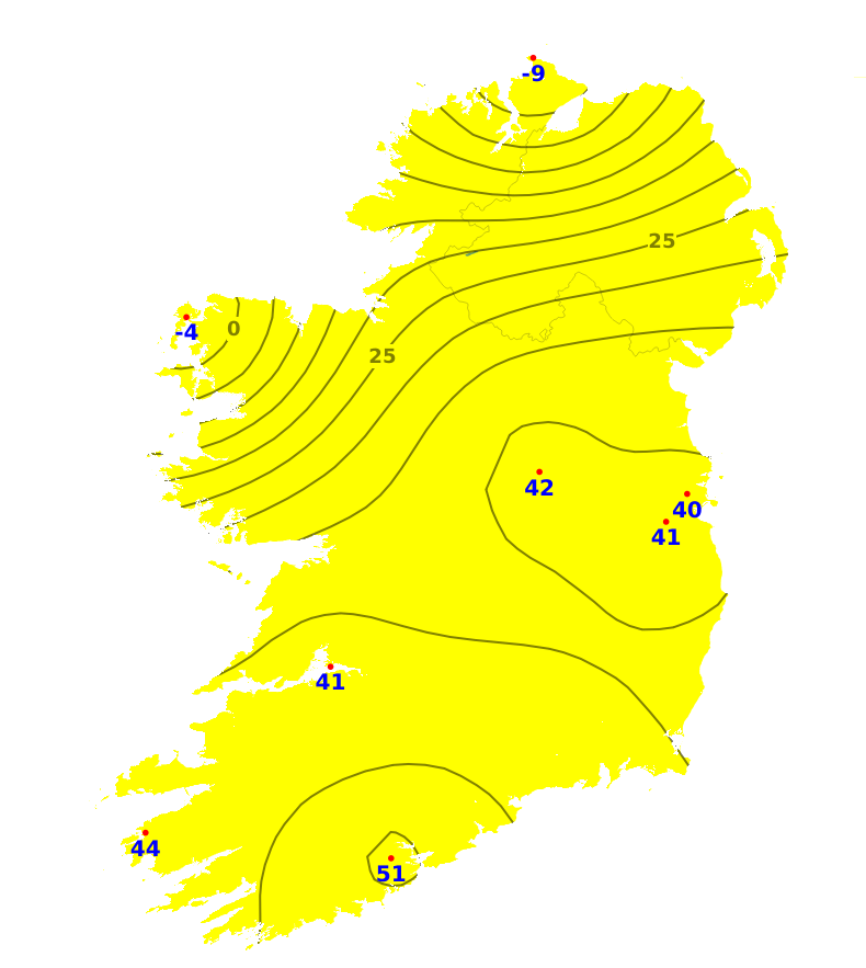
Field Conditions
Soil moisture deficits (SMDs) currently range from 8mm in the north and northwest to 93mm in the east. Away from the northwest, ground is generally hard and there is restriction to growth. Very little change in SMDs is expected for the coming week.