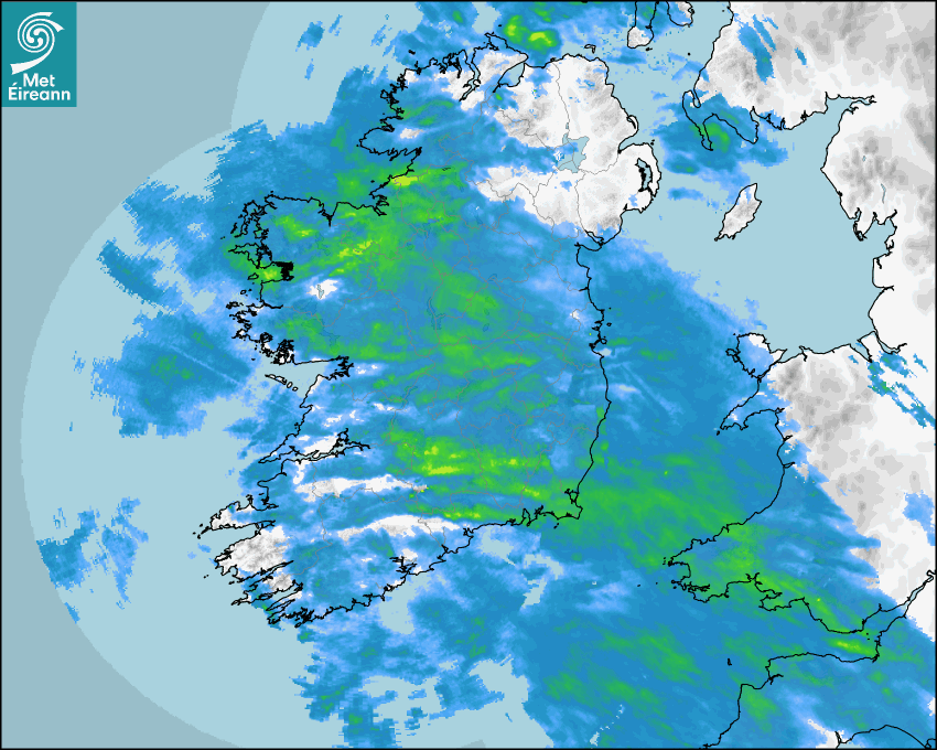

Latest Rainfall Radar showing live precipitation and the last 90 minutes precipitation over Ireland, updated every 5 minutes. Precipitation can be rain, hail or snow. Accumulations can refer to rainfall only.
Lightning strikes, when they occur, are displayed as a cross. Initially, they are red but change to orange and then yellow after a period, then disappear © Met Office ATDNet.
Ground Clutter may appear (South Co. Dublin), bright bands and spokes may also be present in images. They are artefacts (false echoes) of rainfall radar systems and should be ignored. Further information on Radar here
Met Éireann forecasters manually produce the weather icons for midday and midnight to reflect the predicted major weather type for these times.
The rainfall forecast is direct model output from Numerical Weather Prediction models but is a guideline only. Rain refers to precipitation, which can be rain, sleet or snow. It forecasts how much rain will fall (in mm) hourly during the previous hour (accumulations), then in 3 hourly and finally 6 hourly accumulations up to 7 days. This service is based on data and products of the HARMONIE-AROME and the European Centre for Medium-range Weather Forecasts (ECMWF) models.
The wind is direct model output from Numerical Weather Prediction models but is a guideline only. It forecasts the strength of the wind (in knots and km/h) at 10m for the top of each hour, in hourly, then 3 hourly and finally 6 hourly intervals up to 7 days. The wind arrow tip points in the direction the wind is blowing and the tail length indicates wind strength. However, in the text forecast below, it is described as where it is blowing from. This service is based on data and products of the HARMONIE-AROME and the European Centre for Medium-range Weather Forecasts (ECMWF) models.
The temperature is direct model output from Numerical Weather Prediction models but is a guideline only. It forecasts air temperature on land and over sea in °C for the top of each hour, 3 hourly and finally 6 hourly intervals up to 7 days. Minus zero (-0) indicates values between 0 to -0.5°C. This service is based on data and products of the HARMONIE-AROME and the European Centre for Medium-range Weather Forecasts (ECMWF) models.
The Mean Sea Level Pressure (MSLP) is direct model output from Numerical Weather Prediction models but is a guideline only. It forecasts the MSLP in hecto Pascals (hPa) for the top of that hour initially in 3 hourly intervals, then 6 hourly. This service is based on data and products of the HARMONIE-AROME and the European Centre for Medium-range Weather Forecasts (ECMWF) models.
Réamhaisnéis Náisiúnta
26 October 2026 05:00
Inniu
This morning will start wet and breezy with widespread rain and drizzle along with moderate to fresh and gusty south to southeast winds, stronger in western and southern coastal counties. The rain will clear for a time from Munster, Leinster and east Ulster this afternoon, but another spell of rain will move in from the west and southwest during the late afternoon and evening, becoming widespread by early night. Localised flooding is possible, particularly in the west and southwest. It will become windier later with fresh to strong and gusty south to southwest winds, reaching gale force on western coasts this afternoon and on southern coasts this evening. Mild with highest temperatures of 14 to 17 degrees.
Anocht
Windy and wet tonight with strong to near gale force and gusty south to southwest winds and gales on southern coasts. Rain will clear northeastwards early on tonight with blustery, occasionally heavy, showers following in behind with the odd thunderstorm too. Winds will ease overnight, with moderate to fresh winds, stronger in western and southern coastal parts coasts. Lowest temperatures of 6 to 10 degrees.
Amárach
Tomorrow, Tuesday, will be a blustery day with mostly moderate to fresh west to southwest winds, strong on western and southern coasts. There will be a mix of sunshine and scattered showers, some turning heavy with a chance of isolated thunderstorms and hail. Feeling fresher with highest afternoon temperatures of 8 to 12 degrees.
Met News
02a Deaireadh Fómhair 2026
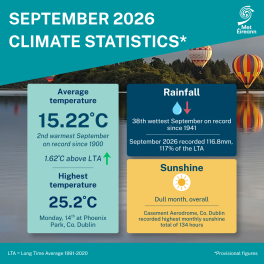
Provisionally second warmest September on record for Ireland
September 2026 was provisionally the second warmes... léigh níos mó

25ú Meán Fómhair 2026
Met Éireann marks 90 years by looking to the future of meteorology and climate science
Met Éireann’s 90th Anniversary Conference broug... léigh níos mó
03ú Meán Fómhair 2026
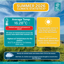
Climate Statement for Summer 2026
Hottest summer on record for Ireland. Sunny and dr... léigh níos mó


