Forecast issued at: Saturday 01st August 2026 15:00
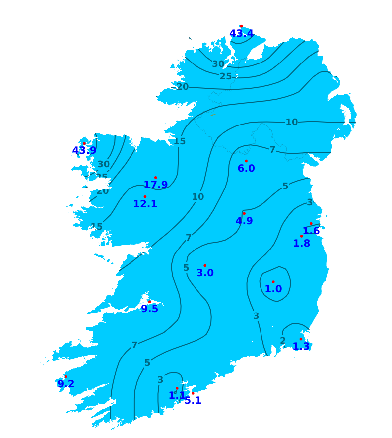
Rain
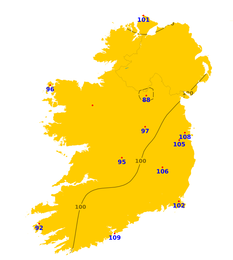
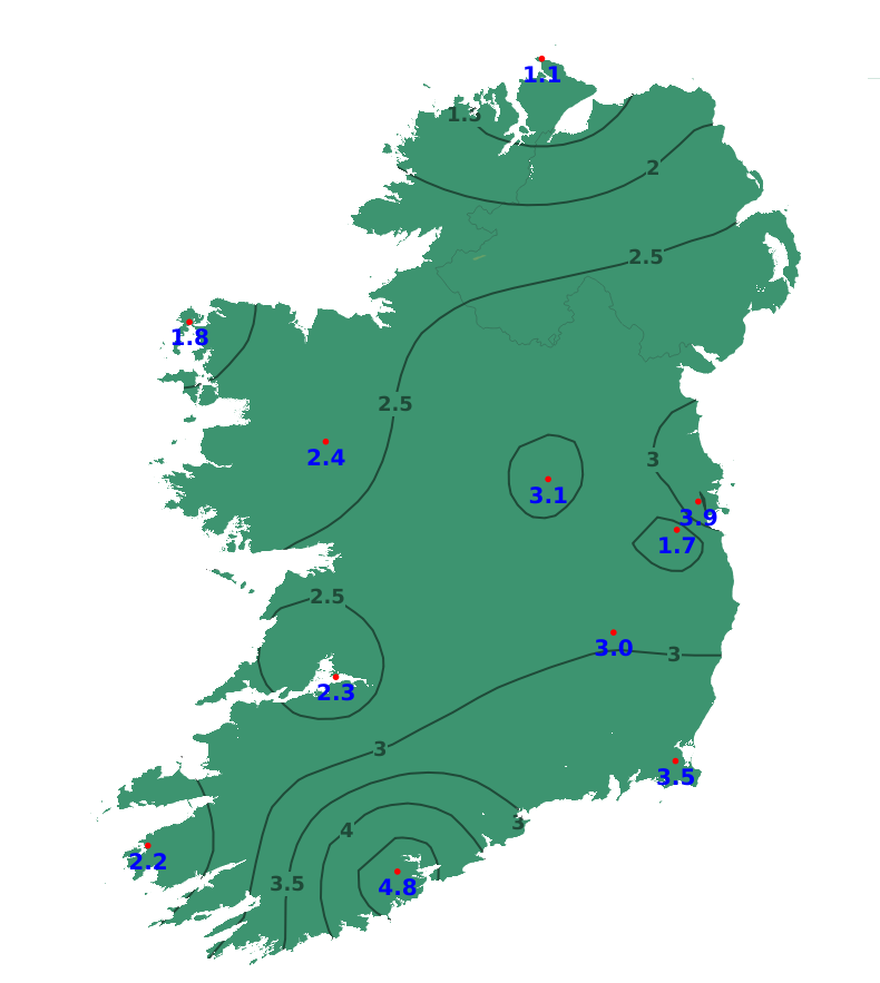
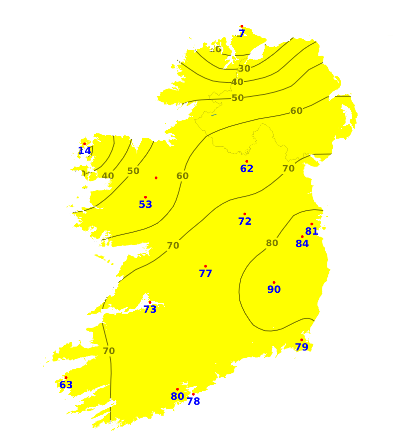
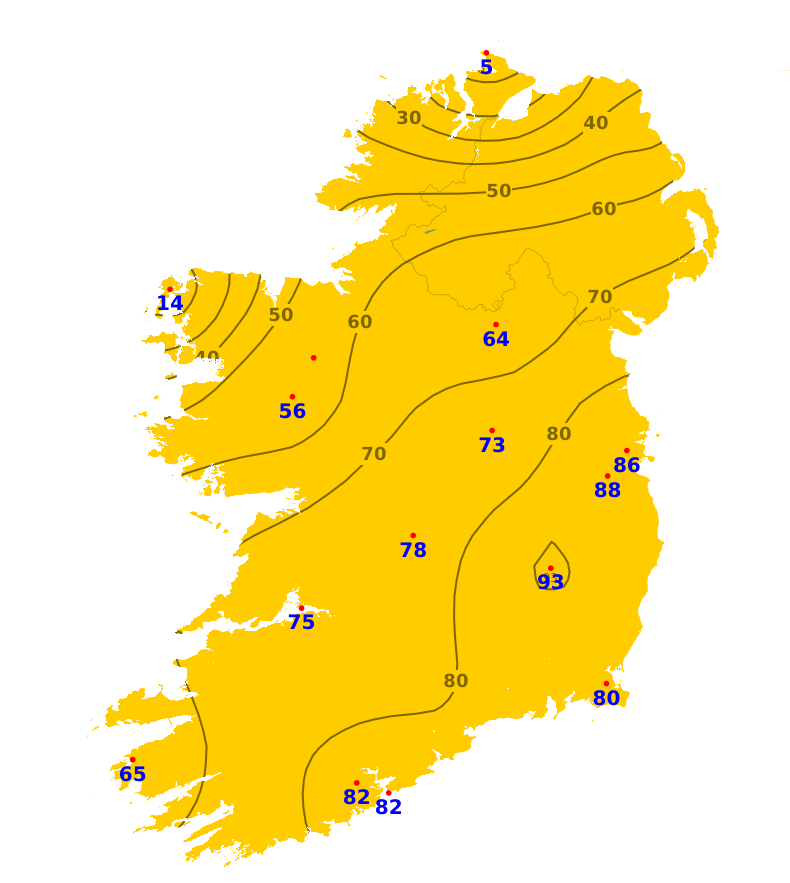
In terms of rainfall amounts, there was a northwest-southeast divide across the country during the past 7 days. In general parts of south and east saw between 7% and 13% of average with the exception of Roches Point and Valentia where 31% and 39% of average was record respectively. The least rainfall was recorded at Oak Park, Co. Carlow with 1mm or 7% recorded. In contrast parts of the west and north observed nearly twice its average rainfall. The most rainfall (43.9mm or 221%) was recorded at Belmullet, Co. Mayo. With showers and rain forecast for the week ahead, rainfall amounts will increase generally. Rainfall amounts are still forecast to be below or average for most for the time of year, between 58% and 121% of average.
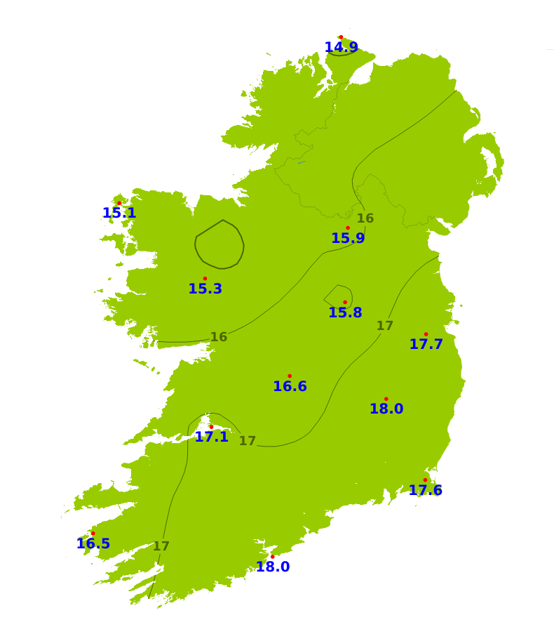
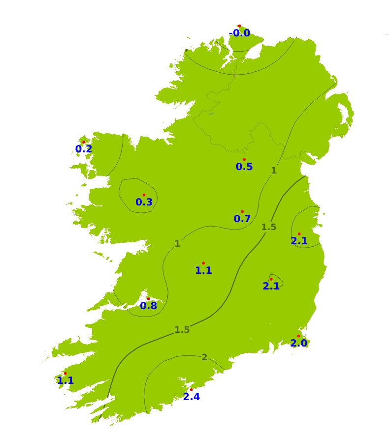
Temperatures
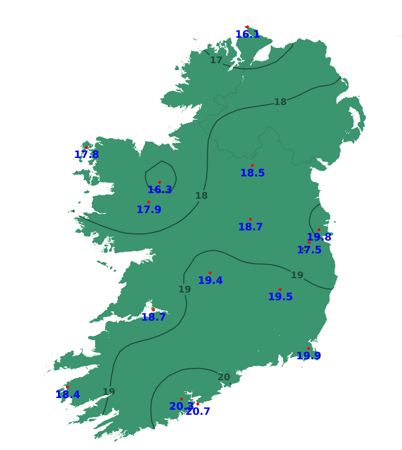
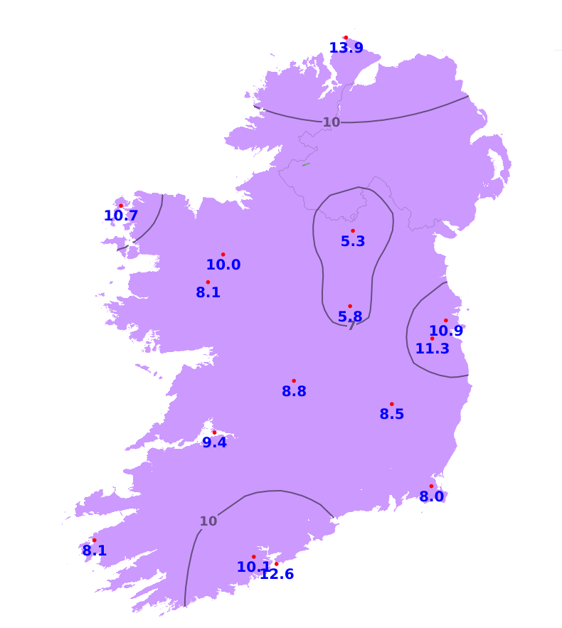
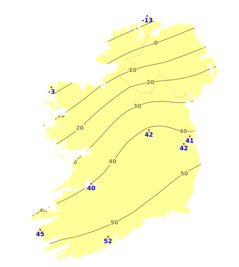
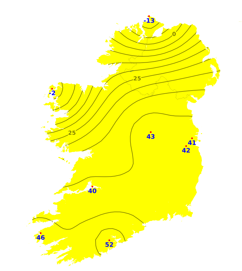
All areas experienced average or above mean air temperatures during the past 7 days, with the coolest conditions in the northwest and the warmest conditions in the south and southeast. The lowest such temperature was 14.5 degrees recorded at Knock Airport, Co. Mayo which was 0.6 degrees of average. The highest such temperature was 18.0 degrees recorded at both Roches Point, Co. Cork (2.4 degrees of average) and at Oak Park, Co. Carlow (2.1 degrees of average). For the coming 7 days, mean air temperatures are expected to be average or a degree below, ranging from 14 to 16 degrees, and again warmest in the south and east. Mean soil temperatures were above average during the past week by between 1.1 and 4.8 degrees, ranging from 16.1 degrees in the north to 20.7 degrees in the south, and would be expected to remain above average for the coming week.
Sunshine
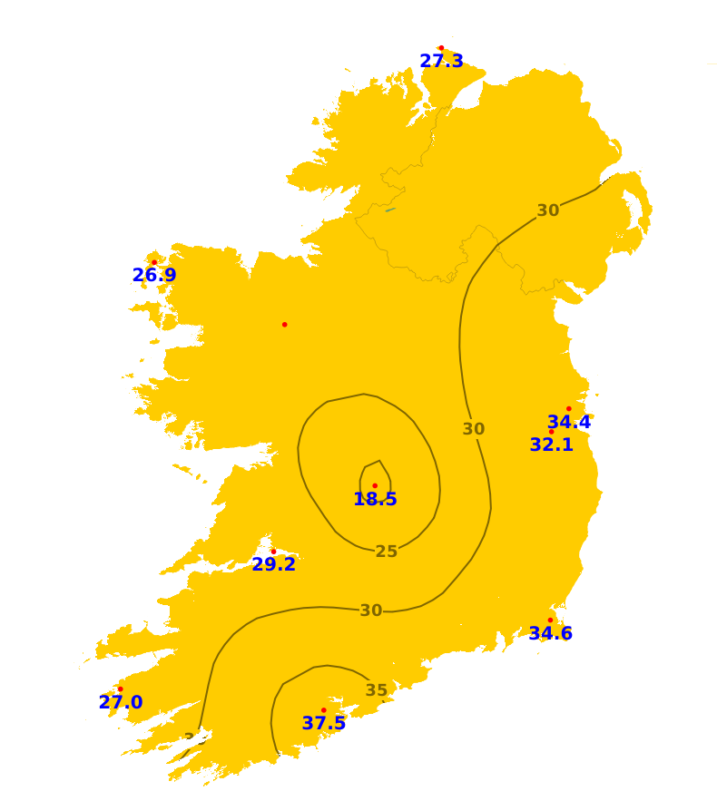
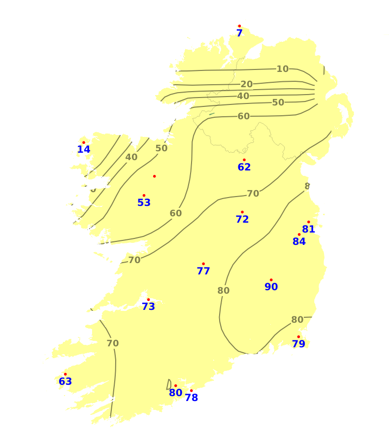
Sunshine amounts were generally below average across the country over the last seven days. The least amount of sunshine was recorded at Gurteen, Co. Mayo with 18.5 hours. Further south at Cork Airport saw the highest amount with 37.5 hours. Over the coming week conditions are expected to become unsettled with more in the way of cloud forecast. It is likely that we will see sunshine amounts decrease for a time particularly in the west and south.
Drying Conditions
With fresher conditions over the coming days, there will be good drying conditions today. Drying conditions are expected to deteriorate from Sunday onwards with cloudier and wetter conditions expected.
Spraying
The best spraying opportunities are likely to be today, Saturday, with generally dry conditions forecast. However, breezier conditions may limit opportunities for some, particularly along the west coast. Opportunities will become more limited from Sunday onwards, but there is uncertainty in the detail and some areas may still experience opportunities for spraying, with the greatest chance being in the southeast.
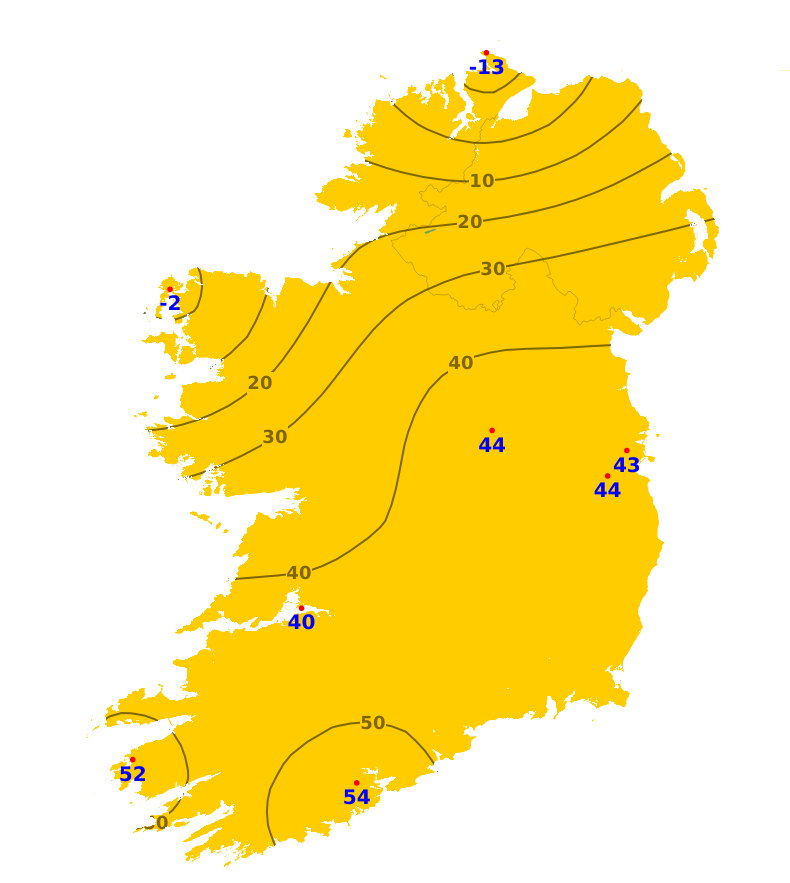
Field Conditions
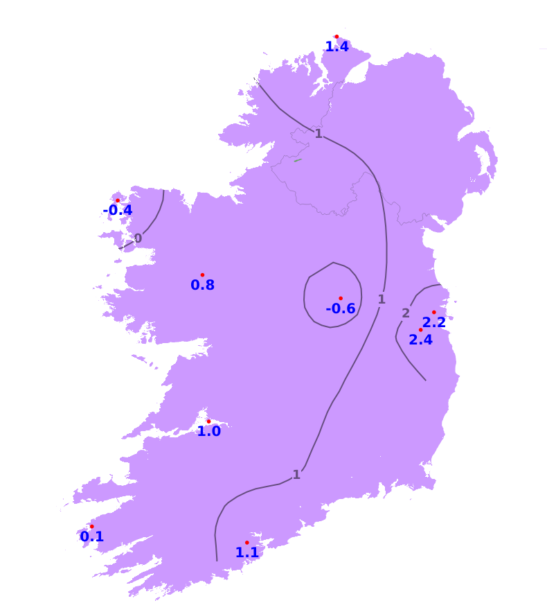
Soil moisture deficits (SMDs) currently range from 5mm in the north and northwest to 93mm in the east. Away from the northwest, ground is generally hard and there is restriction to growth. Over the coming week very little change is expected in the SMDs, with the exception of the northwest weher SMDs are likely to decrease, ranging between 4 and -1.
Further Comments
A potato blight advisory is in effect. From Sunday Morning 2nd August until Tuesday 4th August. Weather conditions conductive to the spread of potato blight will affect many coastal regions, mostly of the west and south, and in parts of the midlands.