Ceanglaíonn an Creat Náisiúnta um Sheirbhísí Aeráide (CNSA) soláthraithe seirbhísí aeráide agus úsáideoirí chun cruthú seirbhísí aeráide faoi cheannas an úsáideora a éascú. Tacaíonn CNSA le Pleananna Oiriúnaithe Earnála (POEnna) a fhorbairt trí theagmháil a dhéanamh le foirne tionscadail chun seirbhísí agus faisnéis shaincheaptha a sholáthar. Chomh maith le sonraí a sholáthar, is é CNSA do threoir maidir leis an eolaíocht aeráide, seirbhísí agus faisnéis agus do POEnna á bhforbairt agus á gcur chun feidhme.
Féach ar an bhfíseán thíos chun tuilleadh faisnéise a fháil faoi CNSA:
Tacaíocht POE CNSA
Tugann CNSA tacaíocht aeráide earnála le linn gach céime den phróiseas POE. Áirítear leis an tacaíocht sin eolas ar theagmhais aeráide agus aimsire na hÉireann, go seirbhísí aeráide chun tacú le cinnteoireacht. Lenár mbaill, is féidir le CNSA saineolas a chur ar fáil i réimsí na faisnéise aeráide ar fad le haghaidh do mheasúnachta tionchair.
I measc an tsaineolais pobail tá réamh-mheastacháin aeráide, tuilte agus bainistíocht riosca tuilte, sreafaí uisce agus treoir oiriúnaithe, seirbhísí aeráide talmhaíochta agus go leor eile. Féach ar roinnt dár mbaill anseo:

Treoirlínte maidir le Pleananna Oiriúnaithe Earnála
Tá Pleananna Oiriúnaithe Earnála i bhfeidhm anois tar éis Creat Náisiúnta Oiriúnaithe (CNO) 2024 a fhoilsiú. Soláthraítear sna Treoirlínte Pleanála Earnála a bhaineann leis, arna bhfoilsiú ag an Roinn Comhshaoil, Aeráide agus Cumarsáide, treoir ar conas plean oiriúnaithe aeráide a fhorbairt.
Leagtar amach sna treoirlínte sin 6 chéim chun do phlean a fhorbairt. Ar an suíomh gréasáin seo, tugtar míniú ar gach ceann de na céimeanna seo thíos, agus béim á cur ar sheirbhísí aeráide ó raon soláthraithe a d’fhéadfadh cabhrú le do POE a ullmhú. Is féidir le CNSA tacú le forbairt POEnna ag gach uile chéim thar a chomhaltaí go léir.
Chun tuilleadh a fháil amach faoi aon cheann de na tacaíochtaí thíos, déan teagmháil le Deasc Chabhrach CNSA .
Céim 1: Tuiscint a fhorbairt
Tá sé ríthábhachtach príomhthuiscint a fhorbairt ar aeráid na hÉireann agus ar an athrú aeráide ionas go mbeifear in ann Plean Oiriúnaithe Earnála a fhorbairt. Trí thuiscint bhonnlíne ar na hábhair sin a fhorbairt, cuirfear ardán ar fáil le gur féidir gníomhartha oiriúnaithe cliste a fhorbairt a bhaineann le gach earnáil.
Chun Aeráid na hÉireann agus an tAthrú Aeráide a thuiscint agus cad a spreagann é, tá roinnt acmhainní ar fáil ar fud CNSA..
Aeráid na Éireann : Cliceáil anseo chun tuilleadh eolais a fháil ar ár suíomh gréasáin.
Is féidir tuilleadh eolais a fháil ar an mapa scéala seo.
An t-Athrú Aeráide agus Éire : Cliceáil anseo chun tuilleadh eolais a fháil ar ár suíomh gréasáin.
Fiosraigh an chaoi ar athraigh aeráid na hÉireann ar an mapa scéala seo.
Faisnéis Tosaigh
Achoimrí ar Aeráid na hÉireann: An Aeráid Faoi Láthair agus sa Todhchaí
Tá roinnt tuarascálacha agus doiciméad ann ina dtugtar léargas domhain ar aeráid na hÉireann, ar a staid faoi láthair agus ar an athrú aeráide ón lá atá inniu ann go dtí an todhchaí.
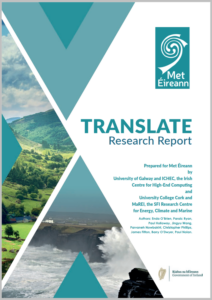
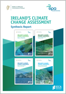
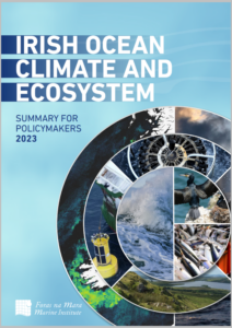
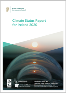
Cliceáil ar gach ceann de na tuarascálacha thíos chun breathnú ar aeráid na hÉireann i dtéarmaí réamh-mheastacháin aeráide amach anseo go dtí deireadh an chéid, breathnú cuimsitheach ar an athrú aeráide in Éirinn, tionchar na haeráide ar aigéin na hÉireann agus stádas na haeráide in Éirinn.
Aeráid Éireann
Is í Aeráid Éireann tairseach oiriúnaithe náisiúnta na hÉireann arna óstáil ag an GCC. Soláthraítear ar an leathanach sin faisnéis, comhairle agus tacaíocht chun cabhrú le hÉirinn dul in oiriúint dár n-aeráid atá ag athrú.
Is é baile an Taiscéalaí Sonraí Aeráid Éireann – áit ar féidir leat teacht ar shonraí AISTRIGH i bhfoirm léarscáile, chomh maith leis na comhaid is féidir a íoslódáil.
Sa tairseach, cuirtear treoir maidir le hoiriúnú ar fáil freisin agus is í an áit le haghaidh na ndoiciméad de chuid an Mheasúnaithe Riosca Náisiúnta ar an Athrú Aeráide.
Tá an leathanach sin ríthábhachtach i bhforbairt do Phleananna Oiriúnaithe Earnála.
Céim 2: Scagadh ar Thionchair Aeráide
Is céim thábhachtach í an chéim scagtha ar thionchair aeráide chun tuiscint a fháil ar na cineálacha gníomhartha oiriúnaithe nach mór duit a fhorbairt chun d’earnáil a oiriúnú do na hathruithe ar dhálaí aeráide. Éilítear leis an gcéim sin ar earnálacha na ndálaí aimsire agus aeráide a raibh tionchar acu orthu san am atá thart agus a mbeidh tionchar acu sa todhchaí a chatalógú. Chun cabhrú le hearnálacha an phróifíl sin a thógáil, molann CNSA an fhaisnéis agus na suíomhanna gréasáin atá thíos a úsáid mar fhoinsí maidir le teagmhais san am atá thart agus leis an aeráid fhéideartha todhchaí in Éirinn.
Chun próifíl a ullmhú agus a thógáil maidir le teagmhais aimsire agus aeráide a raibh tionchar acu ar d’earnáil, tá sé tábhachtach go mbeadh liosta ann de na teagmhais mhóra a tharla agus nuair a tharla siad.
Ó dhearcadh náisiúnta, tugtar san amlíne thíos cuntas ar chuid de na teagmhais mhóra aimsire ar fud na hÉireann.
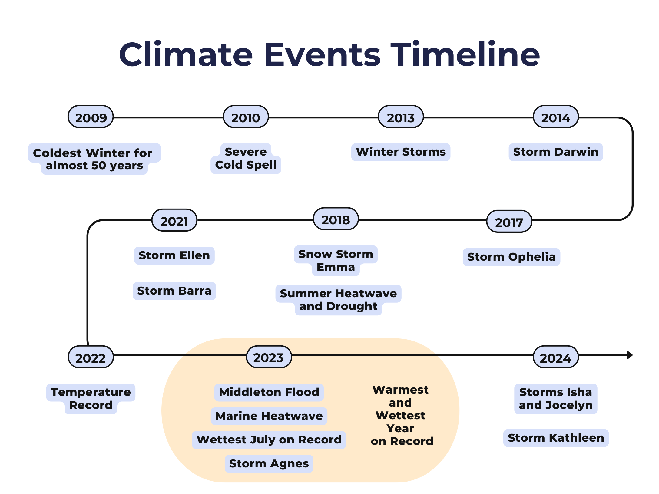
Chun amlíne atá cosúil leis a fhorbairt do d’earnáil ar leith, lean an nasc thíos chuig leathanach na dteagmhas mór aimsire, áit ina bhfuil na leathanaigh stairiúla aimsire agus aeráide doiciméadaithe.
Éilítear leis an Scagadh ar Thionchair Aeráide ort ní hamháin teagmhais san am atá thart a raibh tionchar acu ar d’earnáil a ghabháil, ach breathnú ar thionchair aeráide amach anseo freisin.
Chun seo a dhéanamh, beidh ort breathnú ar réamh-mheastacháin aeráide amach anseo. Chun ailíniú leis na treoirdhoiciméid agus earnálacha eile, tá sé riachtanach na réamh-mheastacháin chaighdeánaithe d’Éirinn a úsáid. Seo iad na réamh-mheastacháin AISTRIGH ó Met Éireann.
Tá siad ar fáil go héasca ar ardán Aeráid Éireann le breathnú orthu. Is féidir leat breathnú ar na sonraí ó amharc mar léarscáileanna ar an ardán, nó is féidir leat na sonraí a íoslódáil chun scrúdú breise a dhéanamh orthu.
Tá tuilleadh eolais faoi na sonraí ar fáil trí theagmháil a dhéanamh le nfcs@met.ie.
Céim 3: Tosaíocht a thabhairt
Agus POE á fhorbairt tá go leor rioscaí agus tionchar ann a bhféadfá dul i ngleic leo. Tá sé tábhachtach, áfach, a bheith in ann tosaíocht a thabhairt do na rioscaí criticiúla is mó tionchar i d’earnáil. Leis an ngníomh sin, cuirtear ar chumas forbróirí POE tuiscint a fháil ar réimsí is mó atá i mbaol ón aeráid ina n-earnáil. Tá clár rioscaí forbartha ag an Measúnú Riosca Náisiúnta ar an Athrú Aeráide (MRNAA) ag GCC, ina sonraítear na rioscaí is cuí i gcomhthéacs na hÉireann le díriú orthu agus POE á fhorbairt. Tá an clár riosca a d’fhorbair siad ar scála náisiúnta, bunaithe ar théamaí, agus mar sin b’fhéidir nach mbaineann siad go léir le d’earnáil. Tá sé ríthábhachtach tosaíocht a thabhairt do rioscaí a bhaineann go sonrach le d’earnáil sa rannóg sin. Is acmhainn thar a bheith luachmhar é an clár rioscaí sin, áfach, agus tú ag iarraidh tosaíocht a thabhairt do mheasúnú riosca le haghaidh do POE. Le haghaidh tuilleadh faisnéise a fháil maidir leis sin, déan teagmháil le GCC nó tabhair cuairt ar Aeráid Éireann – https://www.climateireland.ie/impact-on-ireland/national-climate-change-risk-assessment/.
Céim 4: Measúnacht Tionchair Tosaíochta
Is í seo an chéim den phróiseas ina bhfuil faisnéis agus seirbhísí aeráide ríthábhachtach chun tacú le cinnteoireacht. Tá sé bunriachtanach na sonraí tacaíochta cuí aeráide a bheith ann chun an riosca d’earnáil i leith an athraithe aeráide amach anseo a thuiscint. Tá sé ríthábhachtach don chinnteoireacht go ndéanfaí measúnú riosca ar an aeráid chun tuiscint a fháil ar an tionchar a bheidh ag guaiseacha aeráide ar neamhchosaint agus laigí d’earnála. Is féidir le CNSA tacaíochtaí a thabhairt ar bhealaí éagsúla le linn chéim Measúnachta Tionchair Tosaíochta an phróisis.
Measúnuithe Riosca ar an Aeráid
Tá measúnuithe riosca ar an aeráid ina gcuid bhunriachtanach den phróiseas chun plean oiriúnaithe don athrú aeráide a fhorbairt. Soláthraítear bonn fianaise eolaíche le haghaidh an riosca aeráide amach anseo trí mheasúnú riosca a dhéanamh. Le measúnú níos mionsonraithe cuirtear ar chumas na n-earnálacha guaiseacha agus tionchair a bhaineann leis an aeráid agus leis an aimsir amach anseo a thuiscint agus éagsúlachtaí spáis agus ama atá i gceist leo siúd agus neamhchinnteachtaí gaolmhara á gcur san áireamh.
Is féidir leis an measúnú mionsonraithe sin rannchuidiú na méadrachta neamhchosanta agus laigí a éascú freisin, rud a chinntíonn go sainítear léargas cuimsitheach ar rioscaí aeráide amach anseo.
Tá dhá chineál measúnaithe riosca bunaithe ar shonraí:
- Leathchainníochtúil
- Lánchainníochtúil
Measúnú Riosca Náisiúnta ar an Athrú Aeráide (MRNAA)
Ba cheart go leagfaí amach leis an bpróiseas tionchair thosaíochta an athraithe aeráide d’Éirinn a sholáthróidh bonn chun cinntí a dhéanamh i dtaobh an bhfuil rioscaí inghlactha ag an tsochaí nó ag pobail. Socrófar leis ansin conas is féidir rioscaí a laghdú agus conas is féidir deiseanna féideartha a bhaint amach. Próiseas measúnaithe riosca atriallach leathchainníochtúil córasach a bheidh ann a thacóidh le rioscaí ón athrú aeráide a shainaithint, a mheasúnú agus a chur in ord tosaíochta a bhfuil faisnéis chomhsheasmhach aeráide mar bhonn acu agus a thugann cuntas ar neamhchinnteacht i réamh-mheastacháin aeráide.
- Is doiciméad oibre í an mhodheolaíocht agus beidh an mhodheolaíocht deiridh ar fáil mar aon leis an tuarascáil deiridh, leis an achoimre do lucht déanta beartas agus leis na tuarascálacha uile a ghabhann léi in R1 2025.
- Forbraíodh Treoir Theicniúil maidir le Measúnú Riosca Earnála freisin mar chuid den phróiseas chun comhsheasmhacht a chinntiú ar fud na pleanála náisiúnta agus earnála. Leis an treoir sin, cabhraítear le hearnálacha chun measúnuithe riosca ar an athrú aeráide a chur chun feidhme atá i gcomhréir le Modheolaíocht an Mheasúnaithe Riosca Náisiúnta ar an Athrú Aeráide.”
Measúnú Riosca Leathchainníochtúil
Is cur chuige aitheanta é measúnú riosca leathchainníochtúil i dtaca le measúnú riosca ar an athrú aeráide. Tá sé á chur chun feidhme ní amháin ag MRNAA Éireannach nua atá á fhorbairt ag GCC, ach cloíonn sé leis an dea-chleachtas idirnáisiúnta ón AE, an RA agus an Nua-Shéalainn maidir le measúnuithe riosca ar an athrú aeráide.
Úsáidtear i measúnuithe riosca leathchainníochtúla meascán d’fhoinsí sonraí ar an athrú aeráide atá comhsheasmhach go náisiúnta, faisnéis cháilíochtúil (luach uimhriúil sannta) agus eolas páirtithe leasmhara agus saineolaithe. Sa chás sin, bhainfí úsáid sa mheasúnú riosca as trí chineál tacar sonraí, guais an athraithe aeráide (AISTRIGH), neamhchosaint ar an athrú aeráide agus laigí i leith an athraithe aeráide.
Leis an gcur chuige sin, soláthraítear tuiscint níos mionsonraithe ar na rioscaí agus ar na deiseanna a bhaineann leis an athrú aeráide agus cuirtear ualú eolaíoch le measúnú ar an riosca ón aeráid. Is féidir le staidéir leathchainníochtúla a bheith mar an chéad chéim chun rioscaí féideartha ón aeráid a thuiscint agus béim a chur orthu agus is féidir leo tú a chur ar an eolas nuair a bhíonn staidéar lánchainníochtúil ag teastáil.
Tá sé tábhachtach an deis a thabhairt d’earnálacha riosca ón aeráid a shainmhíniú. Trí shonraí aeráide, agus méadracht neamhchosanta agus laigí atá sainiúil don earnáil a ionchorprú, is féidir leis an measúnú riosca leathchainníochtúil é sin a dhéanamh.
Creat measúnaithe riosca leathchainníochtúil AISTRIGH
Mar chuid den tionscadal AISTRIGH, d’fhorbair foireann an tionscadail creat measúnaithe riosca leathchainníochtúil. Soláthraítear sa chreat treoir céim ar chéim maidir le measúnú riosca, tá an cumas ann chun é a chur in oiriúint don úsáideoir aonair.
Tá an creat á óstáil ag Met Éireann agus ag CNSA ar féidir leo oibriú go dlúth le gach earnáil chun measúnú riosca a bhaineann go sonrach léi a ríomh.
Ionchorpraítear sa chur chuige measúnaithe riosca sin sonraí guaise réamh-mheastacháin aeráide amach anseo ó AISTRIGH agus sonraí atá sainiúil don earnáil ar neamhchosaint agus ar laigí. Tá an measúnú bunaithe ar chóras faisnéise geografaí (CFG) agus leis sin tugtar léiriú amhairc ar an riosca ón aeráid atá déanta.
Breathnaítear sa chás-staidéar breise seo ar phróiseas 6 chéim maidir le conas sonraí AISTRIGH a úsáid chun riosca ón aeráid a shainmhíniú i modh measúnaithe riosca leathchainníochtúil.
Cás-staidéar AISTRIGH: Laethanta Oideachais Caillte. Cliceáil anseo chun an mapa scéala lánscáileáin a fheiceáil.
Sonraí chun tacú le Measúnú Riosca ar an Aeráid
Tá sé ríthábhachtach d’aon mheasúnú riosca go mbeadh fáil ar thacair sonraí ardchaighdeáin agus go mbeifí in ann teacht orthu chun tacú leis an staidéar cainníochtúil atá á chur i gcrích. Mar gheall ar ról CNSA maidir le seirbhísí agus faisnéis aeráide a chomhordú in Éirinn, is féidir go leor de na tacair sonraí guaise aeráide a thiomsú chun tacú le do Phleananna Oiriúnaithe Earnála. Tá na tacair sonraí guaise aeráide sin ag teacht le moltaí MRNAA. Seo thíos roinnt de na tacair sonraí guaise aeráide choitianta a bhaineann le forbairt POEnna.
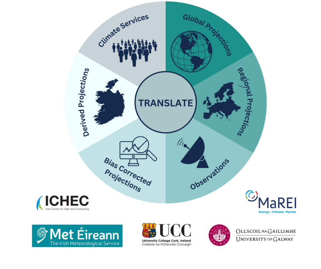
Réamh-mheastacháin AISTRIGH
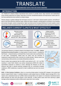
Tionscnamh atá faoi cheannas Met Éireann is ea an tionscadal AISTRIGH chun réamh-mheastacháin aeráide na todhchaí a chaighdeánú d’Éirinn agus chun seirbhísí aeráide a fhorbairt a fhreastalaíonn ar riachtanais faisnéise aeráide na gcinnteoirí.
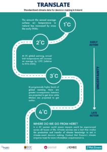
Cuireann AISTRIGH réamh-mheastacháin aeráide ar fáil don todhchaí a ailíníonn le treoir theicniúil MRNAA agus ar féidir leo tacú le forbairt POEnna. Ligeann na réamh-mheastacháin d’úsáideoirí scrúdú a dhéanamh ar aeráid na todhchaí in Éirinn a d’fhéadfadh a bheith i gceist ar scálaí ama an lae inniu, lár na haoise agus dheireadh na haoise agus thar chonairí astaíochta éagsúla (RCPanna) a d’fhéadfadh a bheith ann, ó ghníomh luath go gníomh déanach.
Tá sonraí AISTRIGH ar fáil saor in aisce do chách ar thaiscéalaí sonraí Aeráid Éireann nó trí theagmháil a dhéanamh le deasc chabhrach Sheirbhís Aeráide na hÉireann – nfcs@met.ie.
Réamh-mheastacháin 2020 Nolan agus Flanagan
Tugtar le réamh-mheastacháin aeráide 2020 CMIP5 Nolan agus Flanagan de chuid Ionad na hÉireann um Ríomhaireacht Ardleibhéil (IÉRA) roinnt de na hathróga aeráide nach bhfuil ar fáil go fóill ó réamh-mheastacháin AISTRIGH.
Ina measc sin tá athróga gaoithe agus sneachta.
In éagmais na n-athróg sin trí AISTRIGH, molann CNSA réamh-mheastacháin Nolan agus Flanagan a úsáid.
Tá siad sin ar fáil trí theagmháil a dhéanmah le IÉRA le haghaidh na sonraí.
*Note* – Tabhair faoi deara* – Tá foireann AISTRIGH ag obair faoi láthair ar athróga gaoithe agus bogthaise coibhneasta a fhorbairt
Tuilte – Rochtain a Fháil ar Shonraí
Riosca mór do go leor daoine ar fud na tíre is ea tuilte. Baineann riosca leo ó leibhéal náisiúnta go háitiúil faoi láthair, agus beidh siad ina riosca amach anseo.
Cruthaítear tuilte ar bhealaí éagsúla:
- Báistiúil
- Abhann
- Cósta
- Screamhuisce
Faigh tuilleadh eolais ar an mbrí atá le gach ceann díobh sin ar Floodinfo
Tá sonraí le measúnú a dhéanamh ar thuilte amach anseo ar fáil d’Éirinn. Tá tacair sonraí éagsúla ar fáil maidir le cineálacha éagsúla tuilte.
Báistiúil agus Abhann – Measúnú agus Bainistíocht Riosca i gcás Tuilte Dobharcheantair & Léarscáiliú Abhann Táscach Náisiúnta OOP.
Cósta – Léarscáiliú Guaise Tuilte Cósta Náisiúnta OOP
Screamhuisce – GWFlood: Tionscadal um Thuilte Screamhuisce de chuid SGÉ
Chun tuilleadh faisnéise a fháil agus chun léarscáileanna tuilte a fheiceáil de gach ceann de na cineálacha éagsúla tuilte thuas, tabhair cuairt ar floodinfo.ie/map/floodmaps nó https://data.gov.ie/
Chun rochtain a fháil ar na sonraí, déan teagmháil le OOP.
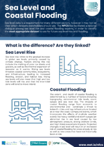
Treoir maidir le Leibhéal na Farraige agus Tuilte Cósta
Céim 5: Do Phlean a Fhorbairt
Is é buaic na hoibre ar fad í an chéim seo, an obair a rinneadh ar scagadh an tionchair aeráide, measúnuithe riosca ar an aeráid agus níos mó. Gníomhartha oiriúnaithe a shainaithint atá le cur i bhfeidhm le linn chéim chur chun feidhme agus mhonatóireacht an phlean.
Ag gach céim den phlean, lena n-áirítear an chéim seo, tá CNSA ar fáil agus réidh chun cabhrú le comhairle a thabhairt duit maidir le faisnéis agus seirbhísí aeráide. Cuireann CNSA fáilte roimh rannpháirtíocht le linn an phróisis agus tá sé ar fáil chun tacú le do riachtanais seirbhíse aeráide agus faisnéise trí theagmháil a dhéanamh leis an Deasc Chabhrach agNFCS@met.ie .
Céim 6: Cur Chun Feidhme, Measúnú agus Athbhreithniú
Ag an bpointe seo, tá do phlean foilsithe agus faofa le haghaidh gnímh. Tá sé ríthábhachtach don phróiseas iomlán go gcaithfidh na POEnna tascanna inghníomhaithe a shainmhíniú a chuirtear chun feidhme agus a ndéantar measúnú orthu. Cé go bhfuil CNSA ann chun tacú le do phlean a fhorbairt, tá sé ann freisin chun tacú le do phlean a chur chun feidhme, a mheasúnú agus athbhreithniú a dhéanamh air. Mar chomhordaitheoir na seirbhísí aeráide ar fud na hÉireann, tá CNSA páirteach fós le linn chéim chur chun feidhme na bPleananna Oiriúnaithe Earnála. D’fhéadfadh sé sin a bheith i bhfoirm coistí stiúrtha le haghaidh tionscadal a thagann amach mar ghníomhartha sna POEnna, cabhrú le grúpaí oibre d’earnálacha atá ag iarraidh cur leis na gníomhartha atá leagtha amach sna pleananna nó cúnamh agus treoir a thabhairt maidir le haon riachtanais seirbhíse agus faisnéise aeráide.
Tá deasc chabhrach ar féidir teagmháil a dhéanamh léi ag CNSA atá thar a bheith sásta bualadh le hearnálacha agus cabhrú leo.
