The Meteorologist’s Commentary page has been updated to include details on Storm Dennis, which is also available here:
Latest updated Meteorologist’s Commentary issued at 3pm, Friday, 14th February 2020 by Paul Downes, Meteorologist, Forecast Division
Storm Dennis – Saturday 15th to Monday 17th February
Storm Dennis (as named by the UK Met Office), is currently undergoing rapid cyclogenesis in the Western Atlantic. While staying to the northwest of Ireland Storm Dennis will produce some wet and windy weather over Ireland this weekend.
The Meteorological Situation (Technical discussion)
The strength of the Jet stream (an atmospheric river) is determined by the temperature gradient closer to the surface, we call the zone where warm and cold air meet the baroclinic zone (a strong temperature gradient that separates warmer air from colder air and often the battle field that spans our storms)
The ongoing battle between warm air over the south central Atlantic and a cold pool over much of Eastern Canada has led to a strong level baroclinic zone fuelling a powerful jet aloft with several waves tracking across the Atlantic. The lead wave of the two has been the driving force for this first deep low ~933hpa currently tracking northwestly and occluding south of Iceland.
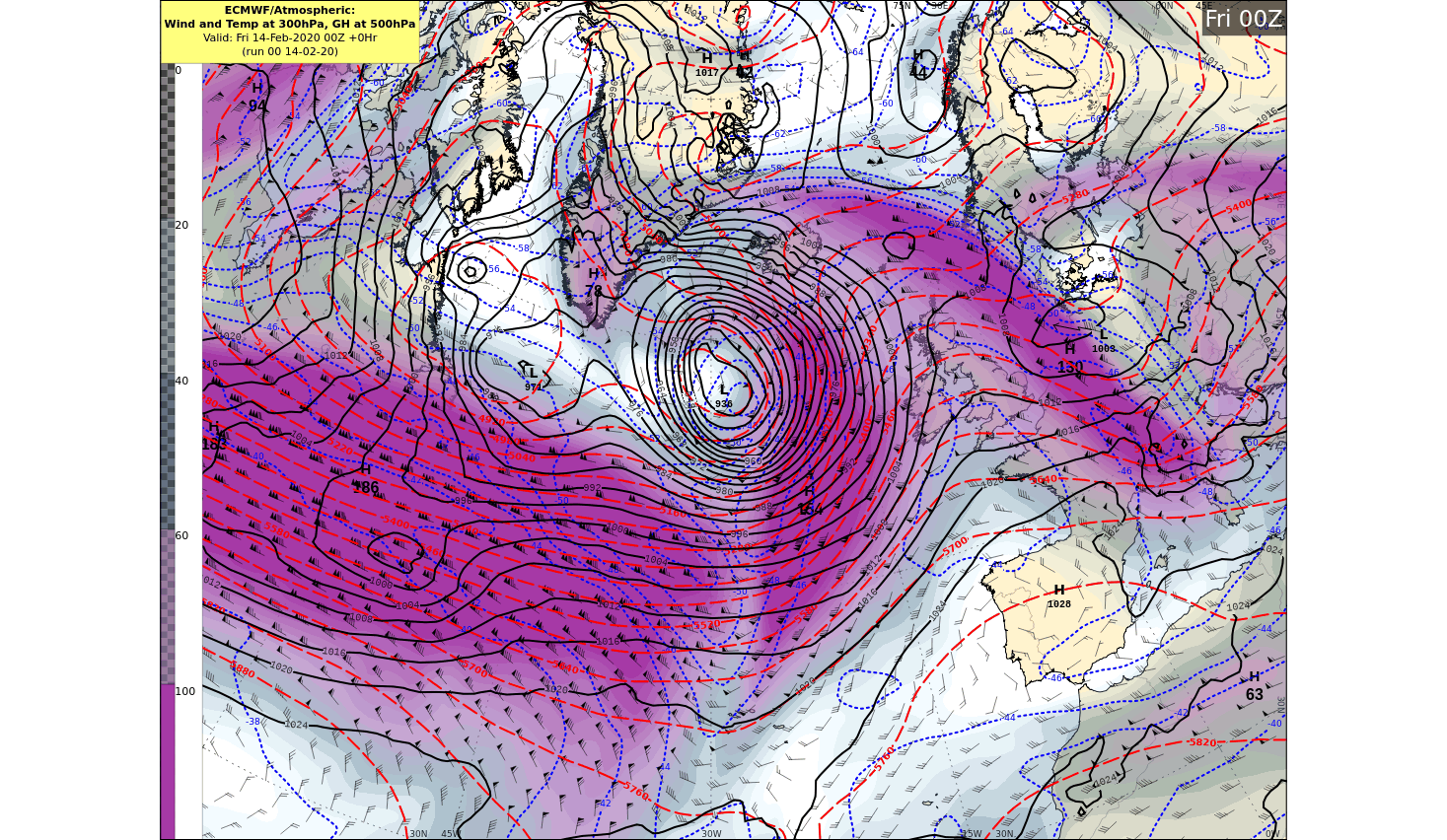
Warm air being pushed up along the US east coast meeting very cold air over Eastern Canada is the driving force for this powerful jet, with winds up to 225knots (~416kph) at its core, currently aiding the rapid development of Storm Dennis. Dennis will develop rapidly today, to put this into perspective, rapid cyclogenesis is defined as a drop in pressure of greater than 24hpa in 24hours, this storm is forecast to drop by around 70hpa in 24hours as it rapidly tracks north towards Iceland and with a forecast central pressure in the low 9-teens it will rival the lowest ever pressure recorded in the north Atlantic of 913hpa off the coast of Scotland Jan 11th 1993. Thankfully the core of Storm Dennis stays well to our northwest as it rapidly strengthens before pirouetting( the Fujiwhara effect) around Fridays low and comes back to visit us on Sunday as it slowly weakens.
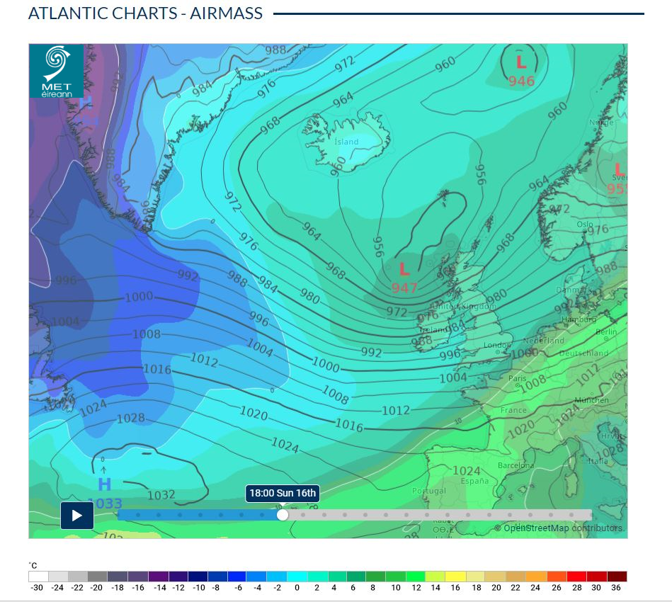
View the Atlantic Chart – Airmass animation here
Timeline for Ireland
For the latest warnings see
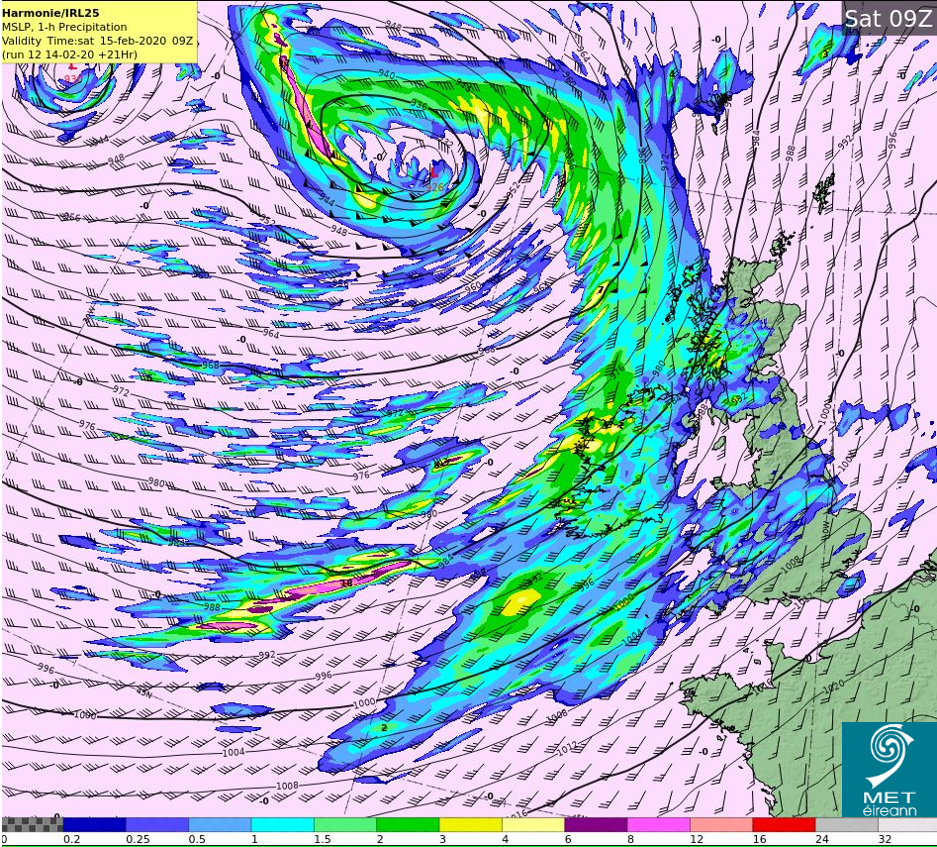
Saturday) The first round of wet and windy weather will reach the Atlantic coast on Saturday morning spreading countrywide during the morning easing later and Status Yellow wind and rain warnings are in operation.
For the latest warnings see
Sunday) The core of storm Dennis (actually a hybrid of Fridays Low and Storm Dennis) will gradually fill and weaken as it tracks south-eastward towards Ireland bringing squally showers with a risk of thunder. A widespread StatusYellow wind warning is likely to be issued and possibly Orange level winds locally (especially in the vicinity of squally showers along Atlantic coasts) can be expected.
Monday) Winds will gradually ease through Monday, but not dissimilar to this past Monday showery conditions can be expected with wintry conditions possible.
Flooding issues
A) Elevated river levels
Currently river levels are elevated across the country, particularly in the midlands, west and south, so any heavy rainfall would cause issues
B) Coastal Flooding
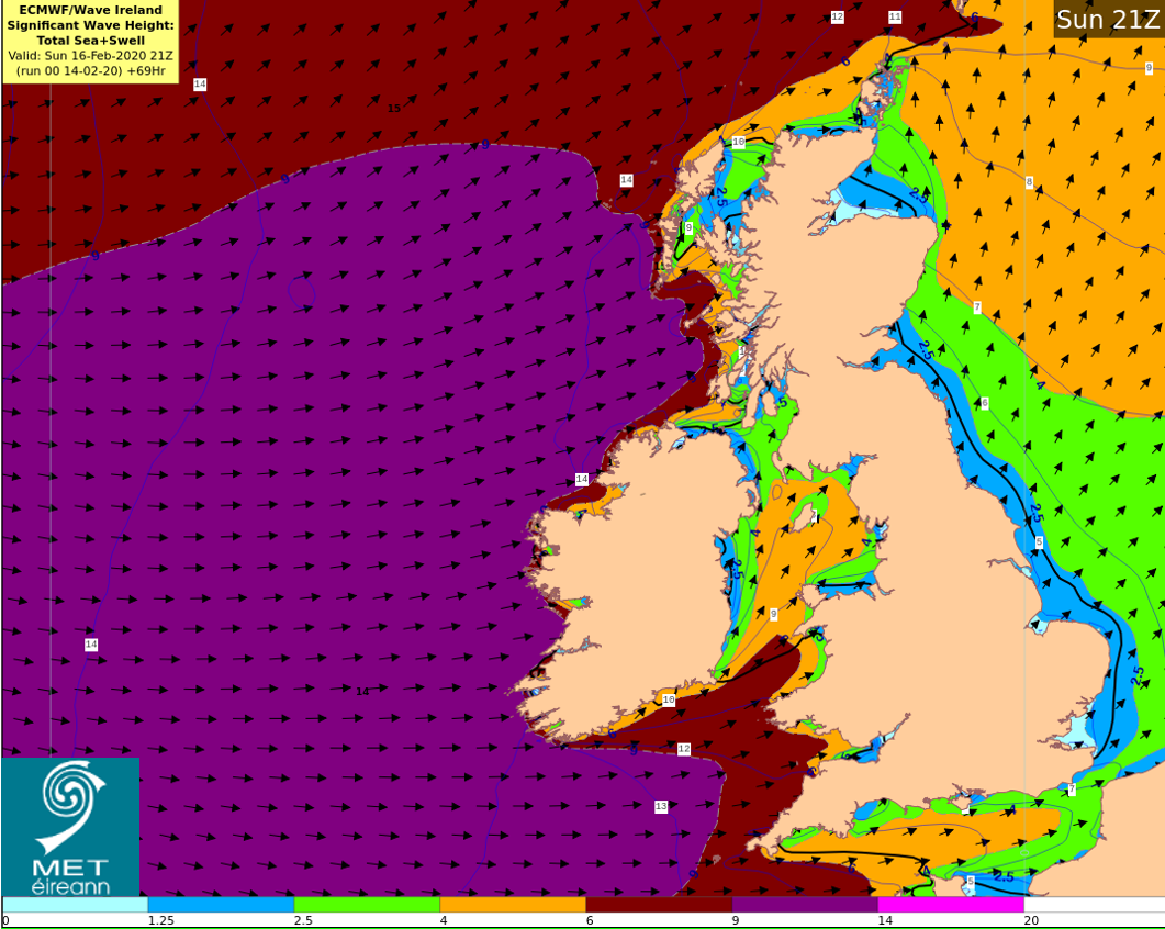
We are entering into a period of transition between Spring (High) Tides and Neap (Low) Tides. This means there will not be a large variation between high and low tides. The combination of high seas and strong winds or stormy conditions, may increase the possibility of coastal flooding especially along western and southern coasts Saturday and Sunday coinciding with high tides.
As forecast confidence improves over the coming days Met Éireann will issue warnings as required. Please check for updates on https://www.met.ie/warnings.
Weather Warning Alerting Services
Push notifications for all weather warning levels (yellow, orange and red) for your location are available on the latest version of the Met Éireann App. Alternatively, you can also sign up to receive emails/SMS (red only) of weather warnings on our warning page. Both services are outlined here.