Storm Ciarán has been named by the UK Met Office on Sunday 29th October. The storm is due to pass close to the south coast of Ireland on Wednesday night, 1st November. Showers and longer spells of rain will continue through the Bank Holiday weekend and into next week ahead of Storm Ciarán.
A weather dvisory has been issued for the coming days as the unsettled weather continues to have an impact across the country.
Advisory for Ireland
On Monday, Tuesday and Wednesday, there will be heavy showers or longer spells of rain at times over Ireland with flooding likely in places, as soils are saturated and river levels are high.
Later Wednesday and on Thursday, Storm Ciaran will bring falls of heavy rain and strong winds. Current indications suggest the heaviest rain and strongest winds will be in Munster and Leinster with flooding likely.
Additional Impacts:
- Poor visibility
- Difficult/dangerous driving conditions
Valid: 14:40 Sunday 29/10/2023 to 23:30 Thursday 02/11/2023
Issued: 14:41 Sunday 29/10/2023
Low pressure will continue to dominate Ireland’s weather for the week ahead, bringing further heavy showers and rain. With already significant rainfall amounts over the past weeks, ground conditions are saturated or waterlogged nationwide and many rivers are high. As a result, the risk of flooding in the coming days is increased.
Met Éireann meteorologist Aoife Kealy said “Even today (Sunday), heavy showers will bring a risk of localised flooding, especially to western areas and the north midlands. So, a yellow rain warning is in place for Cavan, Monaghan, Connacht, Longford, Louth and Westmeath until 9pm Sunday.”
Visit our Weather Warnings page.
There will be very little respite from the rain ahead of Storm Ciarán, as showers and spells of rain will continue on Monday and Tuesday.
Aoife continued “Further heavy showers on Monday will add to already high rainfall accumulations. Then, more widespread and potentially heavy rain on Tuesday will lead to a further deterioration in ground conditions and river levels. So, there will be an ongoing risk of localised flooding as we move into the new week.”
This wet weather in the early days of next week is likely to exacerbate the impact of Storm Ciarán on Wednesday evening and Thursday. Current indications suggest that the storm will track past our south coast on Wednesday evening and night before moving northeastwards through the Irish Sea and over the UK (see Figure 2 below). As it passes us, it will bring a spell of very wet and windy weather, with heavy rainfall in places. With already wet conditions preceding Storm Ciarán, there will be a heightened risk of flooding, with possible disruption from strong winds also.
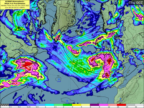
Figure 2: Current forecast track of Storm Ciarán on Wednesday night
Currently, there remains some uncertainty in the exact path that Storm Ciarán will take but it is most likely to track past the south coast of Ireland. Updates to the forecast and future warnings in the coming days can be found at https://www.met.ie/warnings
For advice and information on staying save in severe weather, please consult www.winterready.ie