The weather in the lead up to Easter weekend will be largely dry and settled with sunny spells for most. However later on Easter Sunday we’ll see a big change as much colder air arrives across the country, introducing the chance of wintry showers of hail, sleet and snow.
Met Éireann meteorologist, Matthew Martin, said: “High pressure will establish across Ireland in the run up to Easter, allowing a spell of settled weather lasting until the first half of Easter Sunday.
“It’ll be largely dry with sunny spells for most, though there’ll be a bit of a temperature contrast – today and Good Friday we could see highs of around 15 to 18 Celsius across southern and western areas in the best of the sunshine, whereas northern and eastern areas will be notably cooler as easterly breezes keep temperatures at around 10 to 12 Celsius. These coastal areas may also see low cloud lingering through the first part of the day. Saturday will be another dry day with good spells of sunshine and temperatures of around 10 to 13 Celsius, still feeling cooler though along northern and eastern coasts.”
Commenting on the forecast for Easter Sunday and the change to colder conditions, Matthew continued: “Easter Sunday will start dry with sunshine for most and whilst southern areas will continue to enjoy a dry and bright day, a cold front will introduce cloud and rain across the northern half of the country through the afternoon – it’s this cold front that opens the gates to very cold air from the Arctic from Easter Sunday night and through much of next week.”
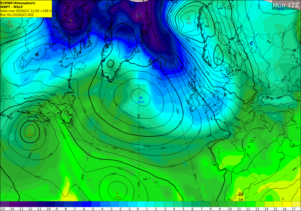
Forecast chart for Monday 5th April showing a colder, northerly airflow across Ireland (blue colours) that will bring wintry showers of hail, sleet and snow across the island.
The cold airmass will introduce the chance of wintry showers of hail, sleet and snow on Easter Monday and Easter Tuesday, with temperatures limited to around 3 to 7 Celsius. Temperatures overnight will widely fall close to freezing with a touch of frost in places, which could cause problems for gardeners so take care to cover vulnerable plants and protect from frost damage.
The cold snap could also pose challenges for farmers and so we’re encouraging farmers to keep an eye on our farming commentary ahead of the cold conditions arriving later this weekend.
For the most accurate and up to date 7-day, hourly forecast for your local area on the Island of Ireland go to met.ie. The latest weather advisories and warnings for Ireland are on the Met Éireann Warnings page. These services and more are available on our free app – available from the App store for iPhone, and Play store for Android. Follow us on Twitter and Facebook for extra weather and climate content.
But whatever the weather please follow the public health advice and help keep everybody safe from COVID-19.