A second named storm in August
Meteorologist Commentary by Joan Blackburn (Deputy Head of Forecasting) and Sinéad Duffy, Met Éireann, Monday 24th August 2020
Storm Francis was named by the UK Met Office due to expected impacts in the UK as a result of the second unseasonable storm in August 2020.
Storm Francis is expected to cross Ireland during Tuesday morning 25 August 2020.
Over Ireland the main concern is for intense rainfall over short periods of time. Orange level rainfall warnings are in operation for Connacht, Donegal, Cavan and Monaghan and also for Southern Coastal Counties of Kerry, Cork, Waterford, Wexford with status yellow rainfall elsewhere. Some flash flooding is likely in places and also this rainfall will further elevate river levels and may result in river flooding as well. The intense rainfall is likely to ease off in southern counties by early Tuesday morning.
It will be very windy, possibly stormy, for a time Tuesday mainly in parts of the south and southeast with yellow wind warnings in operation for Munster and for counties Wexford, Wicklow and Dublin with potential for some damaging gusts.
Caution is advised. With trees in full leaf and many on holidays across the country, impacts could be significant with the potential for damaging winds, heavy rain, and flooding in affected areas.
Tourists in exposed locations in particular will be at risk.
Please sign up for warnings notifications on the Met Éireann app and get the latest warnings https://www.met.ie/warnings and www.metoffice.gov.uk
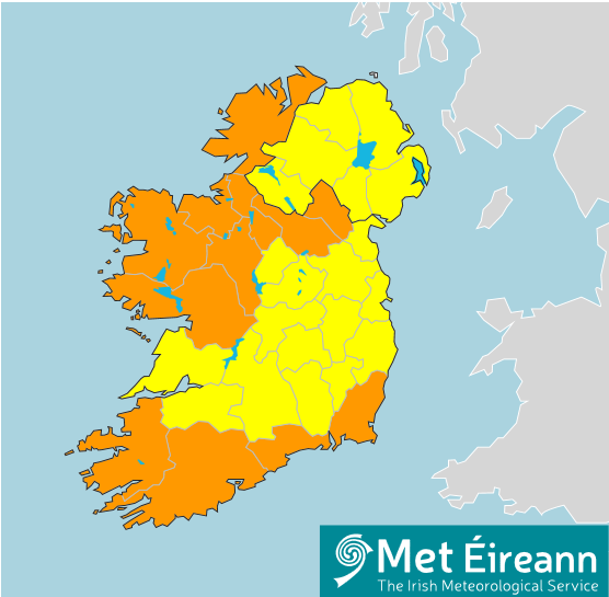
Figure 1. Rain and Wind warnings associated with Storm Francis (as at 7pm 24th August 2020)
Storm Francis is forming in the Atlantic to the southwest of Ireland as a low pressure deepens rapidly. The extensive bands of cloud and rain are approaching quickly.
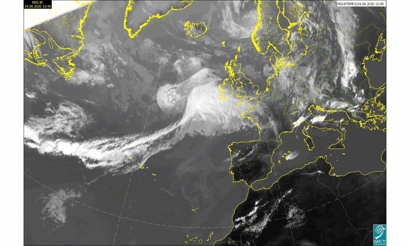
Figure 2. EUMETSAT animation of Storm Francis on 24th August 2020
The warnings may be updated as the forecast models are updated, so please keep up to date on the website and apps.
https://www.met.ie/forecasts/national-forecast
https://www.met.ie/forecasts/marine-inland-lakes/sea-area-forecast
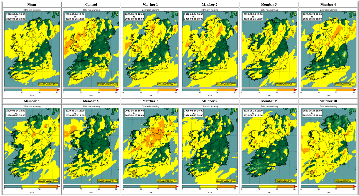
Figure 3. Met Éireann’s high-resolution Ensemble Prediction System (IREPS) showing the range of possibilities of 24 hour rainfall amounts.
Climate perspective
As our planet warms, so does our atmosphere. Warmer air has the ability to hold more moisture. Here in Ireland we have seen an increase in average annual rainfall by about 6% over the last 30 years as compared to the previous 30 years. The latest climate model projections suggest Ireland will likely see more frequent heavy rainfall events, as our planet continues to warm.
Named Storms
Storm Francis is the sixth named storm from the 2019/2020 storm list of the Met Éireann, UKMO and KNMI partnership. It is the ninth named storm overall.
The first one, storm Lorenzo, was named by the National Hurricane Center in the USA. Lorenzo originated as Hurricane Lorenzo, the eastern- and northern-most category 5 hurricane ever recorded in the Atlantic Ocean but it weakened considerably as it stalled off the northwest coast and produced few impacts as it tracked over Ireland on Friday 4th October 2019.
Storm Elsa (18th December 2019) and Storm Jorge (29th February 2020) were named by the IPMA, the national meteorological service of Portugal, and AEMET, the national meteorological service of Spain, due to their forecasted impacts in the Iberian region.
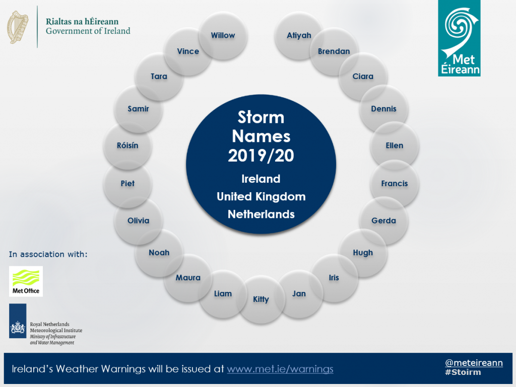
Figure 4: Storm names for 2019/2020 season