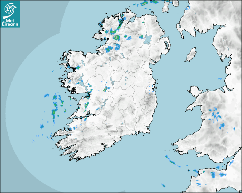

Latest Rainfall Radar showing live precipitation and the last 90 minutes precipitation over Ireland, updated every 5 minutes. Precipitation can be rain, hail or snow. Accumulations can refer to rainfall only.
Lightning strikes, when they occur, are displayed as a cross. Initially, they are red but change to orange and then yellow after a period, then disappear © Met Office ATDNet.
Ground Clutter may appear (South Co. Dublin), bright bands and spokes may also be present in images. They are artefacts (false echoes) of rainfall radar systems and should be ignored. Further information on Radar here
Met Éireann forecasters manually produce the weather icons for midday and midnight to reflect the predicted major weather type for these times.
The rainfall forecast is direct model output from Numerical Weather Prediction models but is a guideline only. Rain refers to precipitation, which can be rain, sleet or snow. It forecasts how much rain will fall (in mm) hourly during the previous hour (accumulations), then in 3 hourly and finally 6 hourly accumulations up to 7 days. This service is based on data and products of the HARMONIE-AROME and the European Centre for Medium-range Weather Forecasts (ECMWF) models.
The wind is direct model output from Numerical Weather Prediction models but is a guideline only. It forecasts the strength of the wind (in knots and km/h) at 10m for the top of each hour, in hourly, then 3 hourly and finally 6 hourly intervals up to 7 days. The wind arrow tip points in the direction the wind is blowing and the tail length indicates wind strength. However, in the text forecast below, it is described as where it is blowing from. This service is based on data and products of the HARMONIE-AROME and the European Centre for Medium-range Weather Forecasts (ECMWF) models.
The temperature is direct model output from Numerical Weather Prediction models but is a guideline only. It forecasts air temperature on land and over sea in °C for the top of each hour, 3 hourly and finally 6 hourly intervals up to 7 days. Minus zero (-0) indicates values between 0 to -0.5°C. This service is based on data and products of the HARMONIE-AROME and the European Centre for Medium-range Weather Forecasts (ECMWF) models.
The Mean Sea Level Pressure (MSLP) is direct model output from Numerical Weather Prediction models but is a guideline only. It forecasts the MSLP in hecto Pascals (hPa) for the top of that hour initially in 3 hourly intervals, then 6 hourly. This service is based on data and products of the HARMONIE-AROME and the European Centre for Medium-range Weather Forecasts (ECMWF) models.
National Forecast
04 June 2026 21:00
Tonight
Showers will gradually ease tonight, becoming mostly confined to western areas later on.The westerly winds will ease too, becoming light to moderate southwesterly. Cooler than recent nights with overnight lows of 5 to 9 degrees.
Tomorrow
Tomorrow, Friday, will bring an improvement to most places for a time, as it won't be as showery or as breezy as of late. It'll stay mostly dry in the east, with some sunny spells too. However, there'll still be scattered showers, especially further west and north. Cloud will increase generally during the afternoon, and it'll become wet and breezy across Munster through the evening, with rain moving up from the southwest, heavy later in the south and southwest Cool for early summer with top temperatures of 12 to 16 degrees generally, in a mostly moderate southerly wind, backing southeasterly later and freshening in Munster.
Met News

04th June 2026
Climate Statement for Spring 2026
Third warmest Spring on record. Wet in the West, d... more


03rd June 2026
Climate Statement for May 2026
National May Maximum Temperature Record Broken by ... more
![]()
28th May 2026
EUMETNET celebrates 30 years of European meteorological cooperation
In 2026, the European network of national meteorol... more