The climate of Ireland is changing. Consequently, the Department of Housing, Local Government and Heritage funded this project to update ‘Climate maps and data to support building design standards in Ireland’.
The motivation of this research was to produce maps of the return levels of snow loads at 100m above mean sea level for the return periods of 50, 100 and 120 years for use in building design to enhance resilience in support of climate change adaptation in Ireland. The new maps will support the structural design of buildings and civil engineering works in Ireland.
The outputs of this research will benefit a wide range of stakeholders currently collaborating with Met Éireann, such as the National Standards Authority of Ireland and the Department of Housing, Local Government and Heritage. This report will also inform policy in delivering key national infrastructures such as housing and building renovation.
The new maps of return values of snow loadings at 100m above mean sea level in Ireland for 50, 100, and 120-year return periods should be adopted by stakeholders. These new maps are more representative and supersede the previous map of return values of snow loadings at 100m above mean sea level for 50-year return period.
It is hoped that the detailed explanation of the methodology and the clarification of the rationale for the new maps being more accurate than the preceding map provided here will be of assistance to regulators elsewhere in adopting these new maps in their own jurisdictions.
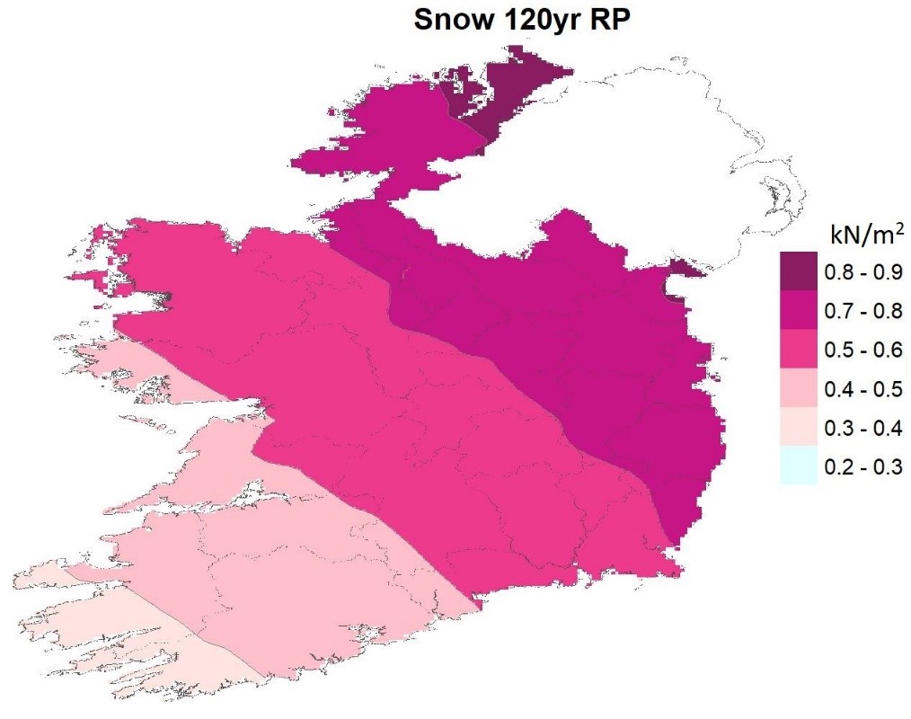
Return values of snow loadings at 100m above mean sea level in Ireland for a 120-years return period
Read the full report:
Mateus, C., and Coonan, B. 2022. Snow loadings at 100m above mean sea level in Ireland. Climatological Note No. 20. Dublin: Met Éireann. REPORT.