Forecast issued at: Tuesday 28th July 2026 13:00
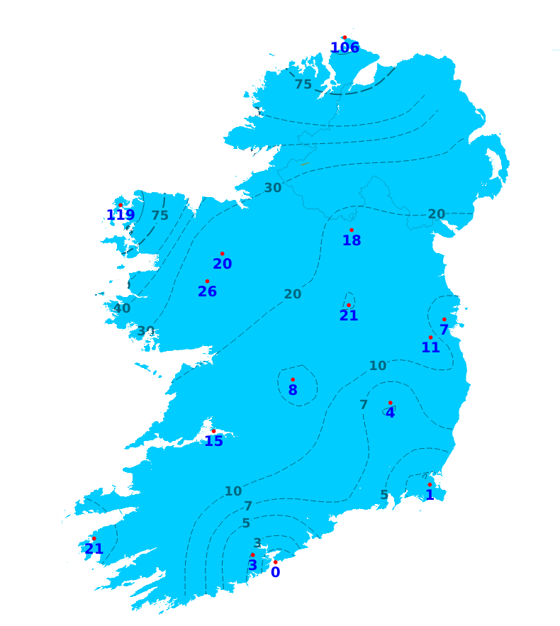
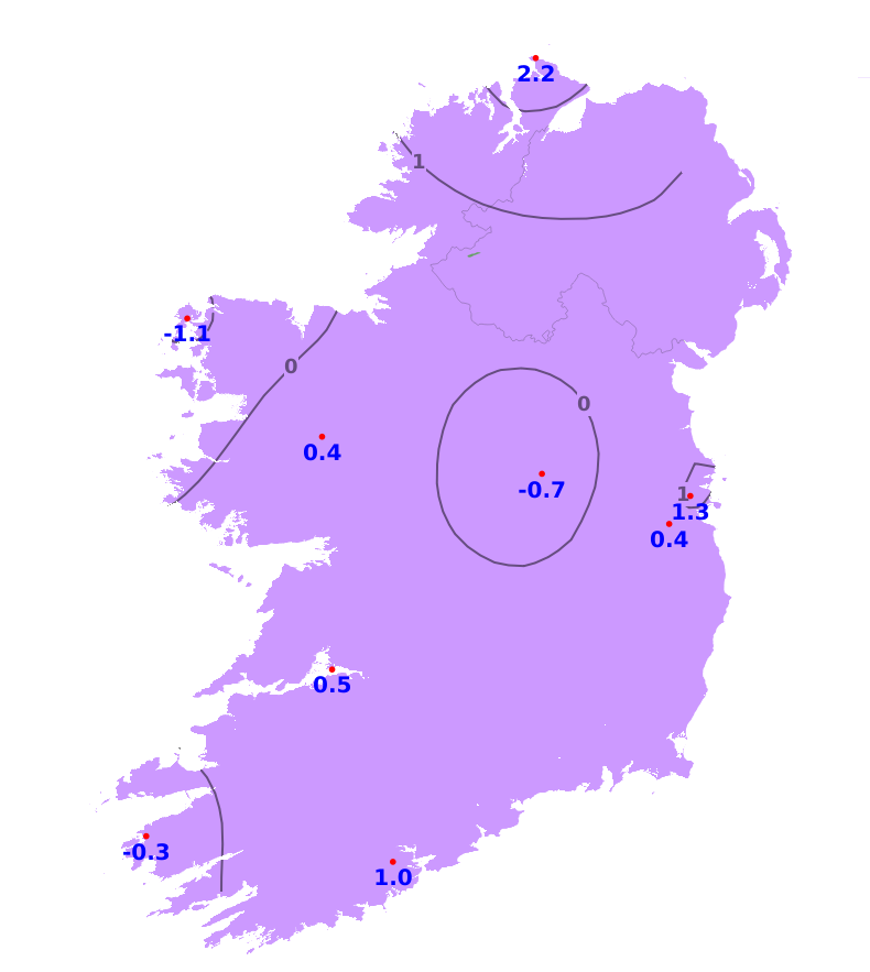
Rain
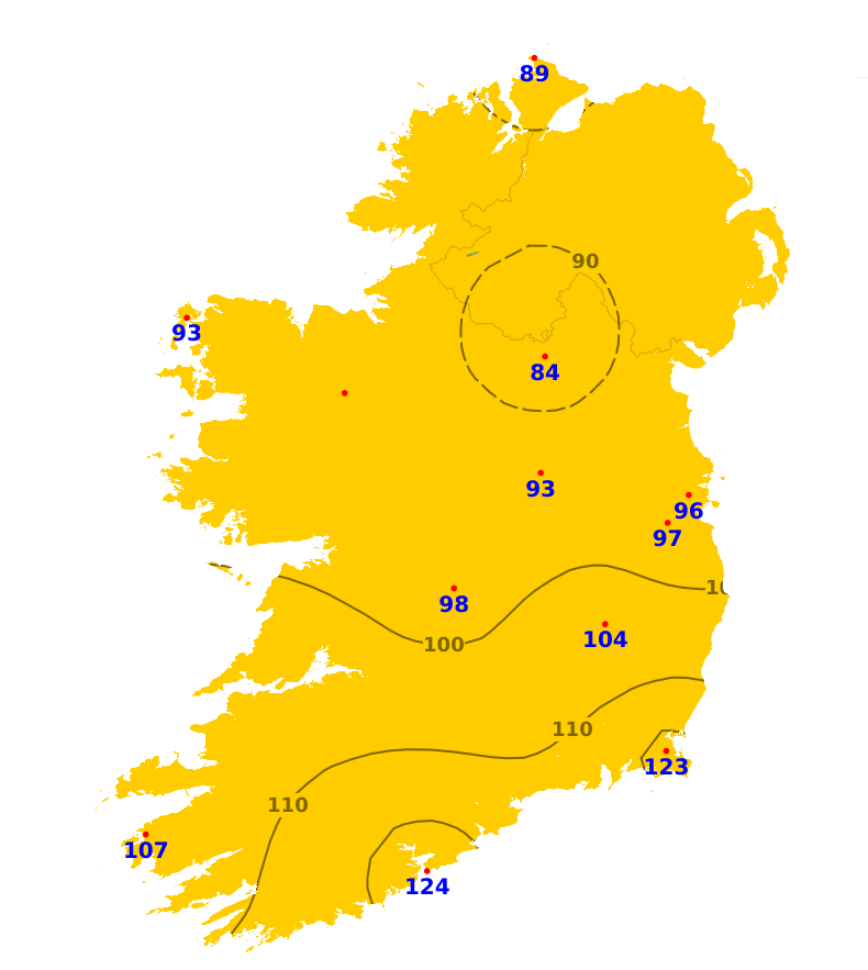
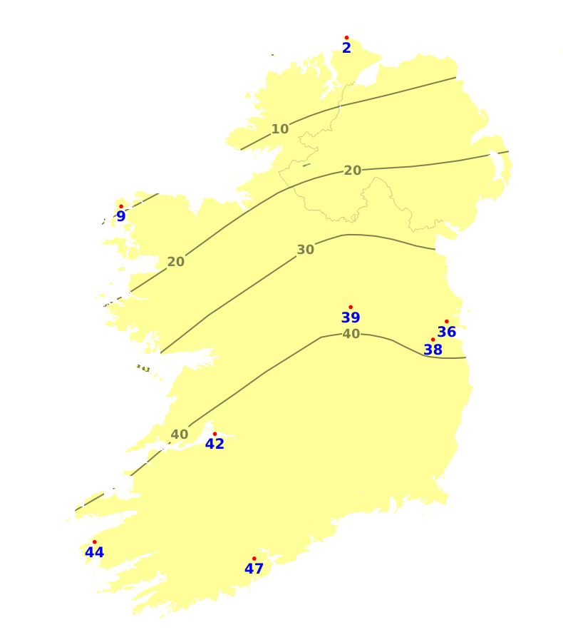
Rainfall accumulations have been substantially below average across much of the country over the last week with most places recording less than 20% of their average rainfall amounts for this time of year. The expections were along the north and western coasts where near or slightly above average rainfall was recorded. It was wettest in Belmullet Co. Mayo where 22.9mm was recorded over the past week (119% of average). It was generally driest in Munster and Leinster with stations along the south coast recording less than 1mm. Cork airport recorded no rainfall at all. With more mixed and eventually unsettled conditions forecast over the coming seven days, rainfall amounts will increase. Amounts in most areas will still be below average until at least Saturday, although there is currently quite a lot of uncertainty pertaining to rainfall accumulations from then onwards, with potential for amounts to approach or even exceed normal by next Monday.
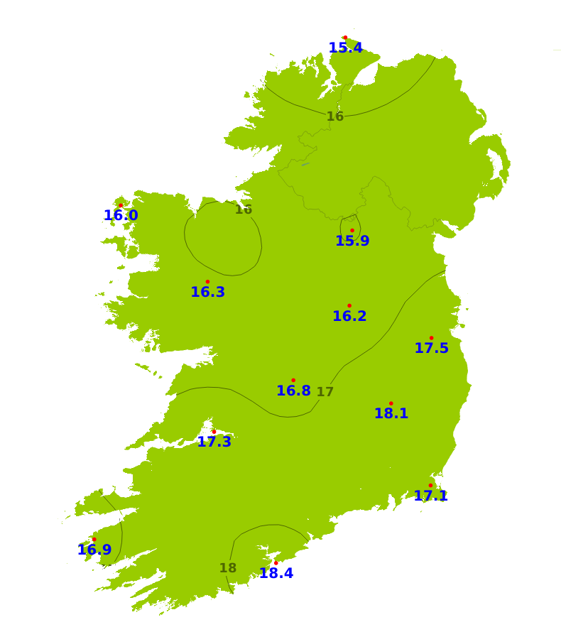
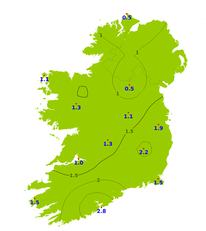
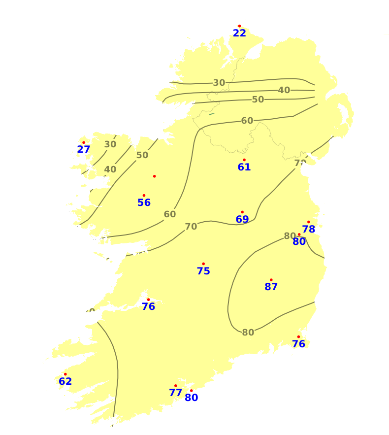
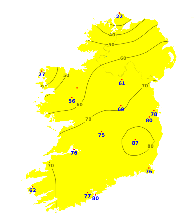
Temperatures
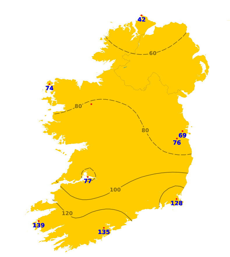
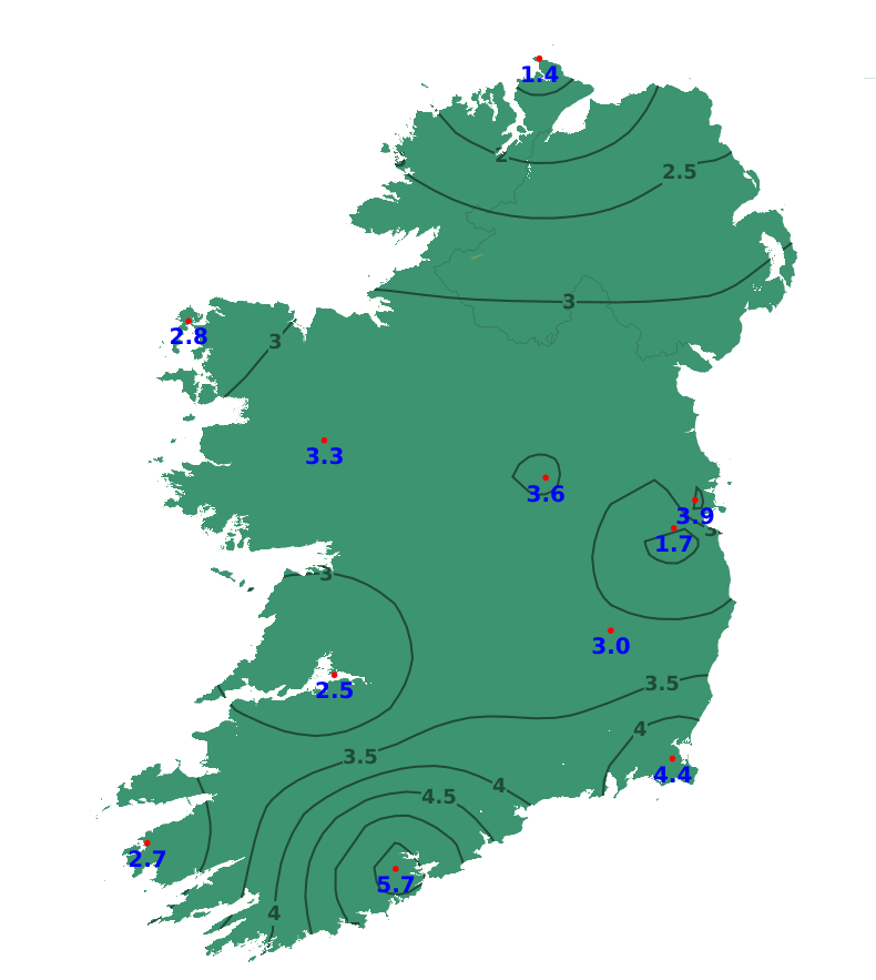
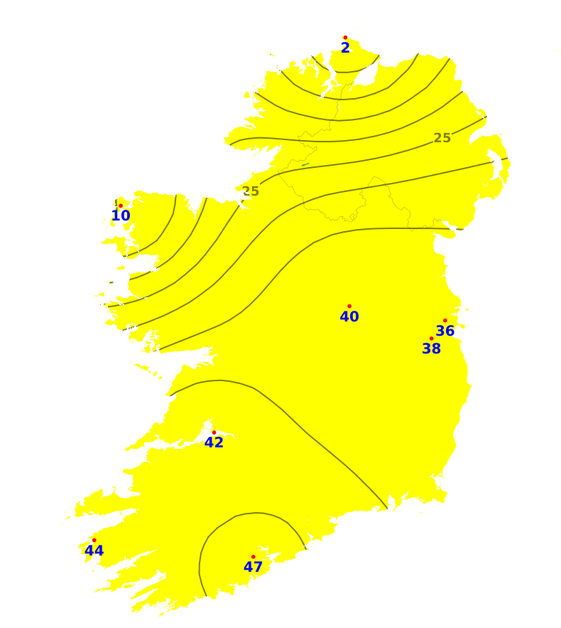
Mean air temperatures over the past seven days were close to or above average. It was warmest in the south with a mean air temperature of 18.4 degrees recorded at Roches Point Co. Cork, which is 2.8 degrees above average for the time of year. The coolest mean air temperature was recorded in the northwest with 15.4 degrees at Malin Head, Co. Donegal (0.5 degrees above average). Mean air temperatures are forecast to be close to average for much of the country over the coming week, with the exception of temperatures in the southeast which are forecast to be a degree warmer than average. Mean air temperatures will range from 14 to 17 degrees. Mean soil temperatures were also above average over the past seven days by between 1.4 and 5.7 degrees, ranging from 16.5 in the north to 21.9 degrees in the south. They are expected to stay above average for the coming week.
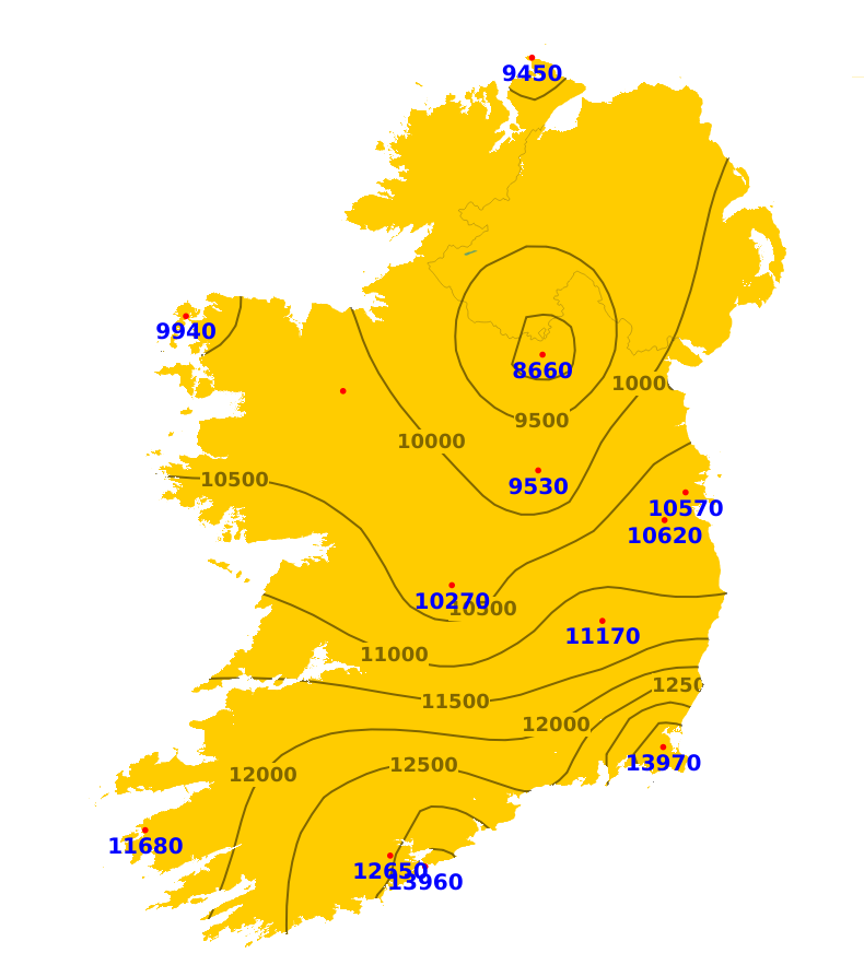
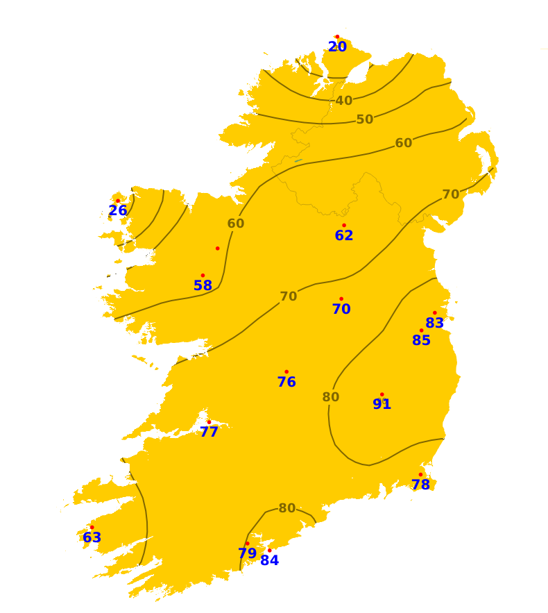
Sunshine
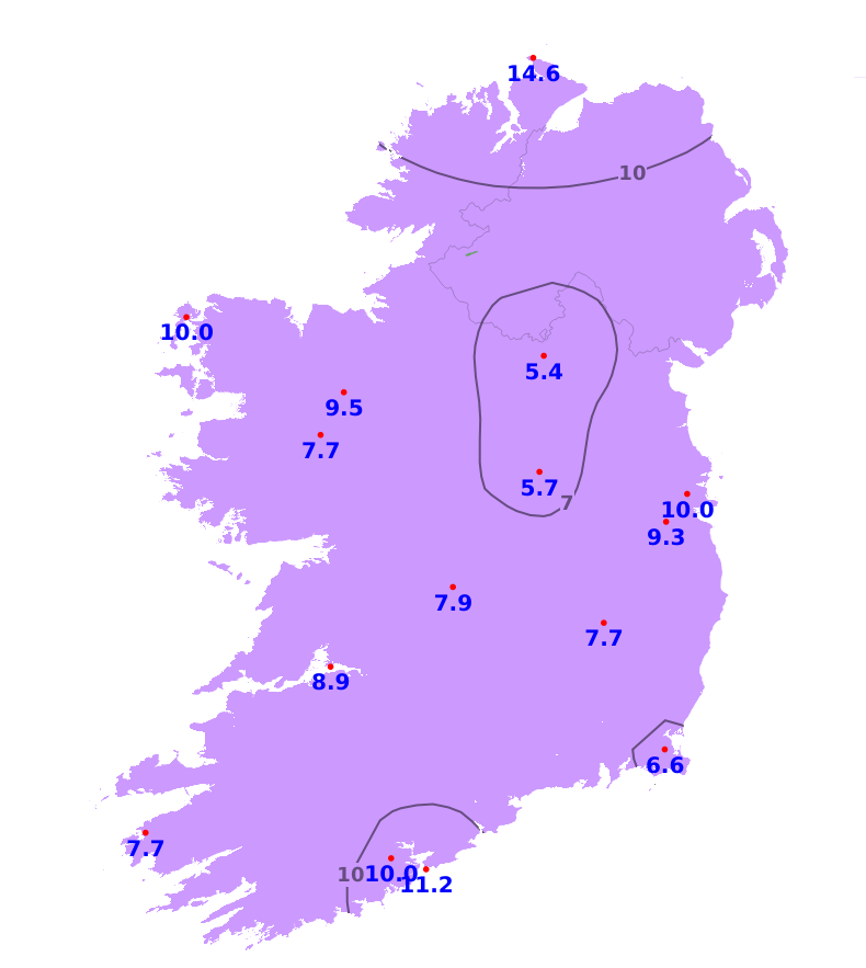
Over the last seven days sunshine amounts were generally below normal apart from along the south coast which saw above average sunshine. The most sunshine was recorded at Cork Airport where there was 50.4 hours which is 135% of average. In contrast, it was duller than average at Malin Head, Co. Donegal with just 12.8 hours of sunshine or 42% of average. With plenty of cloud and just limited sunny spells forecast for the coming week, sunshine amounts are expected to fall below average.
Drying Conditions
Drying conditions will deteriorate over the coming days due to increased precipitation, particularly in the west and north. Humidity levels are high but are expected to decrease over the coming days. The best drying conditions will be closer to the southeast where it will be drier. Moderate to fresh westerly winds will also help.
Spraying
Spraying opportunities will become more limited over the coming days due to forecast rain and drizzle and breezier conditions developing. The best opportunities will be closer to the southeast where it will be drier.
Field Conditions
All areas are currently experiencing restriction to growth, with near drought conditions across much of the southern half of the country. Soil moisture deficits (SMDs) currently range from 20mm in the north to 90mm in the southeast. Forecast rainfall will reduce SMDs in parts of the north and northwest with light soils expected to become trafficable there over the next 7 days. Elsewhere SMDs are currently expected to lower only slightly to between 40 and 80mm. In this scenario, the ground will remain hard with ongoing restriction to growth. There is some uncertainty in the forecast rainfall towards the end of the coming 7 days, however, so SMDs could improve quicker in some parts.
Further Comments
Weather conditions conducive to the spread of potato blight in parts of the north and Atlantic coastal counties will extend to Connacht, Ulster, north Leinster and north and west Munster until the morning of Wednesday 29th of July. A condition orange high fire risk has been issued by the Department of Agriculture, Food and the Marine until 12 noon on Wednesday 29th July. Arising from current weather patterns a high fire risk is deemed to exist in all areas where flammable vegetation such as dead grasses and heather and gorse exist. There is a continued risk of underground peat fires on bogs where fires occur and an increased availability of larger fuel types across all land types, with increased difficulty of fire suppression.