Forecast issued at: Friday 24th July 2026 12:00
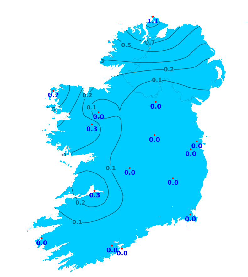
Rain
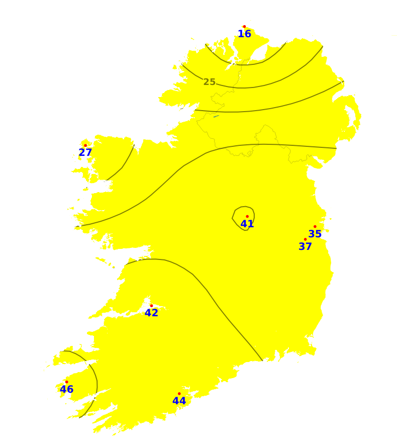
There has been little to no rainfall across the country over the past week. Malin Head, Co. Donegal recorded the most with just 1.1mm or 6% of its average. Over the coming week, more unsettled conditions will develop though rainfall amounts will remain below normal across much of the country with accumulations of less than 10mm (40% of the average or less). However, parts of the north, west and far southwest will be wetter normal with 20 to 35mm expected (80 to 200% of the average).
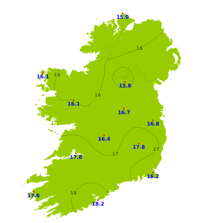
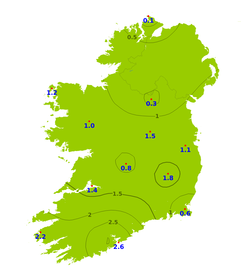
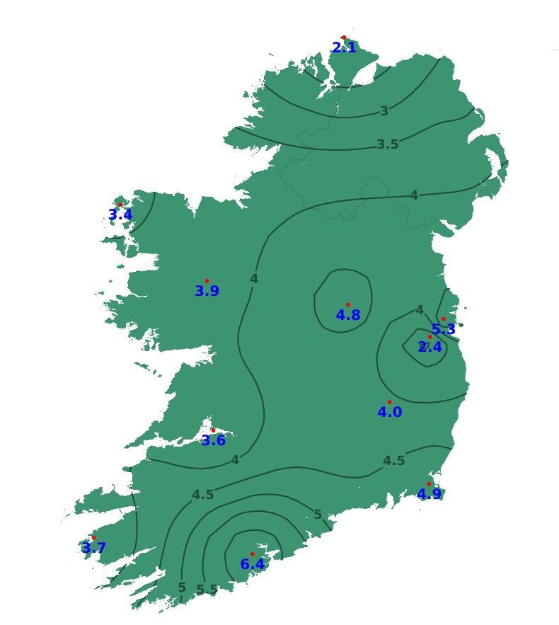
Temperatures
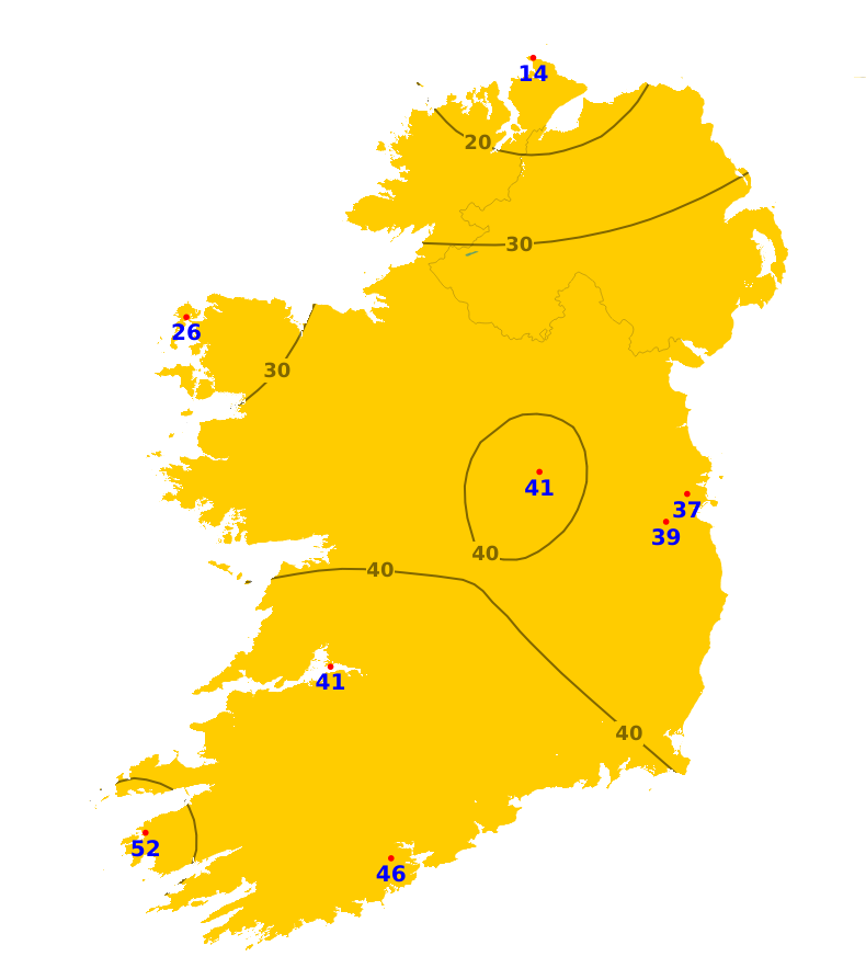
Mean air temperatures were above average over the past week ranging between 15 degrees in the north to 18.5 degrees in the south, which is between 0.1 and 3.2 degrees above normal. Mean soil temperatures have been well above average, ranging from 17.1 degrees in parts of the northwest to 23.1 degrees in the south. This is between 2.1 and 6.4 degrees above normal. Over the coming week, mean temperatures will be generally around normal in Atlantic areas and up to 2 degrees above normal in the east. Mean soil temperatures will continue well above normal.
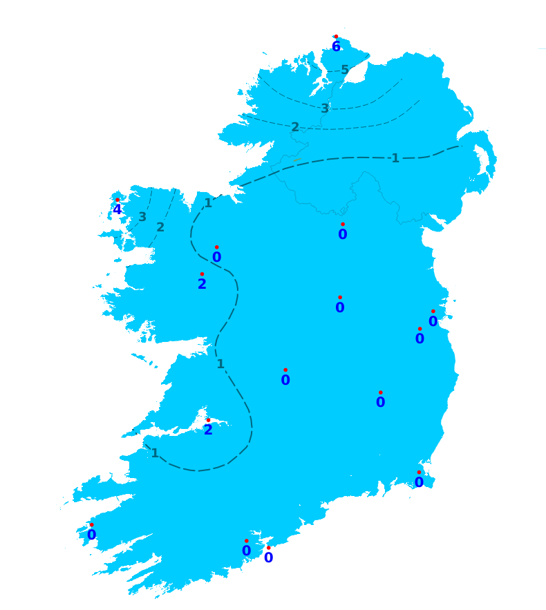
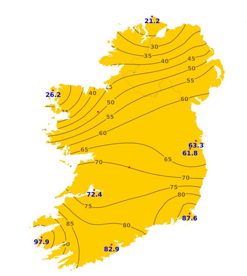
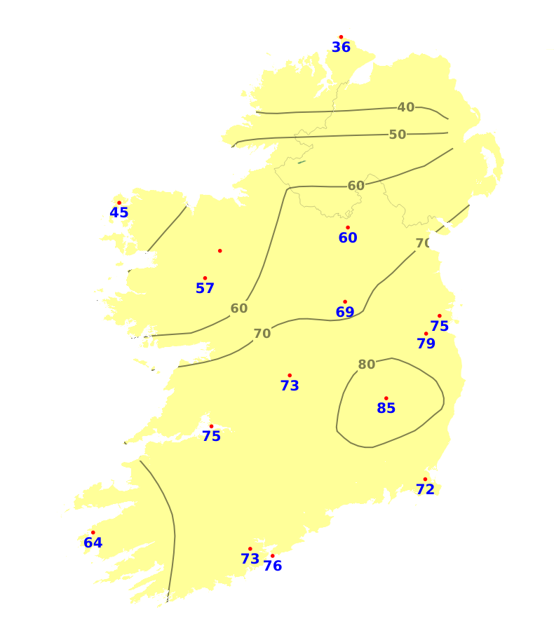
Sunshine
The past seven days were duller than average in parts of the north and northwest with 69 to 85% of the average recorded. Elsewhere it was much sunnier than normal with 172 to 312% of the average amounts recorded, highest at Valentia Observatory, Co. Kerry with 97.9 hours. There will be sunny spells at times but generally a lot of cloud for the weekend and early next week so sunshine amounts will be below average.
Drying Conditions
Drying conditions will deteriorate over the weekend, especially in the northwest, with damp conditions at times.
Spraying
The best of the spraying opportunities over the weekend will be in the southeast. More frequent outbreaks of rain and drizzle in the north and west will limit spraying.
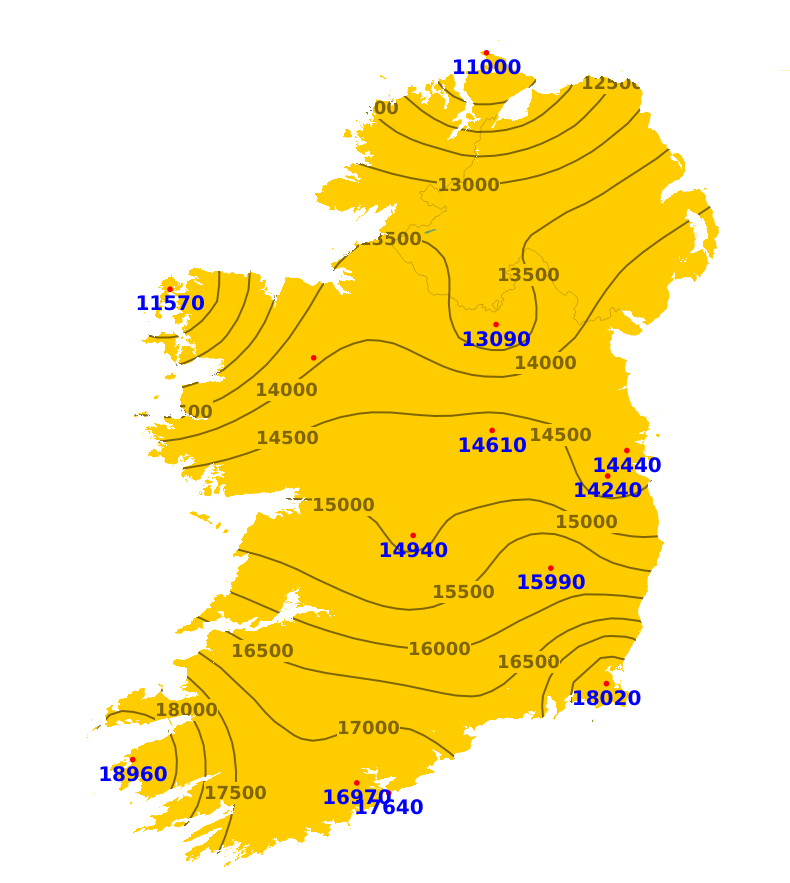
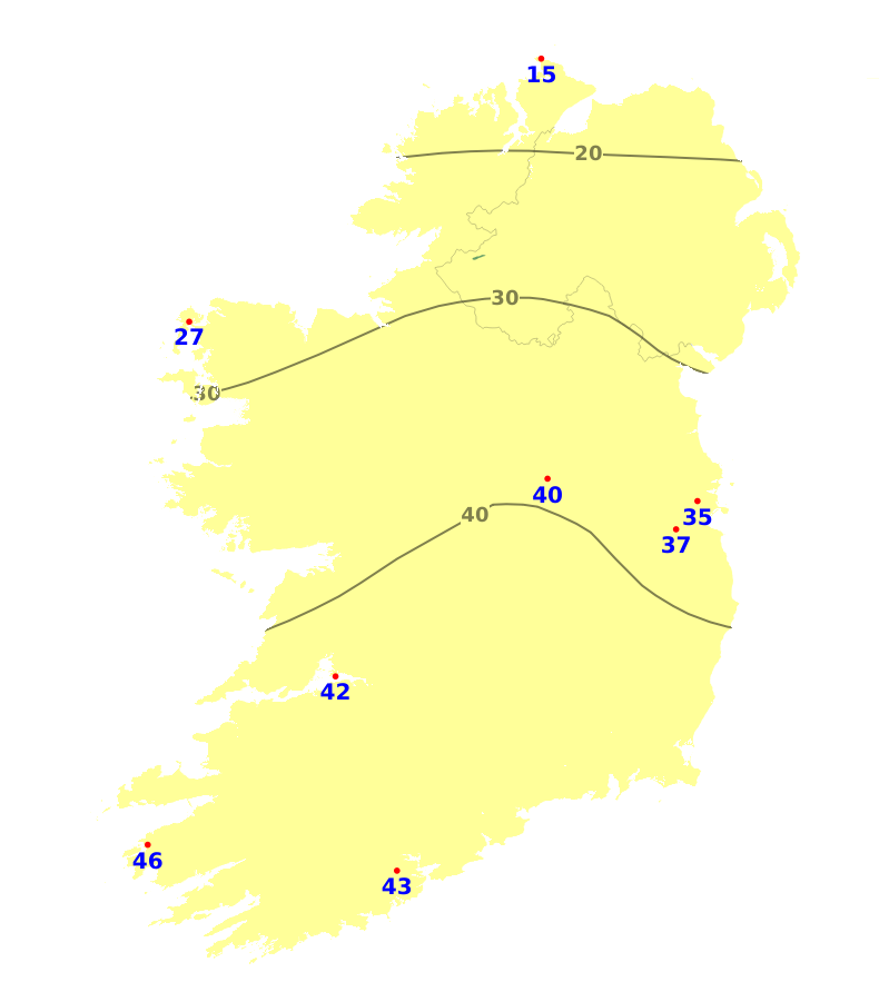
Field Conditions
There is restriction to growth in all areas at present with soil moisture deficits (SMDs) ranging from 33mm in the north to 90mm in the southeast. Ground is hard across Leinster, Munster and the midlands, with near drought conditions in east Munster and south Leinster. With above average rainfall amounts expected for parts of the north and west, SMDs will decrease by around 10mm in these areas. Elsewhere, SMDs will remain similar.
Further Comments
Weather conditions conducive to the spread of potato blight will develop in parts of the north and in Atlantic coastal counties this weekend (25th and 26th July) and for early next week. Opportunities for spraying will be limited after today (Friday) by scattered outbreaks of rain and drizzle.A condition orange high fire risk has been issued by the Department of Agriculture, Food and the Marine until 12 noon on Wednesday 29th July. Arising from current weather patterns a high fire risk is deemed to exist in all areas where flammable vegetation such as dead grasses and heather and gorse exist. There is a continued risk of underground peat fires on bogs where fires occur and an increased availability of larger fuel types across all land types, with increased difficulty of fire suppression.