Forecast issued at: Friday 01st August 2025 13:00
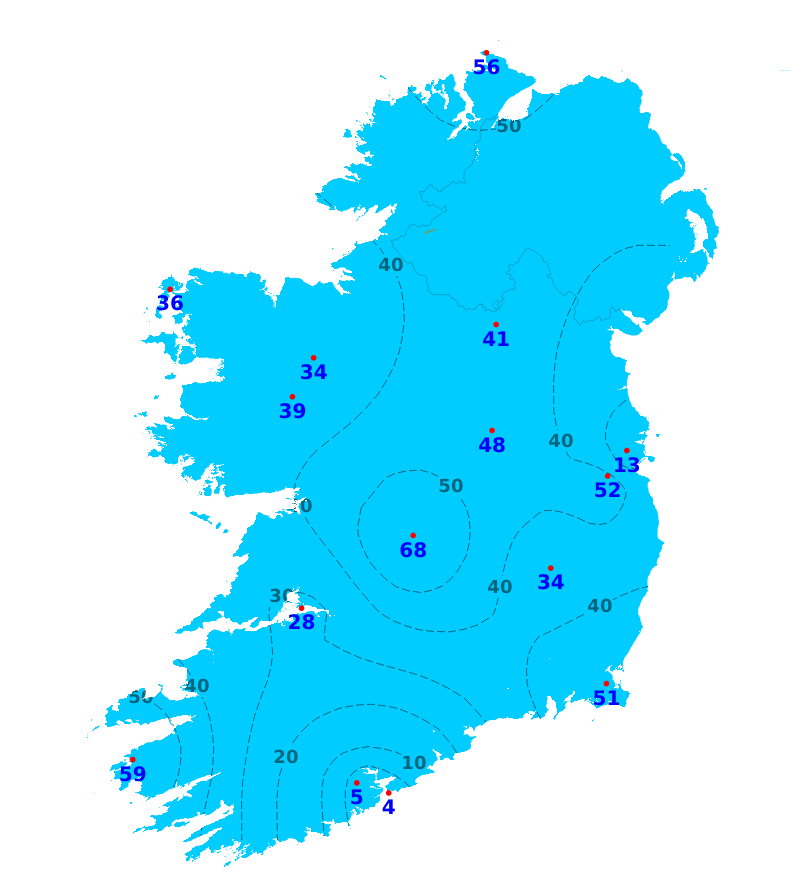
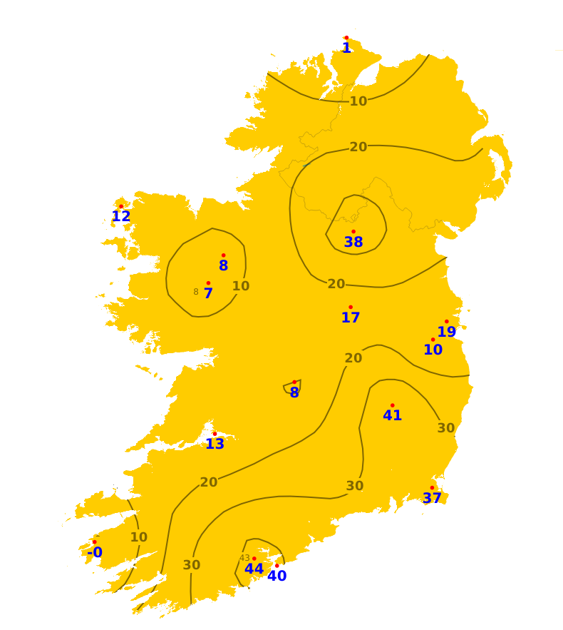
Rain
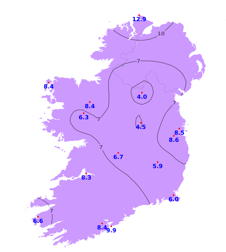
The past week was drier or much drier than normal nationwide. Rainfall totals ranged from just 0.6mm in Roches Point, Co. Cork (4% of its average), to 14.1mm in Valentia, Co. Kerry (59% of its average). The weather over the coming week will be mixed with rain or showers at times, heavy especially for Sunday night and into Monday due to Storm Floris, but there will also be good dry intervals. Overall, rainfall amounts will likely be between 1 and 2 times the normal amounts for much of the country though some southeastern areas may fare better.
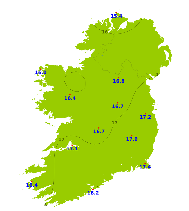
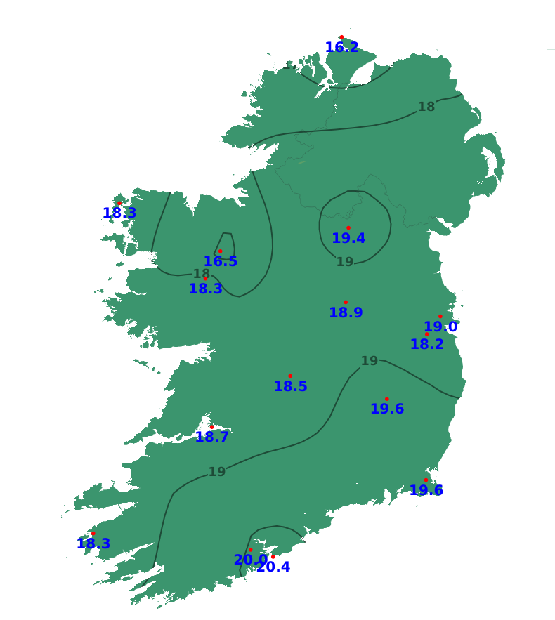
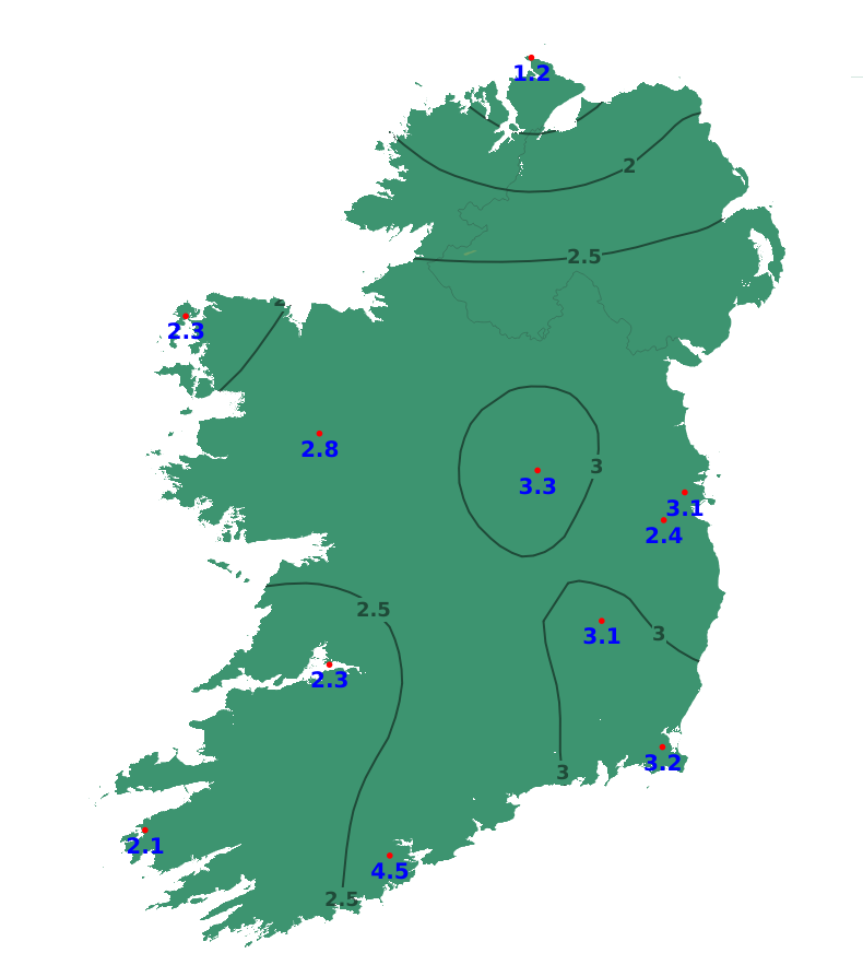
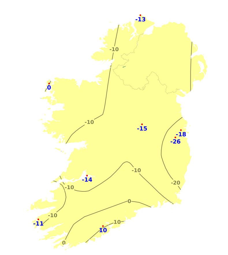
Temperatures
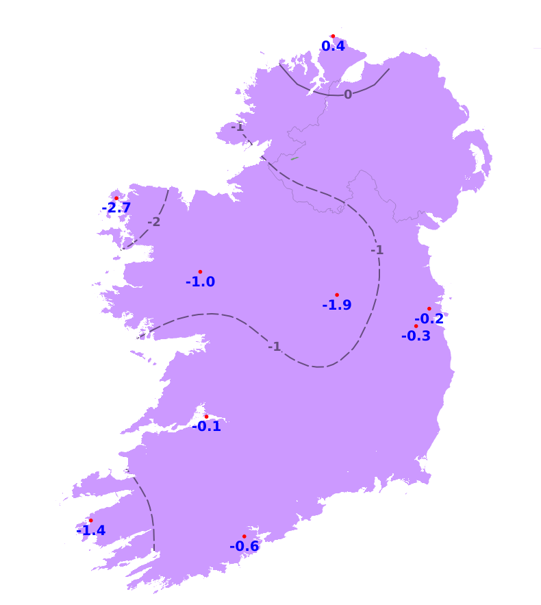
Mean air temperatures over the past week were above average for this time of year, with values ranging from 15.5 degrees at Knock/Ireland West Airport, Co. Mayo to 18.2 degrees at Roche's Point, Co. Cork. This equates to between 0.5 and 2.6 degrees above normal. Mean soil temperatures are also above normal, ranging from 16.5 to 20.4 degrees, which is between 1.2 and 4.5 degrees above average. Over the coming week, mean air temperatures will be close to normal, ranging from 14 to 16 degrees with mean soil temperatures continuing above average.
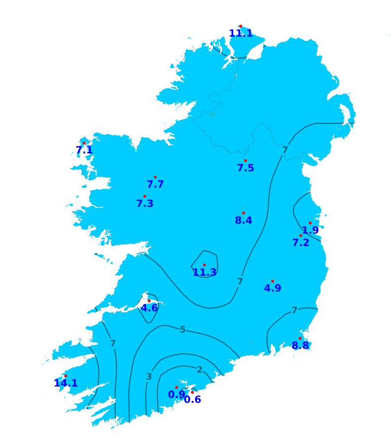
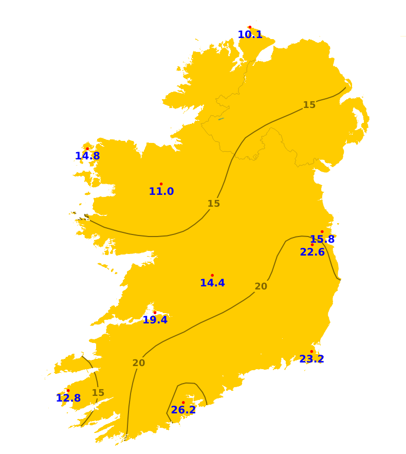
Sunshine
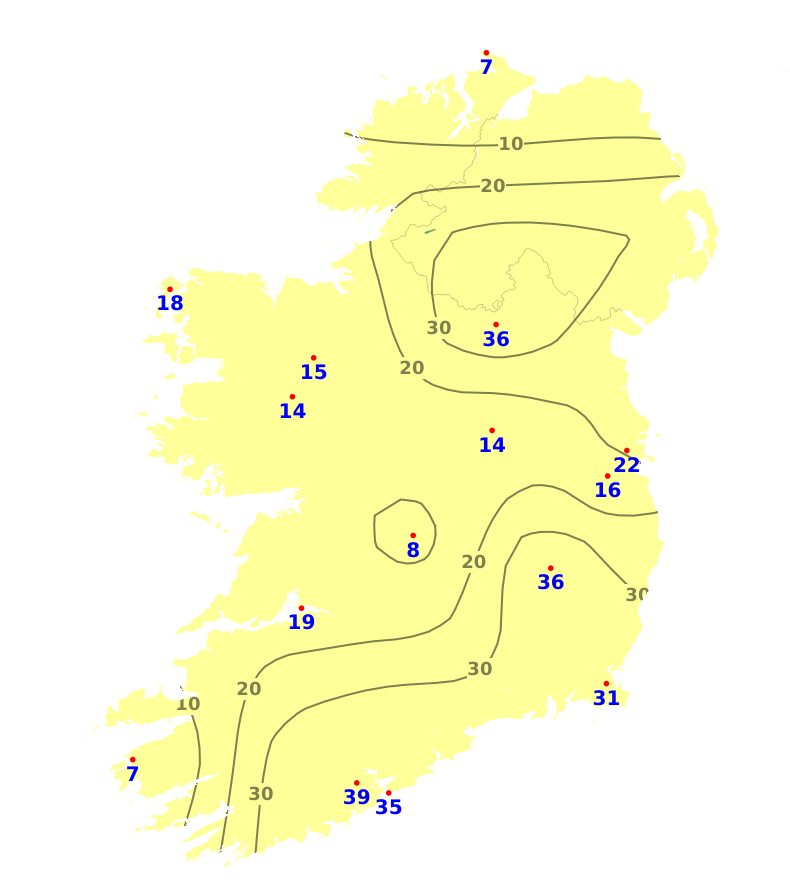
It has been quite dull over the past seven days with below average sunshine amounts nationwide. Parts of the north and west saw the least amount of sunshine, with only 10.1 hours of sunshine recorded at Malin Head, Co. Donegal (33% of average for this time of year). The highest amount of sunshine was recorded in the south, with 26.2 hours at Cork Airport, equating to 70% of average. The weather will be mixed over the next week, so sunshine amounts are likely to be near or below normal.
Drying Conditions
Drying conditions will generally be moderate to good for the rest of today (Friday) away from any showers and on Sunday after the rain clears eastwards in the morning. Conditions will otherwise be more limited until midweek.
Spraying
Spraying opportunities will be good for the rest of today (Friday) away from any showers, for much of tomorrow (Saturday) away from any patchy rain and drizzle and then for a time Sunday after the rain clears eastwards in the morning. Conditions will otherwise be more limited until midweek.
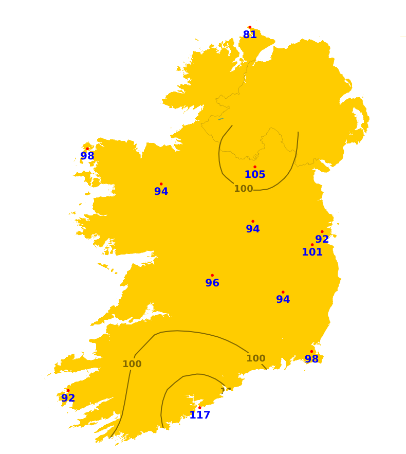
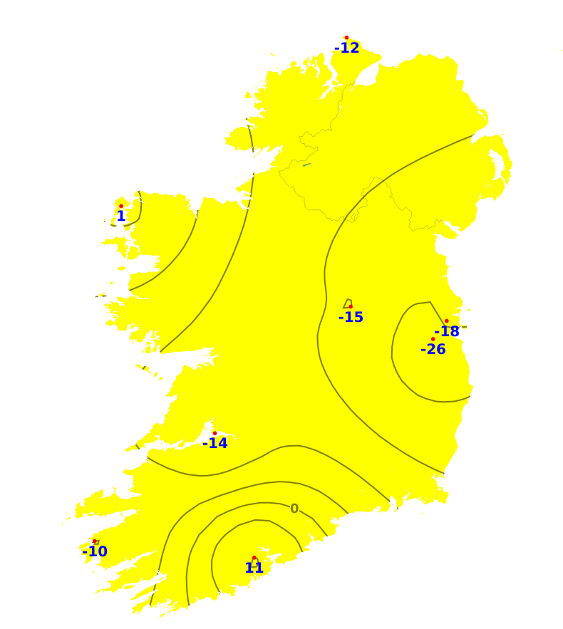
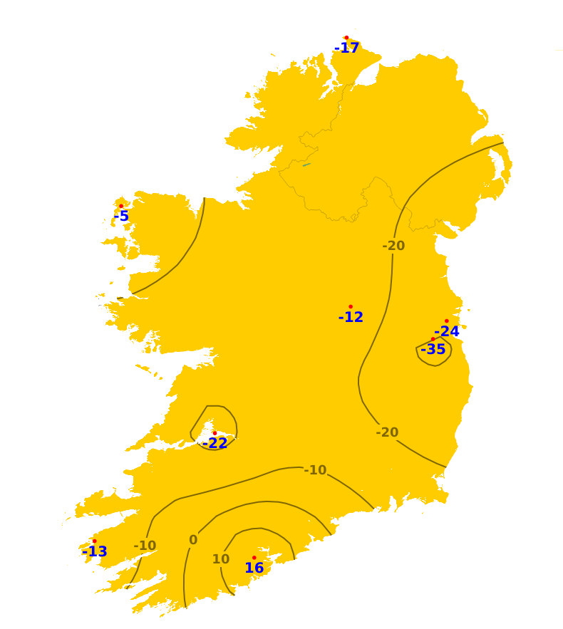
Field Conditions
Currently, most soils are trafficable, with soil moisture deficits (SMDs) generally ranging between 5mm and 40mm, driest in the south and southeast, with some restriction to growth. However, parts of the north are wetter with some poorly drained soils close to saturation. Over the coming days, SMDs will generally increase, especially in the south and southeast with further restriction to growth likely. SMDs will then decrease in many areas with some northern, northwestern and far southwestern soils becoming saturated or waterlogged. However, SMDs will likely remain high in the south and southeast.
Further Comments
Weather conditions conducive to the spread of potato blight will develop in parts of Munster, Connacht and western Ulster from Saturday evening 2nd August to Sunday afternoon 3rd August. Forecast maps and meteograms can be found on Blight Forecast.