Forecast issued at: Wednesday 15th July 2026 14:00
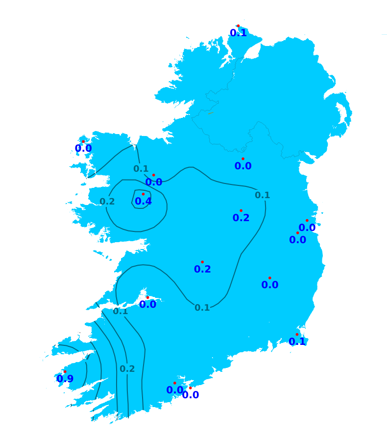
Rain
There has been little to no rainfall across the country over the past week with accumulations below 1mm at all stations (between 0 and 4% of average). With this settled spell continuing, rainfall will remain well below average across the country through the week ahead with below 3mm expected in all areas. However, there is the chance of isolated sharp showers on Thursday.
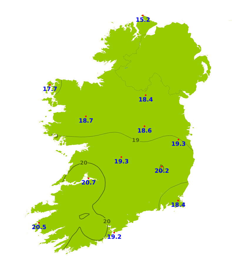
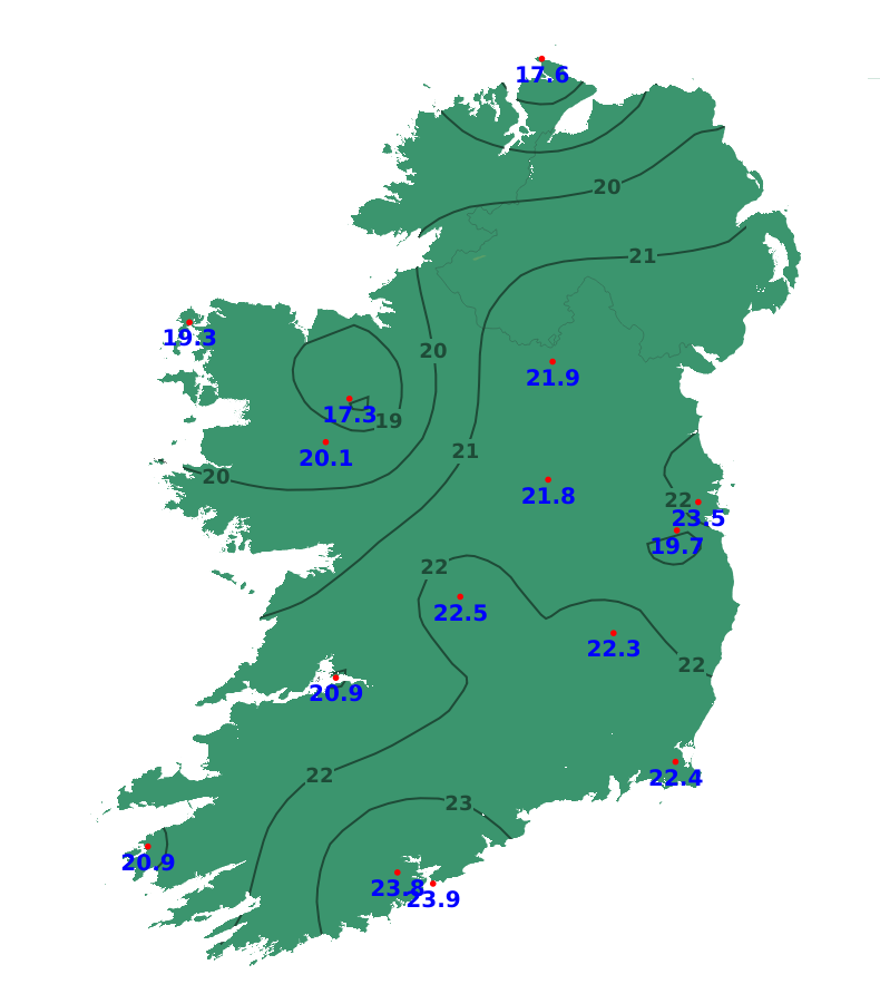
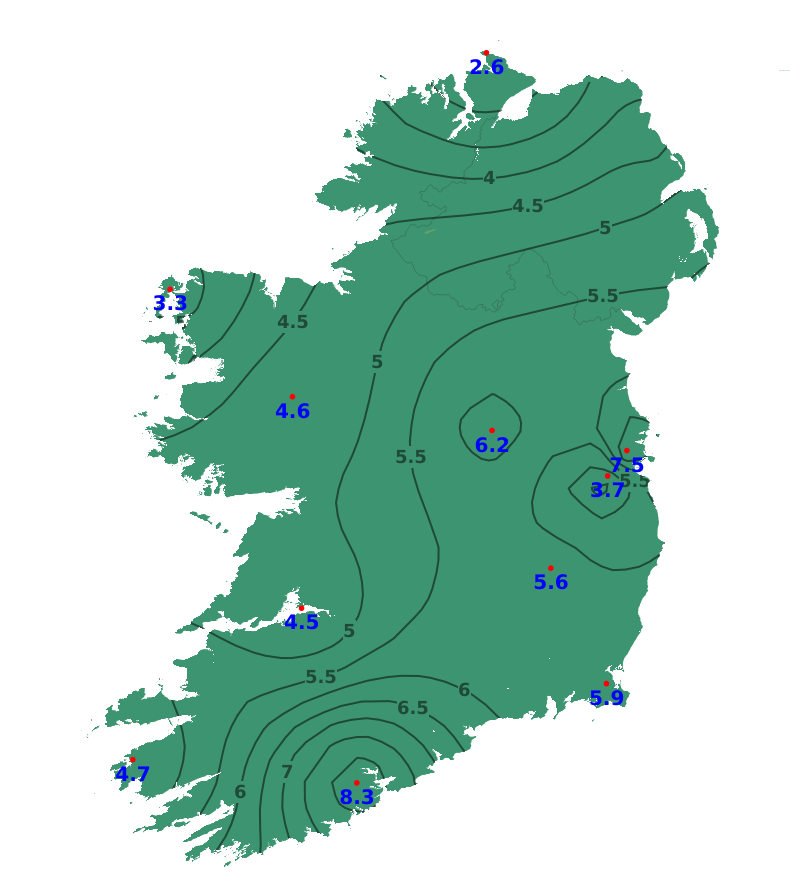
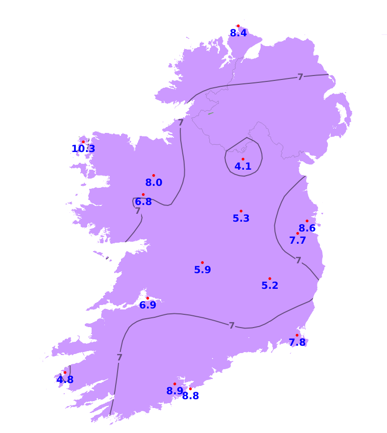
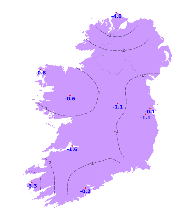
Temperatures
Mean air temperatures were well above average over the past week, with the exception of northern areas where temperatures were close to normal. Temperatures ranged from 15.2 degrees in the north to 20.5 degrees in the south, which is between 0.5 and 5.4 degrees above average. Mean soil temperatures are also well above normal, ranging from 17.3 degrees in the northwest and 23.9 degrees in the south. This is between 2.6 and 8.3 degrees above normal. While temperatures will decrease slightly over the weekend and early next week, mean air temperatures will remain above normal for most areas by 1 to 3 degrees. Temperatures will be close to normal in the north. Soil temperatures will increase further.
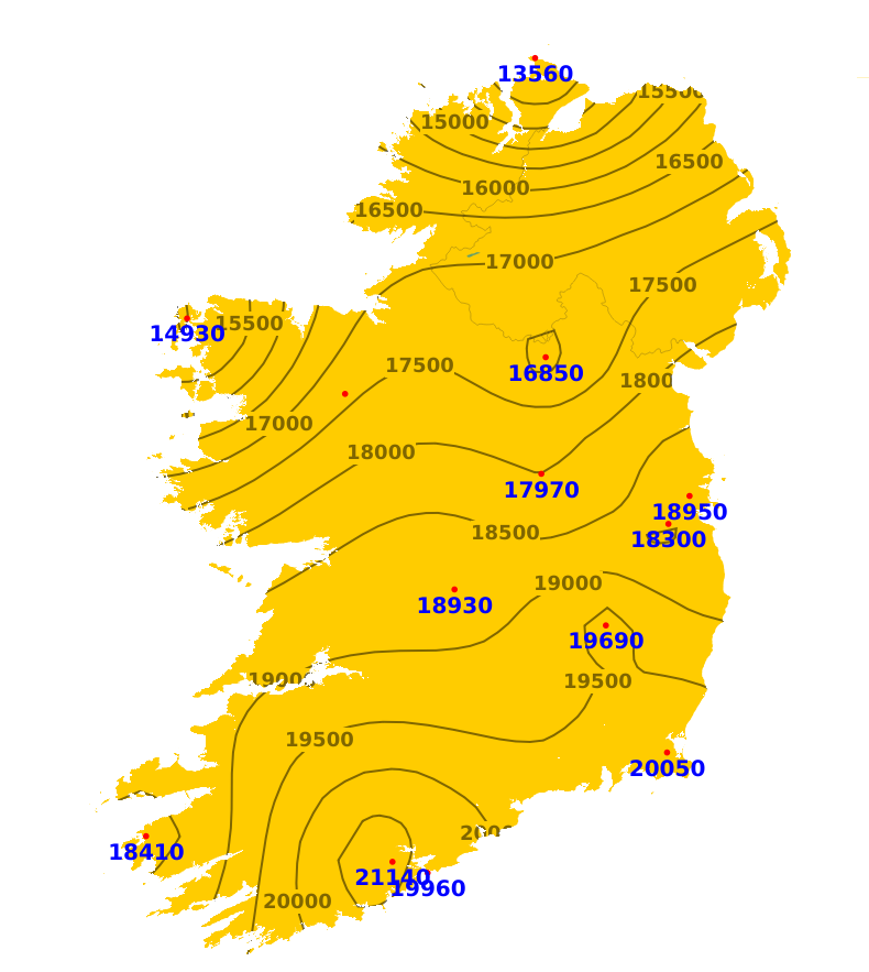
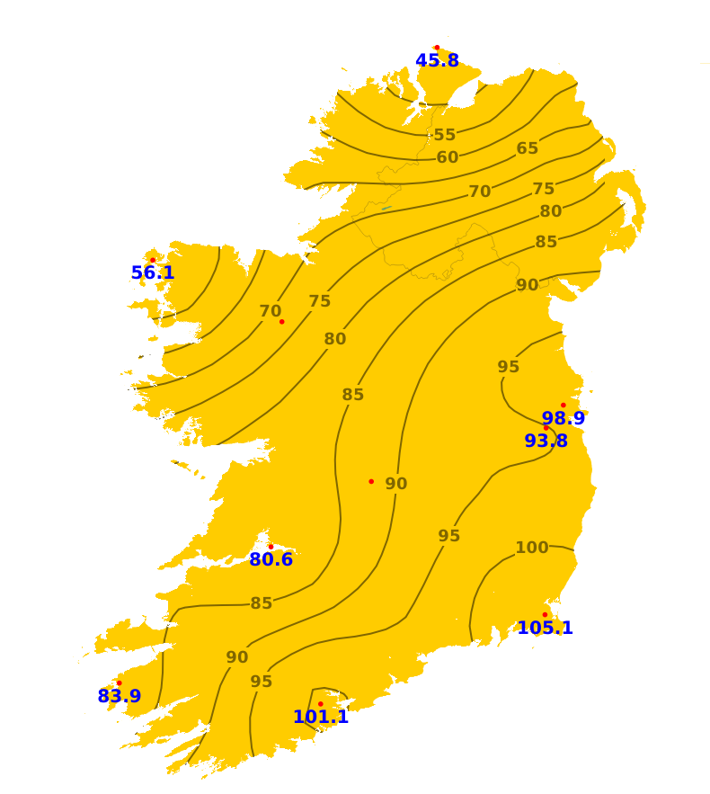
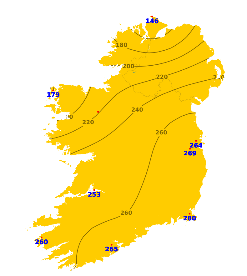
Sunshine
It was brighter than average nationwide over the past weekwith sunshine amounts ranging between 146% and 280% of average. It was brightest in the southeast with 105.1 hours of sunshine recorded at Johnstown Castle, Co. Wexford. The northwest saw less sunshine, though still above average, with 45.8 hours of sunshine recorded at Malin Head, Co. Donegal. With the continued settled spell, sunshine amounts will be above normal for most parts of the country during the next 7 days, though there will be slightly more cloud in some northern and northwestern areas.
Drying Conditions
Drying conditions will be very good over the coming days due to settled and very warm conditions.
Spraying
There will be good opportunities for spraying over the coming days with dry conditions and light to moderate winds. However, it will be very warm for the rest of the working week, especially in the west and midlands, so the window for spraying may be limited to the cooler hours of the morning and late evening.
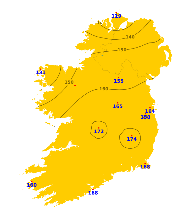
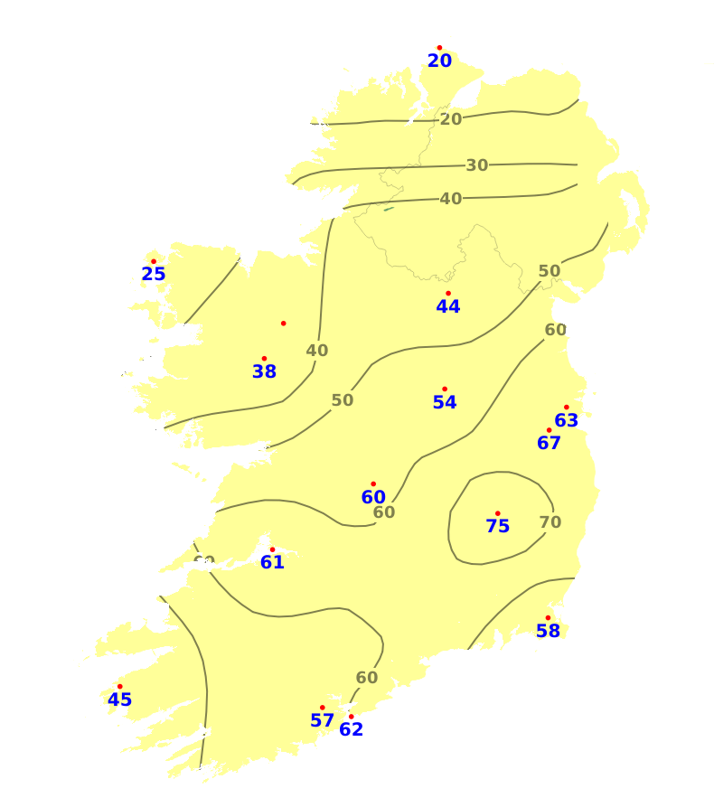
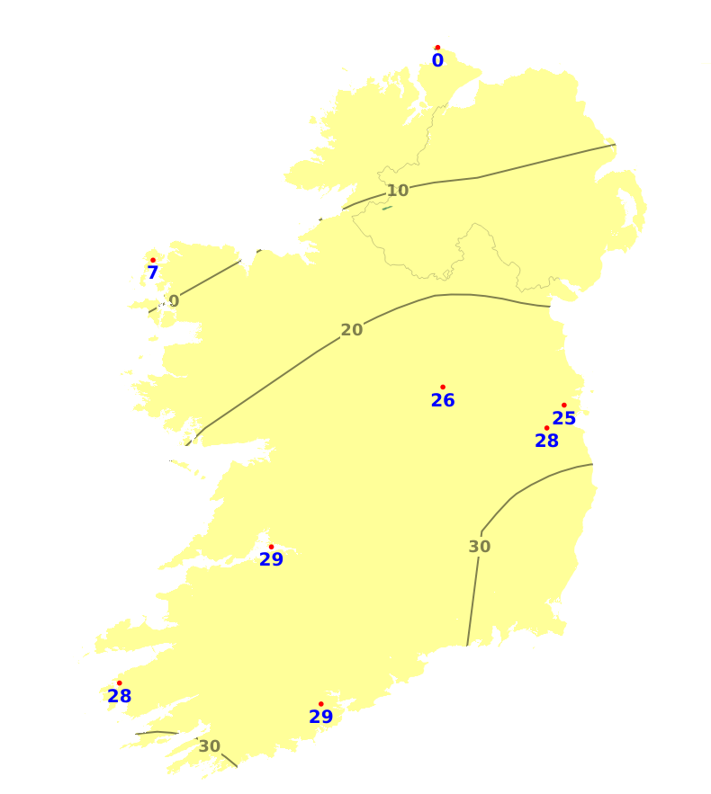
Field Conditions
All soils are trafficable at present with soil moisture deficits (SMDs) ranging from 15mm in the northwest to 80mm in the southeast. There is restriction to growth in most areas away from the west and north with parts of Leinster and Munster with near drought conditions in the southeast. SMDs will increase nationwide over the coming week, ranging from 32mm in the northwest to 87mm in the southeast. Growth will become increasingly restricted.
Further Comments
A condition orange high fire risk has been issued by the Department of Agriculture, Food and the Marine. Arising from continued high temperature weather patterns a high fire risk is deemed to exist
in all areas where hazardous fuels such as dead grasses and shrub fuels such as heather and
gorse exist. Elevated fire risks are expected in all areas during this period but will be especially focussed on eastern regions. With soil moisture deficits increasing there is an added risk of underground peat fires on bogs where fires occur and an increased availability of larger fuel types across all land types.