Today (Thursday 22nd) and Friday will see the hot and largely sunny weather continue, but over the weekend it’ll turn less hot with the chance of a few showers as high pressure gradually loses influence.
Met Éireann has extended the nationwide Yellow High Temperature warning until Saturday morning, with an Orange High Temperature warning for several inland counties remaining in place until Friday, where temperatures are expected to exceed 30°C today and possibly again tomorrow. An Amber Extreme Heat warning is also in place across Northern Ireland until Friday midnight.
Yesterday was the warmest day of the year so far, as temperatures reached 30.8°C at Mount Dillon, Co. Roscommon. In the north temperatures reached 31.3°C at Castlederg, Co. Tyrone – another new temperature record for Northern Ireland just five days after it was broken last weekend. At least ten weather stations have reached heatwave criteria so far, with temperatures having reached at least 25°C for 5 days in a row, with further stations expected to reach heatwave criteria over the coming days.
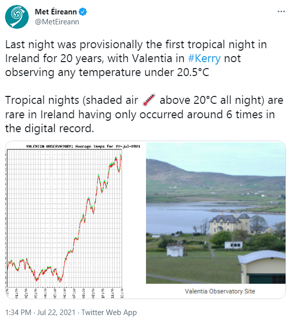
Last night was provisionally the first ‘Tropical Night’ in Ireland for 20 years, with Valentia Observatory, Co. Kerry not observing any temperatures under 20.5°C. Tropical nights (shade air temp above 20°C all night) are a rarity for Ireland, having only occurred around 6 times in the digital record.
Met Éireann Twitter
Met Éireann meteorologist Aoife Kealy said, “We still have another few hot and sunny days ahead with temperatures reaching 30°C, possibly a little higher in a few spots today and tomorrow. It’ll also be warm and humid overnight too, with temperatures not falling below 18°C in areas.
“Whilst today will be largely dry, tomorrow we could see a few heavy showers and thunderstorms breaking out, which could lead to some spot flooding.”
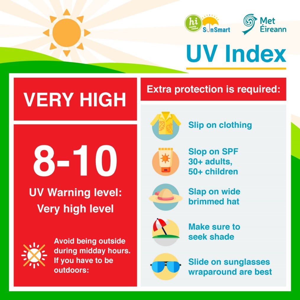
UV Index Advice – Very High – HSE NCCP
UV levels will be High to Very High throughout the week with people being advised to take extra care when outdoors and follow advice from Healthy Ireland and the HSE:
“For many people, the warmer weather is enjoyable. For some people, such as those with underlying health conditions, older people, babies and young children, the heat can bring real health risks. The HSE is advising everyone to be careful and to keep an eye on those you know who may be at risk. Remember to:
- Keep cool
- Stay hydrated
- Protect your skin
- Know when to get medical help.
Ways to stay safe can be found at:
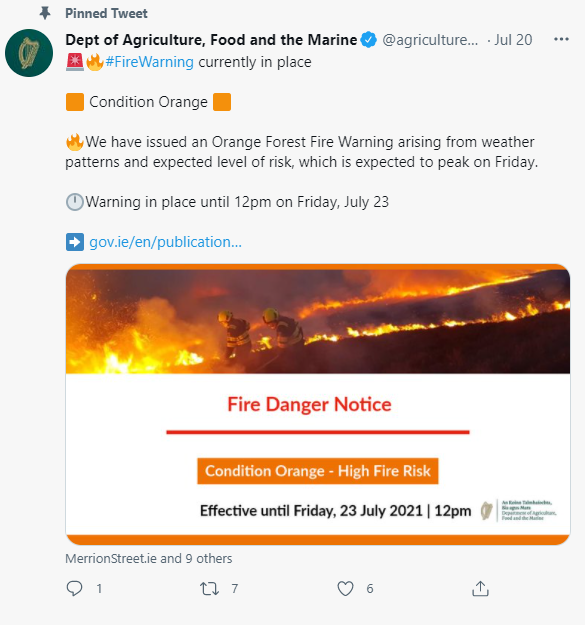
The Department of Agriculture has also issued an Orange Forest Fire Warning due to the hot and dry conditions, in place until 12pm Friday July 23rd.
How long will the warm and sunny weather last?
Meteorologist Aoife Kealy continued: “It looks like the high pressure that has brought us this hot and settled weather will gradually break down through the weekend and we’ll lose the very high temperatures. It’ll still be warm though, with temperatures into the low to mid 20s Celsius across the country on Saturday on Sunday. It won’t be quite as warm during the nights however, which is probably welcome news to many.”
What has brought the hot weather to Ireland?
Last week the Jet Stream started to migrate northwards and is now displaced to the far north of Ireland. This allowed the “Azores High” – a near permanent area of high pressure usually positioned in the sub-tropical Atlantic near the Azores Islands – to build north and steer warm, dry and settled conditions over Ireland.
This weather pattern has brought warm air up from the south with it, and that, together with plenty of strong summer sunshine has allowed temperatures to build, with temperatures exceeding 30°C in some parts of Ireland this week.
Climate change is already increasing the frequency and intensity of extreme events, and many single events have been shown to have been made worse by increasing temperatures. The latest climate projection models for Ireland show a trend towards more warmer wetter winters and hotter dryer summers as we move toward mid-century.