Forecast issued at: Monday 16th February 2026 13:00
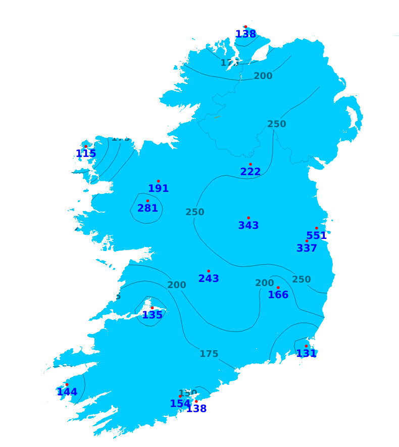
Rain
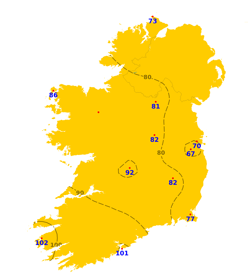
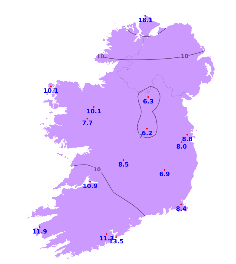
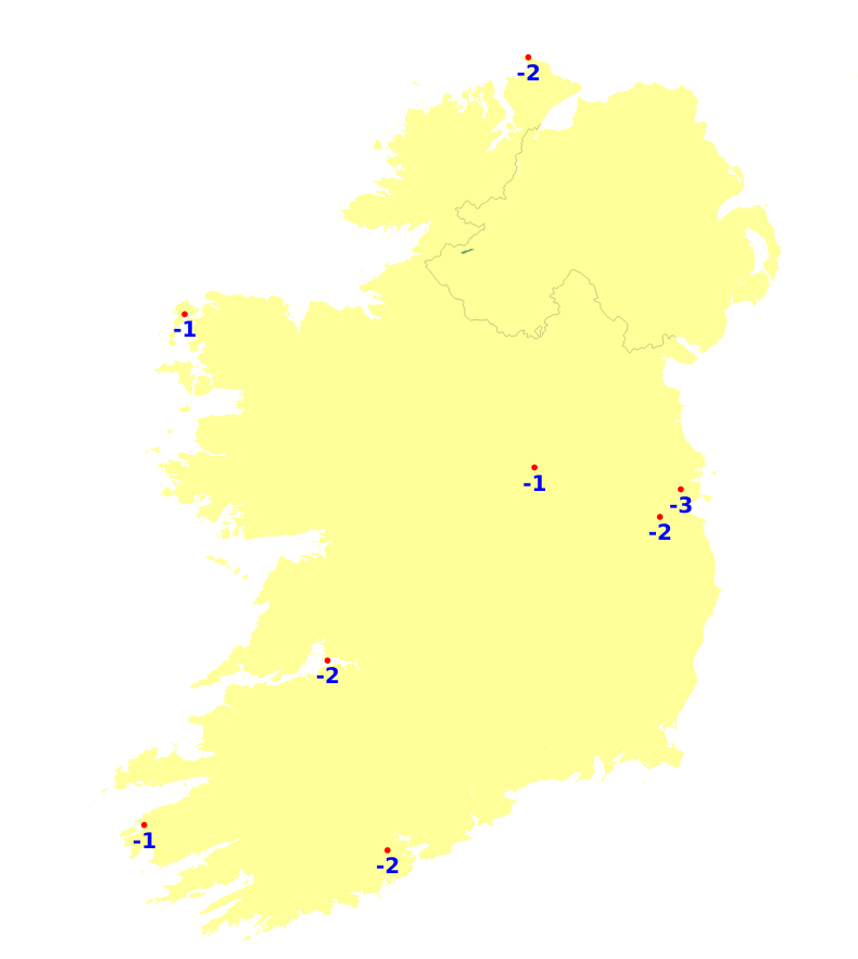
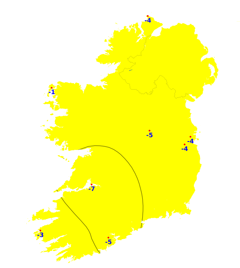
Over the past seven rainfall amounts were above average across the country, ranging between 110 and 160% of normal for most northern, western and southern counties, up to 550% of normal in the east. Knock/Ireland West Airport, Co. Mayo recorded the most with 71.7mm (281% of its average) while Johnstown Castle, Co. Wexford recorded the least with 25.1mm (131% of its average). Over the coming week, while there will be some drier intervals, especially later today (Monday) and much of tomorrow away from the southwest, our weather will continue mostly unsettled with 200 to 350% of the average rainfall amounts expected over the coming week.
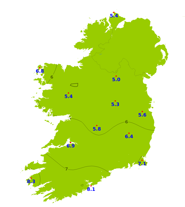
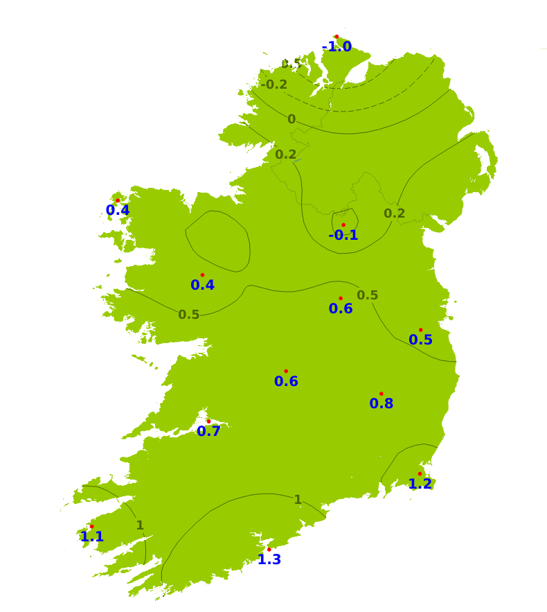
Temperatures
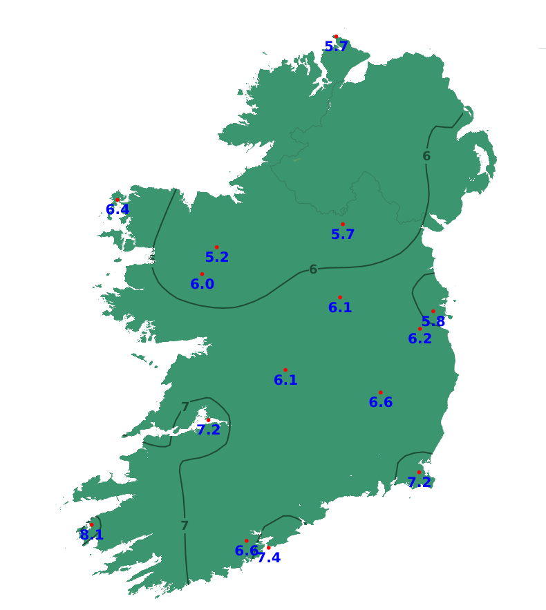
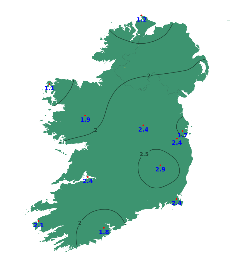
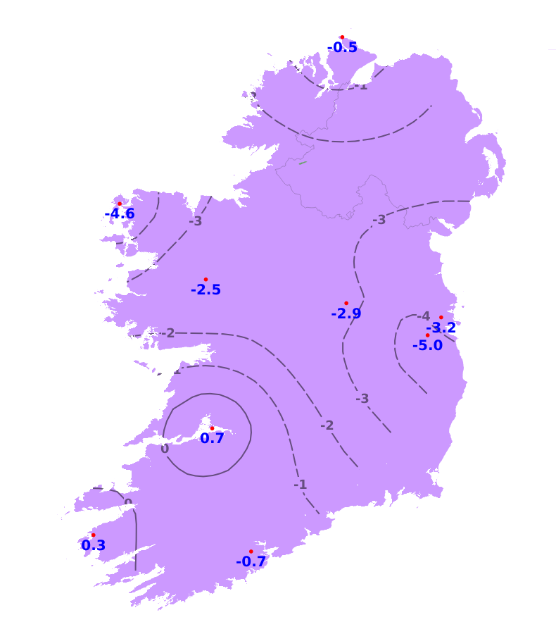
Mean air temperatures for the past week were close to or above average for much of the country, ranging from 4.8 degrees at Knock/Ireland West Airport, Co. Mayo (0.6 degrees above normal) to 8.3 degrees at Valentia Observatory, Co. Kerry (1.1 degrees above normal). However, mean air temperatures at Malin Head, Co. Donegal were a degree lower than its average. Mean soil temperatures were above average throughout the country, ranging between 5.2 and 8.1 degrees which is between 1.1 and 2.9 degrees above normal. Over the coming days, temperatures will fluctuate with some frosts at night, especially Monday night, but indications are for temperatures to increase for Friday onwards. Overall, mean air temperatures will likely be 2 or possibly 3 degrees warmer than average. Mean soil temperatures will continue above average too.
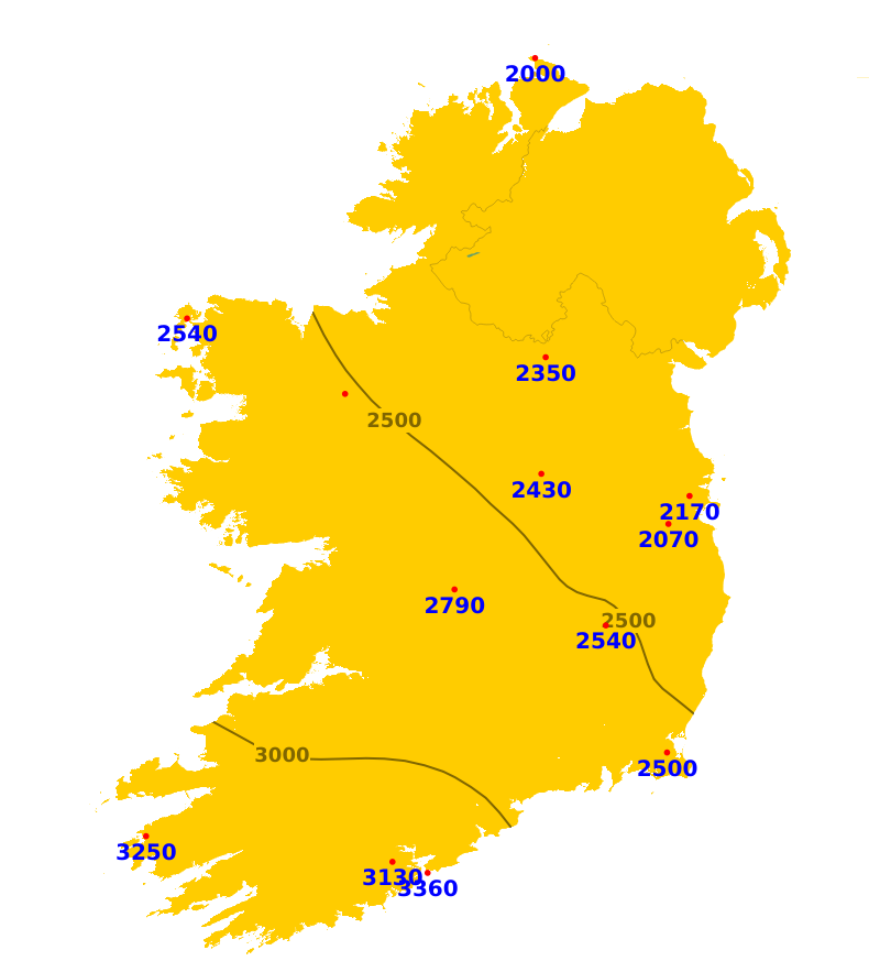
Sunshine
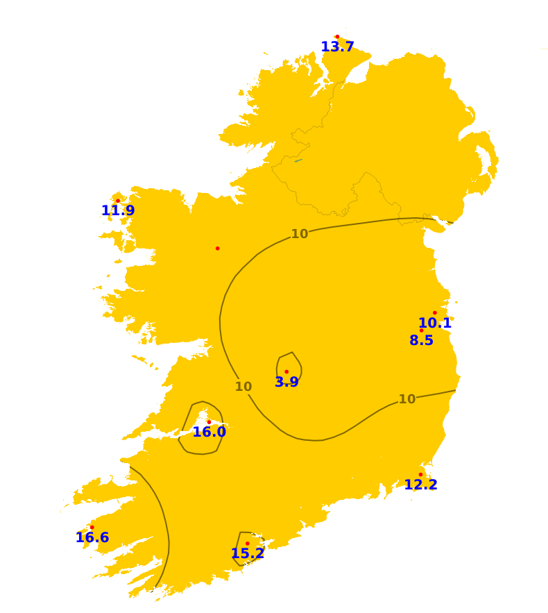
Sunshine amounts were close to or above average in the south-west and mid-west with 16 hours or greater recorded, highest at Valentia Observatory, Co. Kerry with 16.6 hours. Elsewhere, it was duller with 3.9 hours at Gurteen, Co. Tipperary to 13.7 hours at Malin Head, Co. Donegal. While there will be sunshine at times, the coming week will be mostly unsettled with below average sunshine amounts expected generally.
Drying Conditions
Drying conditions will be poor over the coming days with spells of rain or frequent showers.
Spraying
There be limited opportunities for spraying this week with mostly unsettled conditions. The best opportunity will be early tomorrow (Tuesday), away from the southwest.
Field Conditions
All poorly drained soils and some moderately drained soils are waterlogged, while all other soils are saturated. Over the coming week, there will be a further deterioration with more moderately drained soils becoming waterlogged.
Forecast maps and meteograms can be found on Blight Forecast.